TopoQuest Logo
Do you find TopoQuest useful?
Help keep TopoQuest running and adding new maps/features by donating!
Bitcoin:  19c7KJd3qBynnjoSw5npx9KScwjBe4ifkT
Litecoin:  LXs6TkuXGGXo1vDsWCkWVdjQX94eUKd6ui
Home View Maps Find Maps Find Places Resources & Links


East Dayton, Michigan Topographic Map

USGS Map Title: East Dayton, MI
USGS Map MRC: 43083D3
DRG (GeoTIFF) Download: o43083d3.tif


Neighboring USGS Topographic Map Quads:


  Colling, MI  
43083E4
 

  Ellington, MI  
43083E3
 

  Cass City, MI  
43083E2
 

  Caro, MI  
43083D4
 

  East Dayton, MI  
43083D3
 

  Kingston, MI  
43083D2
 

  Juniata, MI  
43083C4
 

  Mayville, MI  
43083C3
 

  Clifford, MI  
43083C2


Map MRC Location:

N44°
W84°
N44°
W83°
H8 H7 H6 H5 H4 H3 H2 H1
G8 G7 G6 G5 G4 G3 G2 G1
F8 F7 F6 F5 F4 F3 F2 F1
E8 E7 E6 E5 E4 E3 E2 E1
D8 D7 D6 D5 D4 D3 D2 D1
C8 C7 C6 C5 C4 C3 C2 C1
B8 B7 B6 B5 B4 B3 B2 B1
A8 A7 A6 A5 A4 A3 A2 A1
N43°
W84°
N43°
W83°

East Dayton, MI USGS 1:24K Topographic Map Preview:
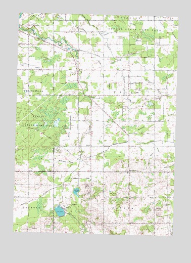
East Dayton, MI USGS Topographic Map
Click on map above to begin viewing in our Map Viewer.

This topographic map contains these locations and features:
Feature Name Type Latitude Longitude GNIS ID View Map
Applegate DrainCanalN43.4703°W83.3736°620181View Map
Berry SchoolSchoolN43.4545°W83.2644°621176View Map
Bethel ChurchChurchN43.4250°W83.3163°621224View Map
Blackmere DrainCanalN43.4403°W83.2647°621548View Map
Bloch SchoolSchoolN43.4778°W83.2877°621596View Map
Butternut DrainCanalN43.4995°W83.2658°622393View Map
Cat LakeLakeN43.3874°W83.3388°622871View Map
Craw DrainCanalN43.4900°W83.3227°624027View Map
DaytonPopulated PlaceN43.4617°W83.2874°1617514View Map
Daytona BranchPopulated PlaceN43.4592°W83.2911°1617516View Map
Dykes DrainCanalN43.4522°W83.3124°625065View Map
East DaytonPopulated PlaceN43.4109°W83.2852°1617536View Map
East Dayton CemeteryCemeteryN43.4111°W83.2878°2554512View Map
East Dayton Post Office (historical)Post OfficeN43.4108°W83.2853°2553978View Map
Fourtowns SchoolSchoolN43.4103°W83.3447°626351View Map
Frankfort SchoolSchoolN43.4797°W83.3286°626408View Map
Green DrainCanalN43.4189°W83.2697°627294View Map
Harmon LakeLakeN43.3989°W83.3263°627809View Map
Hollister Wright DrainCanalN43.4889°W83.2819°628436View Map
Hunt DrainCanalN43.4061°W83.3222°628818View Map
Jacoby DrainCanalN43.4214°W83.2588°629194View Map
Keene Stewart DrainCanalN43.4692°W83.2930°629501View Map
Lake BranchCanalN43.3906°W83.3299°1623468View Map
McDonald DrainCanalN43.4150°W83.2513°631875View Map
McKnight DrainCanalN43.4156°W83.3344°631790View Map
Miller DrainCanalN43.4822°W83.2663°632371View Map
Morse DrainCanalN43.4997°W83.2574°632731View Map
North Wells CemeteryCemeteryN43.4758°W83.2889°2554509View Map
Phelps Lake DrainStreamN43.3872°W83.3355°634753View Map
Riley DrainCanalN43.4659°W83.3099°635934View Map
Rolling DrainCanalN43.4367°W83.3322°636137View Map
Singleton DrainCanalN43.4900°W83.3044°637999View Map
South DrainCanalN43.4292°W83.3227°638338View Map
Sucker Creek DrainCanalN43.4267°W83.2505°639004View Map
Township of WellsCivilN43.4540°W83.2867°1627243View Map
WIDL-FM (Caro)TowerN43.4809°W83.3419°1625361View Map

Note: Coordinates in the location and feature list above are referenced to NAD83 datum.


Copyright (C) 2008-2024 Ryan Niemi / Sunset Dynamics ... All Rights Reserved