TopoQuest Logo
Do you find TopoQuest useful?
Help keep TopoQuest running and adding new maps/features by donating!
Bitcoin:  19c7KJd3qBynnjoSw5npx9KScwjBe4ifkT
Litecoin:  LXs6TkuXGGXo1vDsWCkWVdjQX94eUKd6ui
Home View Maps Find Maps Find Places Resources & Links


Fairhaven, Ohio Topographic Map

USGS Map Title: Fairhaven, OH
USGS Map MRC: 39084F7
DRG (GeoTIFF) Download: o39084f7.tif


Neighboring USGS Topographic Map Quads:


  Richmond, IN  
39084G8
 

  New Paris, OH  
39084G7
 

  Eaton North, OH  
39084G6
 

  Liberty, IN  
39084F8
 

  Fairhaven, OH  
39084F7
 

  Eaton South, OH  
39084F6
 

  New Fairfield, IN  
39084E8
 

  College Corner, OH  
39084E7
 

  Oxford, OH  
39084E6


Map MRC Location:

N40°
W85°
N40°
W84°
H8 H7 H6 H5 H4 H3 H2 H1
G8 G7 G6 G5 G4 G3 G2 G1
F8 F7 F6 F5 F4 F3 F2 F1
E8 E7 E6 E5 E4 E3 E2 E1
D8 D7 D6 D5 D4 D3 D2 D1
C8 C7 C6 C5 C4 C3 C2 C1
B8 B7 B6 B5 B4 B3 B2 B1
A8 A7 A6 A5 A4 A3 A2 A1
N39°
W85°
N39°
W84°

Fairhaven, OH USGS 1:24K Topographic Map Preview:
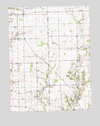
Fairhaven, OH USGS Topographic Map
Click on map above to begin viewing in our Map Viewer.

This topographic map contains these locations and features:
Feature Name Type Latitude Longitude GNIS ID View Map
Beechy Mire Post Office (historical)Post OfficeN39.6987°W84.8375°453040View Map
BostonPopulated PlaceN39.7412°W84.8519°431367View Map
Boston Fire DepartmentBuildingN39.7408°W84.8522°2626256View Map
Church CreekStreamN39.6801°W84.8147°432508View Map
Claysburg (historical)Populated PlaceN39.6264°W84.7597°1063234View Map
Concord CemeteryCemeteryN39.7131°W84.7686°1961418View Map
Concord ChurchChurchN39.7134°W84.7697°1061409View Map
Dixon BranchStreamN39.6964°W84.7558°1039720View Map
Dixon-Israel Middle SchoolSchoolN39.7003°W84.7633°1081207View Map
E-Z Acres Airport (historical)AirportN39.6464°W84.8472°449246View Map
Elleman FarmsLocaleN39.7167°W84.7889°2724133View Map
FairhavenPopulated PlaceN39.6389°W84.7716°1061065View Map
Fairhaven Post Office (historical)Post OfficeN39.6389°W84.7722°2043836View Map
Fairhaven United Presbyterian ChurchChurchN39.6412°W84.7713°1057283View Map
Five PointsPopulated PlaceN39.7120°W84.8519°434543View Map
Fleisch RunStreamN39.6559°W84.8177°434581View Map
Four Mile FarmLocaleN39.6792°W84.7583°2724145View Map
Fourmile ChurchChurchN39.6831°W84.8330°434723View Map
Goodwins CornerPopulated PlaceN39.6492°W84.8336°435177View Map
Goodwins CreekStreamN39.6414°W84.8280°435178View Map
Harshman BridgeBridgeN39.7026°W84.7697°1057776View Map
KitchelPopulated PlaceN39.6831°W84.8613°437365View Map
Kitchel CreekStreamN39.6737°W84.8733°437366View Map
Kitchel FarmLocaleN39.6939°W84.8031°2724141View Map
Norris FieldAirportN39.6520°W84.8643°2676992View Map
Nut RunStreamN39.6509°W84.8750°440372View Map
Orr FarmsLocaleN39.6975°W84.7972°2724127View Map
Pentecost CemeteryCemeteryN39.6514°W84.8244°441005View Map
Radar CreekStreamN39.6695°W84.8186°441724View Map
Railsback CemeteryCemeteryN39.6625°W84.8200°441740View Map
Railsback CreekStreamN39.6639°W84.8211°441741View Map
Silver Station BrookStreamN39.7142°W84.8677°443511View Map
Smith FarmsLocaleN39.7158°W84.7614°2724109View Map
Square RunStreamN39.7256°W84.8188°444030View Map
Statler DitchCanalN39.7367°W84.7522°1046657View Map
Sugar Grove ChurchChurchN39.6489°W84.8333°444342View Map
Toney RunStreamN39.6709°W84.8172°444813View Map
Town of BostonCivilN39.7412°W84.8517°2396597View Map
Township of DixonCivilN39.6996°W84.7591°1086844View Map
Township of HarrisonCivilN39.6904°W84.8709°453397View Map
Twin Acre FarmsLocaleN39.7339°W84.8022°2724136View Map
West FlorencePopulated PlaceN39.7439°W84.7605°1061738View Map
West Florence Post Office (historical)Post OfficeN39.7445°W84.7611°2055831View Map
Witts RunStreamN39.7137°W84.8683°446225View Map
Witts StationPopulated PlaceN39.7123°W84.8616°446226View Map

Note: Coordinates in the location and feature list above are referenced to NAD83 datum.


Copyright (C) 2008-2025 Ryan Niemi / Sunset Dynamics ... All Rights Reserved