TopoQuest Logo
Do you find TopoQuest useful?
Help keep TopoQuest running and adding new maps/features by donating!
Bitcoin:  19c7KJd3qBynnjoSw5npx9KScwjBe4ifkT
Litecoin:  LXs6TkuXGGXo1vDsWCkWVdjQX94eUKd6ui
Home View Maps Find Maps Find Places Resources & Links


Liberty, Indiana Topographic Map

USGS Map Title: Liberty, IN
USGS Map MRC: 39084F8
DRG (GeoTIFF) Download: o39084f8.tif


Neighboring USGS Topographic Map Quads:


  Jacksonburg, IN  
39085G1
 

  Richmond, IN  
39084G8
 

  New Paris, OH  
39084G7
 

  Brownsville, IN  
39085F1
 

  Liberty, IN  
39084F8
 

  Fairhaven, OH  
39084F7
 

  Everton, IN  
39085E1
 

  New Fairfield, IN  
39084E8
 

  College Corner, OH  
39084E7


Map MRC Location:

N40°
W85°
N40°
W84°
H8 H7 H6 H5 H4 H3 H2 H1
G8 G7 G6 G5 G4 G3 G2 G1
F8 F7 F6 F5 F4 F3 F2 F1
E8 E7 E6 E5 E4 E3 E2 E1
D8 D7 D6 D5 D4 D3 D2 D1
C8 C7 C6 C5 C4 C3 C2 C1
B8 B7 B6 B5 B4 B3 B2 B1
A8 A7 A6 A5 A4 A3 A2 A1
N39°
W85°
N39°
W84°

Liberty, IN USGS 1:24K Topographic Map Preview:
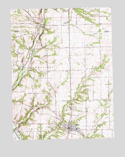
Liberty, IN USGS Topographic Map
Click on map above to begin viewing in our Map Viewer.

This topographic map contains these locations and features:
Feature Name Type Latitude Longitude GNIS ID View Map
AbingtonPopulated PlaceN39.7331°W84.9630°429988View Map
Abington Township Fire DepartmentBuildingN39.7335°W84.9634°2701482View Map
Abington Township Volunteer Fire DepartmentBuildingN39.7335°W84.9635°2626218View Map
Bear BranchStreamN39.7050°W84.9744°430613View Map
Clay CreekStreamN39.6912°W84.9875°432587View Map
CliftonPopulated PlaceN39.6903°W84.9558°432653View Map
Clifton CreekStreamN39.6898°W84.9852°432654View Map
Cream RunStreamN39.7448°W84.9047°433107View Map
Deer BranchStreamN39.7081°W84.9722°433416View Map
Drook CemeteryCemeteryN39.6306°W84.9166°433698View Map
Fayette Regional Emergency Medical ServicesBuildingN39.6402°W84.9288°2719433View Map
Hanna Creek ChurchChurchN39.6759°W84.8808°435690View Map
Harold CreekStreamN39.6356°W84.8966°435759View Map
HopevillePopulated PlaceN39.7014°W84.9705°452217View Map
LibertyPopulated PlaceN39.6356°W84.9311°437816View Map
Liberty City Police DepartmentBuildingN39.6352°W84.9281°2758371View Map
Liberty Junior High SchoolSchoolN39.6342°W84.9208°447579View Map
Liberty Volunteer Fire DepartmentBuildingN39.6351°W84.9283°2625886View Map
Locust CreekStreamN39.7375°W84.9605°438207View Map
Locust Grove CemeteryCemeteryN39.7412°W84.9736°438210View Map
Nutter CemeteryCemeteryN39.6609°W84.8800°440375View Map
Nutter CreekStreamN39.6525°W84.8847°440376View Map
Patterson CemeteryCemeteryN39.6514°W84.9469°440932View Map
Richland CemeteryCemeteryN39.6898°W84.9294°441960View Map
Richland CreekStreamN39.6425°W84.9875°441970View Map
Sering CemeteryCemeteryN39.6531°W84.9269°443216View Map
Silver CreekStreamN39.6753°W84.9136°443496View Map
Silver Creek CemeteryCemeteryN39.6364°W84.9541°443497View Map
Smith Esteb Memorial HomeBuildingN39.7364°W84.9288°443691View Map
Town of LibertyCivilN39.6349°W84.9261°2396717View Map
Township of AbingtonCivilN39.7489°W84.9926°453071View Map
Township of BrownsvilleCivilN39.6919°W84.9811°453144View Map
Township of CenterCivilN39.6253°W84.8806°453194View Map
Union CountyCivilN39.6255°W84.9251°450395View Map
Union County High SchoolSchoolN39.6353°W84.9208°447580View Map
Union County Sheriff's OfficeBuildingN39.6353°W84.9276°2758159View Map
West Point CemeteryCemeteryN39.6398°W84.9388°445799View Map
Woods Chapel CemeteryCemeteryN39.7070°W84.9913°446309View Map
Woods CreekStreamN39.6939°W84.9850°446310View Map
Yankee TownPopulated PlaceN39.6956°W84.9855°446362View Map

Note: Coordinates in the location and feature list above are referenced to NAD83 datum.


Copyright (C) 2008-2025 Ryan Niemi / Sunset Dynamics ... All Rights Reserved