TopoQuest Logo
Do you find TopoQuest useful?
Help keep TopoQuest running and adding new maps/features by donating!
Bitcoin:  19c7KJd3qBynnjoSw5npx9KScwjBe4ifkT
Litecoin:  LXs6TkuXGGXo1vDsWCkWVdjQX94eUKd6ui
Home View Maps Find Maps Find Places Resources & Links


Eaton North, Ohio Topographic Map

USGS Map Title: Eaton North, OH
USGS Map MRC: 39084G6
DRG (GeoTIFF) Download: o39084g6.tif


Neighboring USGS Topographic Map Quads:


  Whitewater, IN  
39084H7
 

  New Madison, OH  
39084H6
 

  Arcanum, OH  
39084H5
 

  New Paris, OH  
39084G7
 

  Eaton North, OH  
39084G6
 

  Lewisburg, OH  
39084G5
 

  Fairhaven, OH  
39084F7
 

  Eaton South, OH  
39084F6
 

  West Alexandria, OH  
39084F5


Map MRC Location:

N40°
W85°
N40°
W84°
H8 H7 H6 H5 H4 H3 H2 H1
G8 G7 G6 G5 G4 G3 G2 G1
F8 F7 F6 F5 F4 F3 F2 F1
E8 E7 E6 E5 E4 E3 E2 E1
D8 D7 D6 D5 D4 D3 D2 D1
C8 C7 C6 C5 C4 C3 C2 C1
B8 B7 B6 B5 B4 B3 B2 B1
A8 A7 A6 A5 A4 A3 A2 A1
N39°
W85°
N39°
W84°

Eaton North, OH USGS 1:24K Topographic Map Preview:
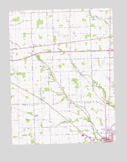
Eaton North, OH USGS Topographic Map
Click on map above to begin viewing in our Map Viewer.

This topographic map contains these locations and features:
Feature Name Type Latitude Longitude GNIS ID View Map
Barnes FarmLocaleN39.8569°W84.7019°2724091View Map
Bowling Trailer ParkPopulated PlaceN39.8019°W84.6794°2634666View Map
Christman BridgeBridgeN39.7703°W84.6552°1057773View Map
City of EatonCivilN39.7506°W84.6342°1086845View Map
County Home CemeteryCemeteryN39.7620°W84.6480°1961419View Map
Darble FarmLocaleN39.8747°W84.7400°2724096View Map
Eaton Fire Division Station 2BuildingN39.7581°W84.6413°2550428View Map
Eaton First Church of the NazareneChurchN39.7514°W84.6313°1063225View Map
EbenezerPopulated PlaceN39.8423°W84.6969°1062466View Map
Ebenezer ChurchChurchN39.8406°W84.7230°1040056View Map
Ebenezer Post Office (historical)Post OfficeN39.8417°W84.6972°2055579View Map
First Baptist ChurchChurchN39.7589°W84.6330°1063227View Map
First Church of GodChurchN39.7520°W84.6369°1063226View Map
Frame CemeteryCemeteryN39.7642°W84.7144°1961425View Map
Gateway Baptist ChurchChurchN39.7520°W84.6372°1796362View Map
GettysburgPopulated PlaceN39.8406°W84.7205°1064718View Map
Gettysburg CemeteryCemeteryN39.8350°W84.7237°1040844View Map
Gettysburgh Post Office (historical)Post OfficeN39.8403°W84.7208°2055816View Map
Greenbriar Nursing CenterHospitalN39.7581°W84.6450°1796363View Map
Growing Acres FarmLocaleN39.8517°W84.6556°2724099View Map
Interchange 10CrossingN39.8353°W84.6294°1057771View Map
Lee FarmsLocaleN39.8289°W84.7000°2724098View Map
Lone Sycamore FarmsLocaleN39.7592°W84.6703°2724138View Map
Lynch FarmsLocaleN39.7792°W84.6817°2724130View Map
Lynch's FarmsLocaleN39.7867°W84.6650°2724137View Map
McFadden School (historical)SchoolN39.8720°W84.7236°1057770View Map
Miller FarmsLocaleN39.7767°W84.7394°2724131View Map
Murphy FarmsLocaleN39.8564°W84.6508°2724100View Map
National Trail Family FarmLocaleN39.8539°W84.6786°2724103View Map
National Trail High SchoolSchoolN39.8367°W84.7222°1057769View Map
New HopePopulated PlaceN39.7917°W84.7133°1065120View Map
New Hope CemeteryCemeteryN39.7867°W84.7000°1961435View Map
New Hope StationLocaleN39.7764°W84.7216°1065121View Map
New Hope Station Post Office (historical)Post OfficeN39.7917°W84.7138°2055825View Map
New Hope United Methodist ChurchChurchN39.7917°W84.7130°1063224View Map
Northedge Shopping CenterLocaleN39.7603°W84.6358°1057772View Map
Oklahoma (historical)Populated PlaceN39.7864°W84.6338°1049037View Map
Orangeburg (historical)Populated PlaceN39.8387°W84.7469°1049040View Map
Periwinkle RunStreamN39.7695°W84.6555°1044375View Map
Petry CemeteryCemeteryN39.8598°W84.6677°1961439View Map
Preble County Home (historical)BuildingN39.7595°W84.6472°1057774View Map
Preble County Sheriff's OfficeBuildingN39.7609°W84.6445°2732539View Map
Prices Creek Church of the BrethrenChurchN39.8684°W84.6511°1061573View Map
Scottish Crest FarmsLocaleN39.7633°W84.6536°2724135View Map
Sherer CemeteryCemeteryN39.8092°W84.6971°1961442View Map
Spacht CemeteryCemeteryN39.7875°W84.6775°1961444View Map
Stamback School (historical)SchoolN39.8162°W84.7227°1057768View Map
Studebaker FarmsLocaleN39.8261°W84.6494°2724132View Map
Stump CemeteryCemeteryN39.8578°W84.6958°1046780View Map
Township of MonroeCivilN39.8726°W84.6501°1086853View Map
Township of WashingtonCivilN39.7745°W84.6515°1086856View Map
Wares Chapel CemeteryCemeteryN39.8645°W84.6469°1961447View Map
Wares Chapel United Methodist ChurchChurchN39.8648°W84.6466°1061723View Map
Westview Acres Care CenterHospitalN39.7614°W84.6466°1796361View Map
Zion ChurchChurchN39.8092°W84.6302°1048269View Map
Zion Church GraveyardCemeteryN39.8098°W84.6308°1961448View Map

Note: Coordinates in the location and feature list above are referenced to NAD83 datum.


Copyright (C) 2008-2025 Ryan Niemi / Sunset Dynamics ... All Rights Reserved