TopoQuest Logo
Do you find TopoQuest useful?
Help keep TopoQuest running and adding new maps/features by donating!
Bitcoin:  19c7KJd3qBynnjoSw5npx9KScwjBe4ifkT
Litecoin:  LXs6TkuXGGXo1vDsWCkWVdjQX94eUKd6ui
Home View Maps Find Maps Find Places Resources & Links


Robbins, Tennessee Topographic Map

USGS Map Title: Robbins, TN
USGS Map MRC: 36084C5
DRG (GeoTIFF) Download: o36084c5.tif


Neighboring USGS Topographic Map Quads:


  Honey Creek, TN  
36084D6
 

  Oneida South, TN  
36084D5
 

  Huntsville, TN  
36084D4
 

  Rugby, TN  
36084C6
 

  Robbins, TN  
36084C5
 

  Norma, TN  
36084C4
 

  Pilot Mountain, TN  
36084B6
 

  Gobey, TN  
36084B5
 

  Fork Mountain, TN  
36084B4


Map MRC Location:

N37°
W85°
N37°
W84°
H8 H7 H6 H5 H4 H3 H2 H1
G8 G7 G6 G5 G4 G3 G2 G1
F8 F7 F6 F5 F4 F3 F2 F1
E8 E7 E6 E5 E4 E3 E2 E1
D8 D7 D6 D5 D4 D3 D2 D1
C8 C7 C6 C5 C4 C3 C2 C1
B8 B7 B6 B5 B4 B3 B2 B1
A8 A7 A6 A5 A4 A3 A2 A1
N36°
W85°
N36°
W84°

Robbins, TN USGS 1:24K Topographic Map Preview:
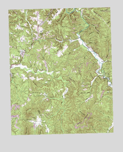
Robbins, TN USGS Topographic Map
Click on map above to begin viewing in our Map Viewer.

This topographic map contains these locations and features:
Feature Name Type Latitude Longitude GNIS ID View Map
Aaron BranchStreamN36.3329°W84.5283°1275414View Map
Al BranchStreamN36.3370°W84.5327°1275522View Map
Bagley BranchStreamN36.3392°W84.5352°1276083View Map
Bear Cove HollowValleyN36.2910°W84.5268°1276574View Map
Big KnobSummitN36.3567°W84.5749°1311270View Map
Big Pond RidgeRidgeN36.3687°W84.5655°1277357View Map
Black Creek CemeteryCemeteryN36.3734°W84.6022°1277564View Map
Boardtree HollowValleyN36.3073°W84.5171°1277849View Map
Brickyard HollowValleyN36.3489°W84.5970°1278333View Map
Brimstone CreekStreamN36.3742°W84.5441°1278397View Map
Brimstone RidgeRidgeN36.3659°W84.5447°1278399View Map
Buck Lick BranchStreamN36.3170°W84.5399°1278829View Map
Burnt House SpringSpringN36.3567°W84.5602°1279099View Map
Butchers CreekStreamN36.3129°W84.5811°1279167View Map
Butler CemeteryCemeteryN36.3217°W84.6097°1279181View Map
Buttram CemeteryCemeteryN36.3684°W84.5338°1279205View Map
Cal BranchStreamN36.3220°W84.5169°1279299View Map
Campground BranchStreamN36.2848°W84.5608°1305648View Map
Campground CemeteryCemeteryN36.2912°W84.5852°1279475View Map
Campground SchoolSchoolN36.2870°W84.5774°1305655View Map
Cecil HollowValleyN36.3419°W84.5626°1279990View Map
Chaney CemeteryCemeteryN36.2637°W84.6008°1646608View Map
Chaney GapGapN36.2648°W84.6061°1280239View Map
Coal HillPopulated PlaceN36.3079°W84.6130°1314865View Map
Coal Hill MountainSummitN36.2995°W84.5969°1280800View Map
Commissioner District 2CivilN36.3267°W84.5712°2463969View Map
Concord ChurchChurchN36.3440°W84.6055°1281069View Map
Copperas BranchStreamN36.3070°W84.5730°1281267View Map
Cowan CreekStreamN36.2756°W84.5608°1281458View Map
Davis CemeteryCemeteryN36.3356°W84.5752°1282162View Map
Diamond CemeteryCemeteryN36.3137°W84.5944°1282414View Map
ElginPopulated PlaceN36.3323°W84.6063°1283622View Map
Elgin Census Designated PlaceCensusN36.3284°W84.6091°2586051View Map
Elgin Post OfficePost OfficeN36.3335°W84.6061°1651045View Map
GlenmaryPopulated PlaceN36.3109°W84.6247°1285513View Map
Gordon BranchStreamN36.3048°W84.5063°1285695View Map
Grassy MountainSummitN36.2509°W84.6056°1269275View Map
Griffith HollowValleyN36.3740°W84.5003°1286287View Map
Griffith KnobSummitN36.2704°W84.6111°1309663View Map
Hambright BranchStreamN36.2606°W84.5811°1286627View Map
HughettPopulated PlaceN36.3212°W84.5094°1315274View Map
Huntsville BranchStreamN36.3195°W84.5122°1288767View Map
Indian ForkStreamN36.3098°W84.5161°1288983View Map
Indian Grave GapGapN36.2912°W84.5983°1288989View Map
Jeffers HollowValleyN36.3667°W84.5345°1289324View Map
Jergin CemeteryCemeteryN36.3365°W84.5580°1289392View Map
Josh HollowValleyN36.3029°W84.5218°1289853View Map
Lewallen CemeteryCemeteryN36.3031°W84.5808°1291055View Map
Lewallen CemeteryCemeteryN36.3215°W84.5683°1291056View Map
Little MountainSummitN36.2740°W84.6033°1291583View Map
Long BranchStreamN36.3051°W84.5049°1291908View Map
Love ChapelChurchN36.3456°W84.5938°1292121View Map
Love Chapel CemeteryCemeteryN36.3398°W84.5997°1292122View Map
Low GapGapN36.3587°W84.5480°1292182View Map
Lowe MountainSummitN36.2901°W84.5163°1292207View Map
Macs BranchStreamN36.3223°W84.5069°1292463View Map
McCoy Big Mary MineMineN36.2620°W84.5327°1651056View Map
Mill CreekStreamN36.2759°W84.5608°1293829View Map
Mill CreekPopulated PlaceN36.2634°W84.5883°1315509View Map
Mill Creek CemeteryCemeteryN36.2656°W84.5949°1646636View Map
Mill Creek ChurchChurchN36.2670°W84.5949°1293855View Map
Miller BranchStreamN36.3129°W84.5905°1293908View Map
Mount Pleasant SchoolSchoolN36.3487°W84.5380°1294787View Map
Mount Zion ChurchChurchN36.2623°W84.5869°1294908View Map
Muley BranchStreamN36.2556°W84.5047°1295072View Map
Newport CemeteryCemeteryN36.3409°W84.5502°1295699View Map
Number One HollowValleyN36.3579°W84.5260°1296013View Map
Pats BranchStreamN36.3142°W84.6036°1296915View Map
Pemberton BranchStreamN36.3437°W84.5374°1297130View Map
Pemberton CemeteryCemeteryN36.3587°W84.5335°1297132View Map
Pemberton SidingLocaleN36.3517°W84.5363°1297134View Map
Peter Cave RidgeRidgeN36.3637°W84.5580°1297245View Map
Pond HollowValleyN36.3393°W84.5280°1298111View Map
Poplar Creek MineMineN36.2890°W84.5130°1651061View Map
Rainbow MinesMineN36.3023°W84.5313°1298832View Map
Reed HollowValleyN36.3697°W84.5502°1299147View Map
Reuben HollowValleyN36.3553°W84.5309°1299236View Map
RobbinsPopulated PlaceN36.3534°W84.5894°1299586View Map
Robbins Census Designated PlaceCensusN36.3537°W84.5839°2586079View Map
Robbins Division (historical)CensusN36.3540°W84.5883°1648942View Map
Robbins Elementary SchoolSchoolN36.3526°W84.5855°1318799View Map
Robbins Post OfficePost OfficeN36.3538°W84.5890°1651063View Map
Robbins TunnelTunnelN36.3651°W84.5788°1299594View Map
Rock Lick GapGapN36.2651°W84.5319°1299775View Map
Rock Lick HollowValleyN36.2724°W84.5436°1299776View Map
Rugby Road School (historical)SchoolN36.3329°W84.6127°1318802View Map
Rugby Road StationLocaleN36.3329°W84.6083°1300242View Map
Sawdust HollowValleyN36.3036°W84.5576°1300826View Map
Schoolhouse HollowValleyN36.3046°W84.5221°1300901View Map
Schoolhouse RidgeRidgeN36.3492°W84.5244°1300905View Map
Sexton CemeteryCemeteryN36.3090°W84.5063°1301128View Map
Sheep Rock MountainSummitN36.3656°W84.5152°1269966View Map
Shepard CemeteryCemeteryN36.3267°W84.6144°1270035View Map
Slick RockPopulated PlaceN36.3040°W84.5044°1314301View Map
Slick Rock Baptist ChurchChurchN36.3037°W84.5047°1318805View Map
Slick Rock School (historical)SchoolN36.3045°W84.5047°1318806View Map
Sophie GapGapN36.2926°W84.5074°1270821View Map
South Scott County Volunteer Fire DepartmentBuildingN36.3601°W84.5838°2654361View Map
Sumner CemeteryCemeteryN36.2626°W84.5866°1646668View Map
Todd CemeteryCemeteryN36.3301°W84.5985°1272709View Map
Walker BridgeBridgeN36.3456°W84.5397°1273576View Map
Walker CemeteryCemeteryN36.2867°W84.5285°1273607View Map
Walker CemeteryCemeteryN36.3006°W84.5285°1273608View Map
Wallace HollowValleyN36.3714°W84.5540°1273686View Map
Webb CreekStreamN36.3051°W84.6222°1274028View Map
Wells BranchStreamN36.3006°W84.5022°1274099View Map
West RobbinsPopulated PlaceN36.3581°W84.6116°1274227View Map
West Robbins Baptist ChurchChurchN36.3592°W84.6116°1318813View Map
West Robbins School (historical)SchoolN36.3590°W84.6113°1318814View Map
Wolf Creek ChurchChurchN36.3142°W84.5847°1274956View Map

Note: Coordinates in the location and feature list above are referenced to NAD83 datum.


Copyright (C) 2008-2025 Ryan Niemi / Sunset Dynamics ... All Rights Reserved