TopoQuest Logo
Do you find TopoQuest useful?
Help keep TopoQuest running and adding new maps/features by donating!
Bitcoin:  19c7KJd3qBynnjoSw5npx9KScwjBe4ifkT
Litecoin:  LXs6TkuXGGXo1vDsWCkWVdjQX94eUKd6ui
Home View Maps Find Maps Find Places Resources & Links


Fulton, Indiana Topographic Map

USGS Map Title: Fulton, IN
USGS Map MRC: 40086H3
DRG (GeoTIFF) Download: o40086h3.tif


Neighboring USGS Topographic Map Quads:


  Kewanna, IN  
41086A4
 

  Pershing, IN  
41086A3
 

  Rochester, IN  
41086A2
 

  Grass Creek, IN  
40086H4
 

  Fulton, IN  
40086H3
 

  Macy, IN  
40086H2
 

  Lucerne, IN  
40086G4
 

  Logansport, IN  
40086G3
 

  Twelve Mile, IN  
40086G2


Map MRC Location:

N41°
W87°
N41°
W86°
H8 H7 H6 H5 H4 H3 H2 H1
G8 G7 G6 G5 G4 G3 G2 G1
F8 F7 F6 F5 F4 F3 F2 F1
E8 E7 E6 E5 E4 E3 E2 E1
D8 D7 D6 D5 D4 D3 D2 D1
C8 C7 C6 C5 C4 C3 C2 C1
B8 B7 B6 B5 B4 B3 B2 B1
A8 A7 A6 A5 A4 A3 A2 A1
N40°
W87°
N40°
W86°

Fulton, IN USGS 1:24K Topographic Map Preview:
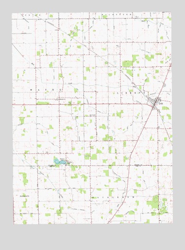
Fulton, IN USGS Topographic Map
Click on map above to begin viewing in our Map Viewer.

This topographic map contains these locations and features:
Feature Name Type Latitude Longitude GNIS ID View Map
Callahan DitchCanalN40.9881°W86.3608°431965View Map
Carson DitchCanalN40.9928°W86.2681°432180View Map
Caston Elementary SchoolSchoolN40.9478°W86.2592°446988View Map
Caston Junior-Senior High SchoolSchoolN40.9478°W86.2592°446987View Map
Clary DitchCanalN40.9237°W86.3461°432579View Map
Collins DitchCanalN40.9909°W86.2603°432796View Map
Conn DitchCanalN40.9306°W86.3092°432881View Map
Conn Fred DitchCanalN40.9348°W86.2814°432882View Map
Costello DitchCanalN40.9345°W86.3633°433010View Map
Dague StripAirportN40.9608°W86.3720°2677032View Map
Dalzall DitchCanalN40.8781°W86.2878°433299View Map
Deweese DitchCanalN40.9342°W86.3233°433521View Map
FletcherPopulated PlaceN40.9120°W86.3328°434594View Map
Fletcher LakeLakeN40.9117°W86.3383°434593View Map
Friedrich AirportAirportN40.9955°W86.3460°2677035View Map
FultonPopulated PlaceN40.9473°W86.2628°434896View Map
Fulton - Liberty Township Volunteer Fire DepartmentBuildingN40.9469°W86.2623°2625743View Map
Fulton CemeteryCemeteryN40.9561°W86.2564°434897View Map
Kern Neff DitchCanalN40.8937°W86.2867°437263View Map
Levi Rouch DitchCanalN40.9598°W86.2697°437798View Map
MarshtownPopulated PlaceN40.9489°W86.3386°449693View Map
North Fork Keren Neff DitchCanalN40.9006°W86.2733°440254View Map
Olive Branch ChurchChurchN40.9384°W86.3139°440644View Map
Olmstead DitchCanalN40.9434°W86.3117°440658View Map
Overmyer DitchCanalN40.9384°W86.2739°440784View Map
Pownall DitchCanalN40.9353°W86.3008°441530View Map
Reed CemeteryCemeteryN40.9170°W86.3492°441850View Map
Rouch DitchCanalN40.9659°W86.3419°442341View Map
Salem CemeteryCemeteryN40.9798°W86.2908°442894View Map
Smalley CemeteryCemeteryN40.9459°W86.3281°443646View Map
Studebaker Hiatt DitchCanalN40.9025°W86.2919°444293View Map
Sylvester Maroney DitchCanalN40.8817°W86.3139°444523View Map
Town of FultonCivilN40.9461°W86.2642°2396953View Map
Ulch DitchCanalN40.9770°W86.2706°445033View Map
Waite DitchCanalN40.9806°W86.2506°445358View Map
Werner DitchCanalN40.9998°W86.2658°445683View Map
West Arm Grube DitchCanalN40.9862°W86.3272°445715View Map
Wilson Friedrick DitchCanalN40.9964°W86.3647°446147View Map

Note: Coordinates in the location and feature list above are referenced to NAD83 datum.


Copyright (C) 2008-2025 Ryan Niemi / Sunset Dynamics ... All Rights Reserved