TopoQuest Logo
Do you find TopoQuest useful?
Help keep TopoQuest running and adding new maps/features by donating!
Bitcoin:  19c7KJd3qBynnjoSw5npx9KScwjBe4ifkT
Litecoin:  LXs6TkuXGGXo1vDsWCkWVdjQX94eUKd6ui
Home View Maps Find Maps Find Places Resources & Links


Pershing, Indiana Topographic Map

USGS Map Title: Pershing, IN
USGS Map MRC: 41086A3
DRG (GeoTIFF) Download: o41086a3.tif


Neighboring USGS Topographic Map Quads:


  Culver, IN  
41086B4
 

  Rutland, IN  
41086B3
 

  Argos, IN  
41086B2
 

  Kewanna, IN  
41086A4
 

  Pershing, IN  
41086A3
 

  Rochester, IN  
41086A2
 

  Grass Creek, IN  
40086H4
 

  Fulton, IN  
40086H3
 

  Macy, IN  
40086H2


Map MRC Location:

N42°
W87°
N42°
W86°
H8 H7 H6 H5 H4 H3 H2 H1
G8 G7 G6 G5 G4 G3 G2 G1
F8 F7 F6 F5 F4 F3 F2 F1
E8 E7 E6 E5 E4 E3 E2 E1
D8 D7 D6 D5 D4 D3 D2 D1
C8 C7 C6 C5 C4 C3 C2 C1
B8 B7 B6 B5 B4 B3 B2 B1
A8 A7 A6 A5 A4 A3 A2 A1
N41°
W87°
N41°
W86°

Pershing, IN USGS 1:24K Topographic Map Preview:
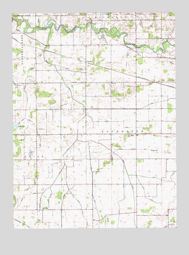
Pershing, IN USGS Topographic Map
Click on map above to begin viewing in our Map Viewer.

This topographic map contains these locations and features:
Feature Name Type Latitude Longitude GNIS ID View Map
Allen DitchCanalN41.0992°W86.2872°430090View Map
Antioch CemeteryCemeteryN41.0020°W86.2564°430200View Map
Baker DitchCanalN41.0056°W86.2944°430431View Map
Burton ChurchChurchN41.0842°W86.2994°431882View Map
Cessna DitchCanalN41.0620°W86.2936°432376View Map
Collins DitchCanalN41.0753°W86.3636°432794View Map
Collins Ditch Arm Number FourCanalN41.0620°W86.3686°432802View Map
Collins Ditch Arm Number ThreeCanalN41.0550°W86.3656°432801View Map
Collins Ditch Arm Number TwoCanalN41.0473°W86.3608°432800View Map
Eddy CreekStreamN41.1164°W86.3553°434001View Map
Fulton CountyCivilN41.0470°W86.2636°450353View Map
Grube DitchCanalN41.0081°W86.3100°435540View Map
Holtz DitchCanalN41.0692°W86.2800°436346View Map
Hudkins DitchCanalN41.0367°W86.3447°436568View Map
Kersey Finney DitchCanalN41.0128°W86.3231°437267View Map
Lears LakeLakeN41.0596°W86.3730°437701View Map
Mathias DitchCanalN41.0848°W86.3247°438718View Map
Miller DitchCanalN41.0239°W86.3331°439205View Map
Mud CreekStreamN41.1162°W86.3458°439818View Map
PershingPopulated PlaceN41.0962°W86.3189°441039View Map
Prairie Grove ChurchChurchN41.0112°W86.3528°441557View Map
Robbins Walters DitchCanalN41.0445°W86.2600°442143View Map
Shakey LakeLakeN41.0452°W86.2643°443270View Map
Steinke DitchCanalN41.0106°W86.3547°444119View Map
Tilden DitchCanalN41.0914°W86.3278°444758View Map
White DitchCanalN41.0187°W86.2742°445934View Map
Wilson DitchCanalN41.0256°W86.3453°446143View Map
Wilson Ditch Arm Number TwoCanalN41.0078°W86.3450°446145View Map
WROI-FM (Rochester)TowerN41.0506°W86.2608°449019View Map

Note: Coordinates in the location and feature list above are referenced to NAD83 datum.


Copyright (C) 2008-2024 Ryan Niemi / Sunset Dynamics ... All Rights Reserved