TopoQuest Logo
Do you find TopoQuest useful?
Help keep TopoQuest running and adding new maps/features by donating!
Bitcoin:  19c7KJd3qBynnjoSw5npx9KScwjBe4ifkT
Litecoin:  LXs6TkuXGGXo1vDsWCkWVdjQX94eUKd6ui
Home View Maps Find Maps Find Places Resources & Links


Canby, California Topographic Map

USGS Map Title: Canby, CA
USGS Map MRC: 41120D7
DRG (GeoTIFF) Download: o41120d7.tif


Neighboring USGS Topographic Map Quads:


  Ambrose, CA  
41120E8
 

  Jacks Butte, CA  
41120E7
 

  Big Sage Reservoir, CA  
41120E6
 

  Washington Mountain, CA  
41120D8
 

  Canby, CA  
41120D7
 

  Rattlesnake Butte, CA  
41120D6
 

  Adin Pass, CA  
41120C8
 

  Hermit Butte, CA  
41120C7
 

  Graven Ridge, CA  
41120C6


Map MRC Location:

N42°
W121°
N42°
W120°
H8 H7 H6 H5 H4 H3 H2 H1
G8 G7 G6 G5 G4 G3 G2 G1
F8 F7 F6 F5 F4 F3 F2 F1
E8 E7 E6 E5 E4 E3 E2 E1
D8 D7 D6 D5 D4 D3 D2 D1
C8 C7 C6 C5 C4 C3 C2 C1
B8 B7 B6 B5 B4 B3 B2 B1
A8 A7 A6 A5 A4 A3 A2 A1
N41°
W121°
N41°
W120°

Canby, CA USGS 1:24K Topographic Map Preview:
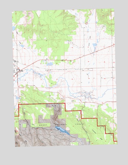
Canby, CA USGS Topographic Map
Click on map above to begin viewing in our Map Viewer.

This topographic map contains these locations and features:
Feature Name Type Latitude Longitude GNIS ID View Map
Arlington Elementary SchoolSchoolN41.4418°W120.8736°1702387View Map
Arlington SchoolSchoolN41.4418°W120.8736°253105View Map
Ballard ReservoirReservoirN41.3924°W120.8219°254585View Map
Blacks CanyonValleyN41.4588°W120.8514°219424View Map
CanbyPopulated PlaceN41.4438°W120.8702°220535View Map
Canby Fire Protection DistrictBuildingN41.4444°W120.8683°2621833View Map
Canby Post OfficePost OfficeN41.4448°W120.8689°1702390View Map
Carpenter Wilson 172-002 DamDamN41.4216°W120.8727°1663770View Map
Clover SwaleValleyN41.4596°W120.7791°221248View Map
Clover Swale CreekStreamN41.4227°W120.7839°258480View Map
Cooley GulchValleyN41.4168°W120.8675°253157View Map
Devils Garden Ranger StationLocaleN41.4449°W120.8691°253130View Map
Evans and Bailey Historical MonumentParkN41.4157°W120.8019°223285View Map
Fletcher (historical)Populated PlaceN41.4457°W120.7544°253162View Map
Kelley Hot SpringSpringN41.4540°W120.8357°251999View Map
Portuguese SpringSpringN41.3806°W120.7507°230973View Map
Ralston GulchValleyN41.4121°W120.8100°231195View Map
Toms CreekStreamN41.4291°W120.8272°236458View Map
Toreson 153 DamDamN41.3916°W120.8211°1663761View Map
Warm Springs ValleyValleyN41.4499°W120.8566°255215View Map
Wilson ReservoirReservoirN41.4199°W120.8719°237985View Map
Witcher CreekStreamN41.4788°W120.7836°269262View Map

Note: Coordinates in the location and feature list above are referenced to NAD83 datum.


Copyright (C) 2008-2024 Ryan Niemi / Sunset Dynamics ... All Rights Reserved