TopoQuest Logo
Do you find TopoQuest useful?
Help keep TopoQuest running and adding new maps/features by donating!
Bitcoin:  19c7KJd3qBynnjoSw5npx9KScwjBe4ifkT
Litecoin:  LXs6TkuXGGXo1vDsWCkWVdjQX94eUKd6ui
Home View Maps Find Maps Find Places Resources & Links


Gladstone, Nebraska Topographic Map

USGS Map Title: Gladstone, NE
USGS Map MRC: 40097B3
DRG (GeoTIFF) Download: o40097b3.tif


Neighboring USGS Topographic Map Quads:


  Tobias SW, NE  
40097C4
 

  Daykin, NE  
40097C3
 

  Western SW, NE  
40097C2
 

  Alexandria, NE  
40097B4
 

  Gladstone, NE  
40097B3
 

  Fairbury, NE  
40097B2
 

  Hubbell, NE  
40097A4
 

  Reynolds, NE  
40097A3
 

  Fairbury SW, NE  
40097A2


Map MRC Location:

N41°
W98°
N41°
W97°
H8 H7 H6 H5 H4 H3 H2 H1
G8 G7 G6 G5 G4 G3 G2 G1
F8 F7 F6 F5 F4 F3 F2 F1
E8 E7 E6 E5 E4 E3 E2 E1
D8 D7 D6 D5 D4 D3 D2 D1
C8 C7 C6 C5 C4 C3 C2 C1
B8 B7 B6 B5 B4 B3 B2 B1
A8 A7 A6 A5 A4 A3 A2 A1
N40°
W98°
N40°
W97°

Gladstone, NE USGS 1:24K Topographic Map Preview:
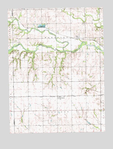
Gladstone, NE USGS Topographic Map
Click on map above to begin viewing in our Map Viewer.

This topographic map contains these locations and features:
Feature Name Type Latitude Longitude GNIS ID View Map
Alexandria DamDamN40.2317°W97.3320°1766991View Map
Alexandria Lakes State Recreation AreaParkN40.2317°W97.3317°826941View Map
Alexandria Lakes State Wildlife Management AreaParkN40.2328°W97.3337°1882783View Map
Alexandria ReservoirReservoirN40.2321°W97.3311°1766992View Map
Big Sandy CreekStreamN40.2064°W97.3017°827425View Map
Buckley Creek Reservoir 3-CLakeN40.1396°W97.3590°1767012View Map
Buckley Creek Reservoir 4-ALakeN40.1309°W97.3141°1767028View Map
C E Rice Storage DamDamN40.2019°W97.2590°1766989View Map
Detention Dam 3-CDamN40.1368°W97.3592°1767011View Map
Floodwater Retarding Dam 4-ADamN40.1262°W97.3101°1767027View Map
GladstonePopulated PlaceN40.1597°W97.3081°829530View Map
Gladstone (historical)LocaleN40.1614°W97.3100°1882848View Map
Gladstone Post OfficePost OfficeN40.1597°W97.3081°1882846View Map
Graysons (historical)LocaleN40.1467°W97.2553°1882748View Map
Jefferson County Recreation Grounds DamDamN40.2317°W97.3303°1766987View Map
KUTT-FM (Fairbury)TowerN40.2319°W97.3014°837801View Map
Lincoln Election PrecinctCivilN40.1325°W97.3125°1929026View Map
Meridian (historical)Populated PlaceN40.2167°W97.3642°1882772View Map
Meridian CemeteryCemeteryN40.2178°W97.3628°831229View Map
Meridian Election PrecinctCivilN40.2195°W97.3121°1929062View Map
Meridian Post Office (historical)Post OfficeN40.2167°W97.3642°1882771View Map
Pleasant Hill SchoolSchoolN40.1617°W97.2548°832185View Map
PowellPopulated PlaceN40.2208°W97.2848°832335View Map
PowellLocaleN40.2189°W97.2837°1882757View Map
Powell CemeteryCemeteryN40.2333°W97.2745°832337View Map
Powell Post Office (historical)Post OfficeN40.2208°W97.2848°1882756View Map
Powell ReservoirReservoirN40.2011°W97.2592°1766990View Map
School Number 10SchoolN40.2197°W97.3498°836118View Map
Township of LincolnCivilN40.1306°W97.3114°1882866View Map
Township of MeridianCivilN40.2167°W97.3087°1882867View Map
Trinity ChurchChurchN40.1619°W97.3503°834173View Map
Zion ChurchChurchN40.1619°W97.2931°834947View Map

Note: Coordinates in the location and feature list above are referenced to NAD83 datum.


Copyright (C) 2008-2025 Ryan Niemi / Sunset Dynamics ... All Rights Reserved