TopoQuest Logo
Do you find TopoQuest useful?
Help keep TopoQuest running and adding new maps/features by donating!
Bitcoin:  19c7KJd3qBynnjoSw5npx9KScwjBe4ifkT
Litecoin:  LXs6TkuXGGXo1vDsWCkWVdjQX94eUKd6ui
Home View Maps Find Maps Find Places Resources & Links


Grissom, North Carolina Topographic Map

USGS Map Title: Grissom, NC
USGS Map MRC: 36078A5
DRG (GeoTIFF) Download: o36078a5.tif


Neighboring USGS Topographic Map Quads:


  Stem, NC  
36078B6
 

  Wilton, NC  
36078B5
 

  Kittrell, NC  
36078B4
 

  Creedmoor, NC  
36078A6
 

  Grissom, NC  
36078A5
 

  Franklinton, NC  
36078A4
 

  Bayleaf, NC  
35078H6
 

  Wake Forest, NC  
35078H5
 

  Rolesville, NC  
35078H4


Map MRC Location:

N37°
W79°
N37°
W78°
H8 H7 H6 H5 H4 H3 H2 H1
G8 G7 G6 G5 G4 G3 G2 G1
F8 F7 F6 F5 F4 F3 F2 F1
E8 E7 E6 E5 E4 E3 E2 E1
D8 D7 D6 D5 D4 D3 D2 D1
C8 C7 C6 C5 C4 C3 C2 C1
B8 B7 B6 B5 B4 B3 B2 B1
A8 A7 A6 A5 A4 A3 A2 A1
N36°
W79°
N36°
W78°

Grissom, NC USGS 1:24K Topographic Map Preview:
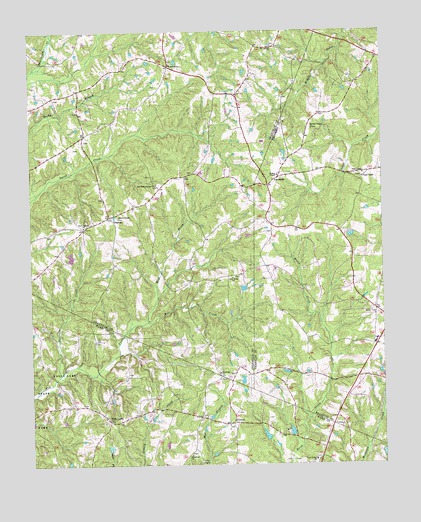
Grissom, NC USGS Topographic Map
Click on map above to begin viewing in our Map Viewer.

This topographic map contains these locations and features:
Feature Name Type Latitude Longitude GNIS ID View Map
Bragg School (historical)SchoolN36.1068°W78.5533°1951042View Map
Brassfield ChurchChurchN36.1157°W78.5747°981838View Map
Brassfield School (historical)SchoolN36.0993°W78.5989°1951044View Map
Brassfield Volunteer Fire DepartmentBuildingN36.1073°W78.5528°2639117View Map
Buckhorn CreekStreamN36.0263°W78.6153°982142View Map
Camp KanataLocaleN36.0010°W78.5653°982537View Map
Cedar Grove Church (historical)ChurchN36.0149°W78.5997°1951438View Map
Good Hope Baptist ChurchChurchN36.0543°W78.5531°985789View Map
GrissomPopulated PlaceN36.0721°W78.5964°986166View Map
Kinches ChapelChurchN36.0971°W78.5244°987972View Map
Kinches School (historical)SchoolN36.0974°W78.5244°1008379View Map
Maple Springs School (historical)SchoolN36.0540°W78.5322°1008385View Map
Marys ChapelChurchN36.0721°W78.5933°989425View Map
Masons PondReservoirN36.0085°W78.5331°999895View Map
Masons Pond DamDamN36.0085°W78.5331°999896View Map
Mill CreekStreamN36.0413°W78.5836°989929View Map
Mount Carmel ChurchChurchN36.1207°W78.5386°990361View Map
New LightPopulated PlaceN36.0129°W78.5972°991063View Map
New Rock Spring ChurchChurchN36.0810°W78.5800°991088View Map
PocomokePopulated PlaceN36.0804°W78.5403°1024227View Map
Poke ChapelChurchN36.0840°W78.5061°992622View Map
Popes ChapelChurchN36.0829°W78.5064°1022034View Map
PurnellPopulated PlaceN36.0121°W78.5533°1024240View Map
Rock Spring ChurchChurchN36.0690°W78.6058°993524View Map
Sunrise School (historical)SchoolN36.0160°W78.5761°1951483View Map
Township of BrassfieldCivilN36.1214°W78.5944°1026712View Map
Wake Union ChurchChurchN36.0015°W78.5244°996682View Map
Wesley ChapelChurchN36.0835°W78.5367°1023156View Map
West Prong New Light CreekStreamN36.0496°W78.5800°997041View Map
Woodland ChurchChurchN36.0029°W78.5686°997588View Map
Woodland ChurchChurchN36.0268°W78.5581°997589View Map

Note: Coordinates in the location and feature list above are referenced to NAD83 datum.


Copyright (C) 2008-2025 Ryan Niemi / Sunset Dynamics ... All Rights Reserved