TopoQuest Logo
Do you find TopoQuest useful?
Help keep TopoQuest running and adding new maps/features by donating!
Bitcoin:  19c7KJd3qBynnjoSw5npx9KScwjBe4ifkT
Litecoin:  LXs6TkuXGGXo1vDsWCkWVdjQX94eUKd6ui
Home View Maps Find Maps Find Places Resources & Links


Hanson Reservoir, Montana Topographic Map

USGS Map Title: Hanson Reservoir, MT
USGS Map MRC: 46111E1
DRG (GeoTIFF) Download: o46111e1.tif


Neighboring USGS Topographic Map Quads:


  Fort Logan, MT  
46111F2
 

  Whitetail Reservoir, MT  
46111F1
 

  Coxcombe Butte, MT  
46110F8
 

  Gipsy Lake, MT  
46111E2
 

  Hanson Reservoir, MT  
46111E1
 

  White Sulphur Springs, MT  
46110E8
 

  Mount Edith, MT  
46111D2
 

  Alkali Lake, MT  
46111D1
 

  Catlin Spring, MT  
46110D8


Map MRC Location:

N47°
W112°
N47°
W111°
H8 H7 H6 H5 H4 H3 H2 H1
G8 G7 G6 G5 G4 G3 G2 G1
F8 F7 F6 F5 F4 F3 F2 F1
E8 E7 E6 E5 E4 E3 E2 E1
D8 D7 D6 D5 D4 D3 D2 D1
C8 C7 C6 C5 C4 C3 C2 C1
B8 B7 B6 B5 B4 B3 B2 B1
A8 A7 A6 A5 A4 A3 A2 A1
N46°
W112°
N46°
W111°

Hanson Reservoir, MT USGS 1:24K Topographic Map Preview:
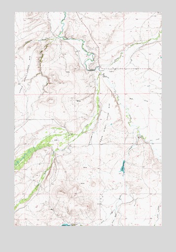
Hanson Reservoir, MT USGS Topographic Map
Click on map above to begin viewing in our Map Viewer.

This topographic map contains these locations and features:
Feature Name Type Latitude Longitude GNIS ID View Map
09N05E10BB__01 WellWellN46.5574°W111.0913°816812View Map
10N05E22B___01 WellWellN46.6116°W111.0911°817111View Map
10N05E25CA__01 WellWellN46.5916°W111.0466°816984View Map
10N05E25DD__01 WellWellN46.5880°W111.0363°816950View Map
10N06E30DA__01 WellWellN46.5944°W111.0136°817002View Map
Big Birch CreekStreamN46.5883°W111.0538°779764View Map
Fox CreekStreamN46.5491°W111.0130°783672View Map
Hanson ReservoirReservoirN46.5344°W111.0337°772134View Map
Hanson Reservoir DamDamN46.5383°W111.0324°798278View Map
Langford City (historical)Populated PlaceN46.5483°W111.0322°1762749View Map
Little Birch CreekStreamN46.5533°W111.0711°786241View Map
Lower Birch Creek BarBarN46.5602°W111.0483°773726View Map
Mud CreekStreamN46.5766°W111.0391°787782View Map
Newlan CreekStreamN46.5908°W111.0538°787971View Map
North Fork Woods Gulch CreekStreamN46.5105°W111.0388°788285View Map
Onondago Post Office (historical)Post OfficeN46.5466°W111.1174°1762713View Map
South Fork Woods Gulch CreekStreamN46.5105°W111.0391°791092View Map
Thompson GulchValleyN46.6102°W111.0894°777584View Map
Woods Gulch CreekStreamN46.5536°W111.0191°778683View Map

Note: Coordinates in the location and feature list above are referenced to NAD83 datum.


Copyright (C) 2008-2024 Ryan Niemi / Sunset Dynamics ... All Rights Reserved