TopoQuest Logo
Do you find TopoQuest useful?
Help keep TopoQuest running and adding new maps/features by donating!
Bitcoin:  19c7KJd3qBynnjoSw5npx9KScwjBe4ifkT
Litecoin:  LXs6TkuXGGXo1vDsWCkWVdjQX94eUKd6ui
Home View Maps Find Maps Find Places Resources & Links


Gipsy Lake, Montana Topographic Map

USGS Map Title: Gipsy Lake, MT
USGS Map MRC: 46111E2
DRG (GeoTIFF) Download: o46111e2.tif


Neighboring USGS Topographic Map Quads:


  Watson, MT  
46111F3
 

  Fort Logan, MT  
46111F2
 

  Whitetail Reservoir, MT  
46111F1
 

  Boulder Baldy, MT  
46111E3
 

  Gipsy Lake, MT  
46111E2
 

  Hanson Reservoir, MT  
46111E1
 

  Gurnett Creek East, MT  
46111D3
 

  Mount Edith, MT  
46111D2
 

  Alkali Lake, MT  
46111D1


Map MRC Location:

N47°
W112°
N47°
W111°
H8 H7 H6 H5 H4 H3 H2 H1
G8 G7 G6 G5 G4 G3 G2 G1
F8 F7 F6 F5 F4 F3 F2 F1
E8 E7 E6 E5 E4 E3 E2 E1
D8 D7 D6 D5 D4 D3 D2 D1
C8 C7 C6 C5 C4 C3 C2 C1
B8 B7 B6 B5 B4 B3 B2 B1
A8 A7 A6 A5 A4 A3 A2 A1
N46°
W112°
N46°
W111°

Gipsy Lake, MT USGS 1:24K Topographic Map Preview:
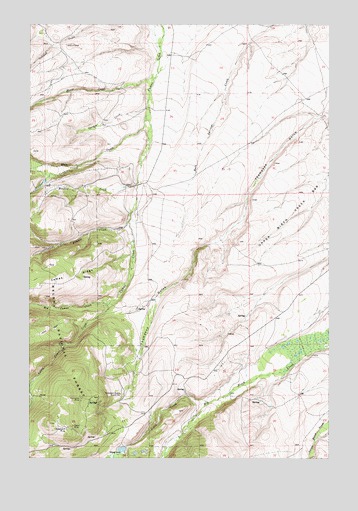
Gipsy Lake, MT USGS Topographic Map
Click on map above to begin viewing in our Map Viewer.

This topographic map contains these locations and features:
Feature Name Type Latitude Longitude GNIS ID View Map
Atlanta CreekStreamN46.5674°W111.2102°779187View Map
Big Camas CreekStreamN46.5444°W111.2186°779772View Map
Bigler MineMineN46.5085°W111.2322°768847View Map
BuckinghamPopulated PlaceN46.5169°W111.1666°794726View Map
Camas RidgeRidgeN46.5505°W111.2441°780817View Map
Garden CreekStreamN46.6011°W111.2019°771703View Map
Gile Post Office (historical)Post OfficeN46.5277°W111.2058°1762750View Map
Gipsy CreekStreamN46.5160°W111.1755°783955View Map
Gipsy LakeReservoirN46.5024°W111.2121°771784View Map
Lane MineMineN46.5391°W111.1786°804640View Map
Little Camas CreekStreamN46.5444°W111.2186°786264View Map
MangerPopulated PlaceN46.5166°W111.2258°794725View Map
Meadow CreekStreamN46.5783°W111.2063°774057View Map
Moose CreekStreamN46.6097°W111.1991°787639View Map
Mule CreekStreamN46.5983°W111.2027°787839View Map
NE NE Section 29 MineMineN46.5177°W111.2466°804639View Map
Pickfoot CreekStreamN46.5841°W111.2311°788832View Map
Porcupine MineMineN46.5172°W111.2297°775377View Map
Porcupine MineMineN46.5180°W111.2297°804690View Map
SE NW Section 24 MineMineN46.5361°W111.1702°804638View Map
Snowbank MineMineN46.5085°W111.2352°776712View Map
Thompson Gulch Guard StationLocaleN46.5183°W111.2125°801775View Map
Thompson Gulch School (historical)SchoolN46.5472°W111.1827°1762730View Map
Thompson Post Office (historical)Post OfficeN46.5472°W111.1827°1762719View Map
Upper Birch Creek BarBarN46.5763°W111.1302°777917View Map

Note: Coordinates in the location and feature list above are referenced to NAD83 datum.


Copyright (C) 2008-2024 Ryan Niemi / Sunset Dynamics ... All Rights Reserved