TopoQuest Logo
Do you find TopoQuest useful?
Help keep TopoQuest running and adding new maps/features by donating!
Bitcoin:  19c7KJd3qBynnjoSw5npx9KScwjBe4ifkT
Litecoin:  LXs6TkuXGGXo1vDsWCkWVdjQX94eUKd6ui
Home View Maps Find Maps Find Places Resources & Links


Harrah, Washington Topographic Map

USGS Map Title: Harrah, WA
USGS Map MRC: 46120D5
DRG (GeoTIFF) Download: o46120d5.tif


Neighboring USGS Topographic Map Quads:


  Wiley City, WA  
46120E6
 

  Yakima West, WA  
46120E5
 

  Yakima East, WA  
46120E4
 

  White Swan, WA  
46120D6
 

  Harrah, WA  
46120D5
 

  Wapato, WA  
46120D4
 

  Toppenish Mountain, WA  
46120C6
 

  Harrah SE, WA  
46120C5
 

  Toppenish SW, WA  
46120C4


Map MRC Location:

N47°
W121°
N47°
W120°
H8 H7 H6 H5 H4 H3 H2 H1
G8 G7 G6 G5 G4 G3 G2 G1
F8 F7 F6 F5 F4 F3 F2 F1
E8 E7 E6 E5 E4 E3 E2 E1
D8 D7 D6 D5 D4 D3 D2 D1
C8 C7 C6 C5 C4 C3 C2 C1
B8 B7 B6 B5 B4 B3 B2 B1
A8 A7 A6 A5 A4 A3 A2 A1
N46°
W121°
N46°
W120°

Harrah, WA USGS 1:24K Topographic Map Preview:
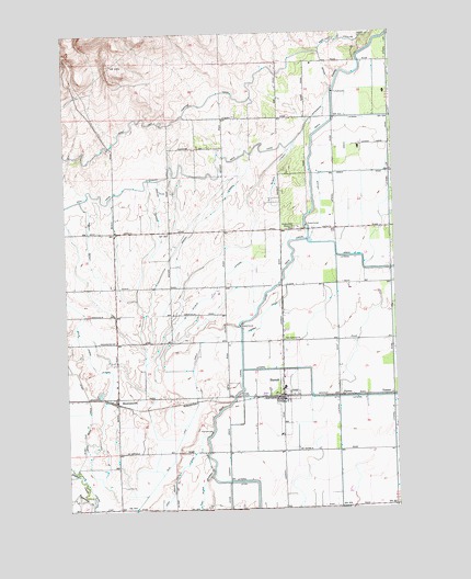
Harrah, WA USGS Topographic Map
Click on map above to begin viewing in our Map Viewer.

This topographic map contains these locations and features:
Feature Name Type Latitude Longitude GNIS ID View Map
Brown LateralCanalN46.4529°W120.5701°1503571View Map
BrownstownPopulated PlaceN46.4043°W120.6070°1512039View Map
Brownstown Post OfficePost OfficeN46.4047°W120.6070°2769220View Map
Dills Lemon LateralCanalN46.4129°W120.6162°1504482View Map
East Island LateralCanalN46.3776°W120.5756°1504644View Map
FarronPopulated PlaceN46.4046°W120.5215°1510964View Map
HarrahPopulated PlaceN46.4043°W120.5442°1512275View Map
Harrah Community Christian SchoolSchoolN46.4036°W120.5477°1515261View Map
Harrah Elementary SchoolSchoolN46.4067°W120.5436°1515258View Map
Harrah FeedlotLocaleN46.4317°W120.5708°2704100View Map
Harrah Post OfficePost OfficeN46.4063°W120.5444°2769182View Map
Labbee Field (historical)AirportN46.3793°W120.5595°1533789View Map
Laclair DrainCanalN46.4629°W120.5231°1506038View Map
Larson LateralCanalN46.4465°W120.6170°1506083View Map
Lateral 1CanalN46.4773°W120.5062°1506090View Map
Main CanalCanalN46.4421°W120.5398°1513941View Map
Mud Lake DrainCanalN46.3923°W120.5842°1506876View Map
Old Wilbur LateralCanalN46.4593°W120.5470°1507159View Map
Olney Flat DrainCanalN46.4032°W120.6178°1507170View Map
Piute LateralCanalN46.3832°W120.6203°1507479View Map
Reservation Memorial ParkParkN46.4487°W120.5376°1507783View Map
Simcoe CreekStreamN46.3765°W120.6181°1508356View Map
Town of HarrahCivilN46.4070°W120.5422°2412728View Map
VennerPopulated PlaceN46.4048°W120.5020°1511394View Map
Vogler LateralCanalN46.4540°W120.5912°1509242View Map
Wilbur LateralCanalN46.4337°W120.5687°1509504View Map
Yakima County Fire District 5 Station 2 BrownstownBuildingN46.4021°W120.6075°2643936View Map
Yakima County Fire District 5 Station 3 HarrahBuildingN46.4033°W120.5437°2643447View Map

Note: Coordinates in the location and feature list above are referenced to NAD83 datum.


Copyright (C) 2008-2024 Ryan Niemi / Sunset Dynamics ... All Rights Reserved