TopoQuest Logo
Do you find TopoQuest useful?
Help keep TopoQuest running and adding new maps/features by donating!
Bitcoin:  19c7KJd3qBynnjoSw5npx9KScwjBe4ifkT
Litecoin:  LXs6TkuXGGXo1vDsWCkWVdjQX94eUKd6ui
Home View Maps Find Maps Find Places Resources & Links


Candor, North Carolina Topographic Map

USGS Map Title: Candor, NC
USGS Map MRC: 35079C6
DRG (GeoTIFF) Download: o35079c6.tif


Neighboring USGS Topographic Map Quads:


  Star, NC  
35079D7
 

  Spies, NC  
35079D6
 

  Robbins, NC  
35079D5
 

  Biscoe, NC  
35079C7
 

  Candor, NC  
35079C6
 

  Zion Grove, NC  
35079C5
 

  Harrisville, NC  
35079B7
 

  Norman, NC  
35079B6
 

  West End, NC  
35079B5


Map MRC Location:

N36°
W80°
N36°
W79°
H8 H7 H6 H5 H4 H3 H2 H1
G8 G7 G6 G5 G4 G3 G2 G1
F8 F7 F6 F5 F4 F3 F2 F1
E8 E7 E6 E5 E4 E3 E2 E1
D8 D7 D6 D5 D4 D3 D2 D1
C8 C7 C6 C5 C4 C3 C2 C1
B8 B7 B6 B5 B4 B3 B2 B1
A8 A7 A6 A5 A4 A3 A2 A1
N35°
W80°
N35°
W79°

Candor, NC USGS 1:24K Topographic Map Preview:
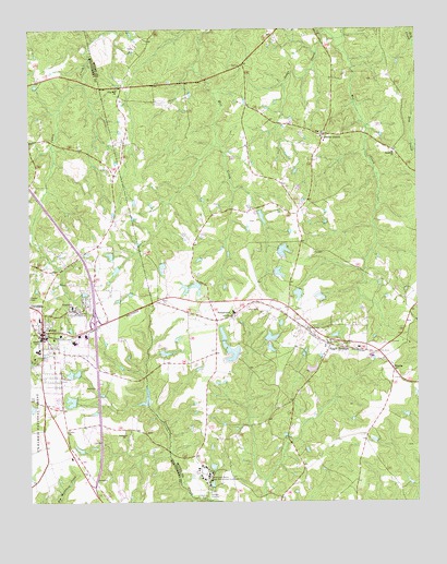
Candor, NC USGS Topographic Map
Click on map above to begin viewing in our Map Viewer.

This topographic map contains these locations and features:
Feature Name Type Latitude Longitude GNIS ID View Map
Antioch ChurchChurchN35.2679°W79.7192°1008746View Map
Archie McDuffie DamDamN35.3218°W79.6764°1017165View Map
Arthur Williams and Son Number One DamDamN35.2885°W79.6831°1017129View Map
Arthur Williams and Son Number Two DamDamN35.2935°W79.6731°1017137View Map
Arthur Williams and Sons Dam Number ThreeDamN35.2918°W79.6731°1017134View Map
Arthur Williams DamDamN35.3168°W79.6698°1017164View Map
Arthur Williams Dam Number TwoDamN35.3068°W79.6631°1017148View Map
Baldwin PondReservoirN35.3154°W79.7237°1017159View Map
Baldwin Pond DamDamN35.3151°W79.7231°1017160View Map
Bengston Lake Dam Number ThreeDamN35.2668°W79.6381°1017114View Map
Bensalem ChurchChurchN35.3424°W79.6323°1009184View Map
Big Oak AcademySchoolN35.3463°W79.6539°1009344View Map
Big Oak ChurchChurchN35.3465°W79.6550°1009345View Map
Brutonville SchoolSchoolN35.3018°W79.7359°1009705View Map
CandorPopulated PlaceN35.2951°W79.7453°1009994View Map
Candor City ReservoirReservoirN35.2776°W79.7123°1017123View Map
Candor City Reservoir DamDamN35.2768°W79.7114°1017124View Map
Candor Elementary SchoolSchoolN35.2901°W79.7473°1017622View Map
Candor Police DepartmentBuildingN35.2931°W79.7460°2769803View Map
Candor Post OfficePost OfficeN35.2992°W79.7464°2773902View Map
Candor Volunteer Fire DepartmentBuildingN35.2939°W79.7467°2638542View Map
Center ChurchChurchN35.2693°W79.7375°1010143View Map
Cunningham LakeReservoirN35.2641°W79.7339°1017112View Map
Cunningham Lake DamDamN35.2635°W79.7331°1017113View Map
Eagle SpringsPopulated PlaceN35.2915°W79.6528°1020069View Map
Eagle Springs Post OfficePost OfficeN35.2924°W79.6521°2773885View Map
Eagle Springs Volunteer Fire DepartmentBuildingN35.2926°W79.6541°2639320View Map
Ed Harris DamDamN35.3135°W79.7081°1017156View Map
Ed Harris Dam Number OneDamN35.3068°W79.7114°1017150View Map
Ed Harris Dam Number TwoDamN35.3068°W79.6981°1017149View Map
ElbertaPopulated PlaceN35.2849°W79.6325°1011036View Map
Ewing LakeReservoirN35.2641°W79.7339°1017111View Map
Ewing Lake DamDamN35.2635°W79.7331°1017110View Map
Flint Hill ChurchChurchN35.3590°W79.7211°1011288View Map
Jordan PondReservoirN35.2896°W79.7059°1017133View Map
Jordan Pond DamDamN35.2901°W79.7081°1017132View Map
Leaks Grove ChurchChurchN35.2960°W79.6600°1012762View Map
McCauley PondReservoirN35.3053°W79.7320°1017147View Map
McCauley Pond DamDamN35.3051°W79.7331°1017146View Map
Mount Zion ChurchChurchN35.3001°W79.7348°1013782View Map
NonameReservoirN35.2858°W79.7204°1017128View Map
NonameReservoirN35.2923°W79.7255°1017136View Map
Phillip Benston Dam Number FourDamN35.2735°W79.6448°1017121View Map
SamarcandPopulated PlaceN35.2996°W79.6845°1015200View Map
Samarcand Manor State Correctional InstitutiLocaleN35.2571°W79.6923°1015201View Map
Sings CreekStreamN35.3729°W79.6478°1015553View Map
Town of CandorCivilN35.2964°W79.7325°2405374View Map
Township 2-BensalemCivilN35.3394°W79.6392°1026968View Map
Upper Pompelli LakeReservoirN35.2945°W79.6875°1017138View Map
Upper Pompelli Lake DamDamN35.2935°W79.6881°1017139View Map
V W Burkhead Dam Number OneDamN35.2851°W79.7198°1017127View Map
V W Burkhead Dam Number TwoDamN35.2918°W79.7248°1017135View Map
W T Lewis DamDamN35.3101°W79.6714°1017153View Map

Note: Coordinates in the location and feature list above are referenced to NAD83 datum.


Copyright (C) 2008-2025 Ryan Niemi / Sunset Dynamics ... All Rights Reserved