TopoQuest Logo
Do you find TopoQuest useful?
Help keep TopoQuest running and adding new maps/features by donating!
Bitcoin:  19c7KJd3qBynnjoSw5npx9KScwjBe4ifkT
Litecoin:  LXs6TkuXGGXo1vDsWCkWVdjQX94eUKd6ui
Home View Maps Find Maps Find Places Resources & Links


Klondike Ranch, Wyoming Topographic Map

USGS Map Title: Klondike Ranch, WY
USGS Map MRC: 44106B7
DRG (GeoTIFF) Download: o44106b7.tif


Neighboring USGS Topographic Map Quads:


  Hunter Mesa, WY  
44106C8
 

  North Ridge, WY  
44106C7
 

  Buffalo, WY  
44106C6
 

  Caribou Creek, WY  
44106B8
 

  Klondike Ranch, WY  
44106B7
 

  T A Ranch, WY  
44106B6
 

  Hazelton, WY  
44106A8
 

  Robinson Canyon, WY  
44106A7
 

  Purdy Reservoir, WY  
44106A6


Map MRC Location:

N45°
W107°
N45°
W106°
H8 H7 H6 H5 H4 H3 H2 H1
G8 G7 G6 G5 G4 G3 G2 G1
F8 F7 F6 F5 F4 F3 F2 F1
E8 E7 E6 E5 E4 E3 E2 E1
D8 D7 D6 D5 D4 D3 D2 D1
C8 C7 C6 C5 C4 C3 C2 C1
B8 B7 B6 B5 B4 B3 B2 B1
A8 A7 A6 A5 A4 A3 A2 A1
N44°
W107°
N44°
W106°

Klondike Ranch, WY USGS 1:24K Topographic Map Preview:
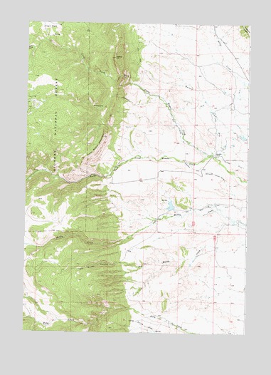
Klondike Ranch, WY USGS Topographic Map
Click on map above to begin viewing in our Map Viewer.

This topographic map contains these locations and features:
Feature Name Type Latitude Longitude GNIS ID View Map
Big Horn Mountains Number One MineMineN44.1586°W106.7981°1726431View Map
Blue Gap Ditch Number 19CanalN44.2166°W106.7653°1605177View Map
Cook Ditch Number 9CanalN44.2161°W106.7631°1605235View Map
Crazy Woman MountainSummitN44.2039°W106.8312°1599013View Map
Dry Muddy CanyonValleyN44.1530°W106.8209°1599374View Map
Elgin CreekStreamN44.2422°W106.8681°1599567View Map
Elgin ParkFlatN44.2480°W106.8617°1599568View Map
Gossett CanyonValleyN44.2186°W106.8164°1600119View Map
Gossett CreekStreamN44.2205°W106.8026°1597117View Map
Klondike RanchLocaleN44.1978°W106.7687°1600746View Map
Little North Fork Crazy Woman CreekStreamN44.1961°W106.7714°1601012View Map
Louise CreekStreamN44.2202°W106.8267°1597092View Map
Louise CreekStreamN44.2205°W106.7992°1604694View Map
Muddy Creek MineMineN44.1736°W106.7903°1726432View Map
Muddy Guard Reservoir Number 1ReservoirN44.1766°W106.7739°1608101View Map
Muddy Guard Reservoir Number 1 DamDamN44.1766°W106.7739°1608100View Map
Muddy Guard Reservoir Number 2ReservoirN44.1850°W106.7556°1608103View Map
Muddy Guard Reservoir Number 2 DamDamN44.1850°W106.7556°1608102View Map
Muffie DamDamN44.2116°W106.7639°1606520View Map
Muffie ReservoirReservoirN44.2116°W106.7639°1606521View Map
Patch DamDamN44.1750°W106.7956°1607126View Map
Patch ReservoirReservoirN44.1766°W106.7935°1607127View Map
Red Bank Ditch Number 2CanalN44.1752°W106.7778°1605438View Map
Rice Ditch Number 1CanalN44.2077°W106.7901°1605446View Map
Roe Brothers Group MineMineN44.2158°W106.8309°1726433View Map
Sisters HillSummitN44.2361°W106.8253°1602938View Map
Sisters Hill MineMineN44.2405°W106.8114°1726434View Map
Spring DrawValleyN44.1252°W106.8003°1603278View Map
Tass DamDamN44.2050°W106.7573°1606972View Map
Tass ReservoirReservoirN44.2050°W106.7573°1606973View Map
Thompson and Mathews Ditch Number 35CanalN44.1897°W106.7695°1605493View Map
Webber CreekStreamN44.2394°W106.8717°1597105View Map
Webber CreekStreamN44.2369°W106.8734°1604693View Map

Note: Coordinates in the location and feature list above are referenced to NAD83 datum.


Copyright (C) 2008-2025 Ryan Niemi / Sunset Dynamics ... All Rights Reserved