TopoQuest Logo
Do you find TopoQuest useful?
Help keep TopoQuest running and adding new maps/features by donating!
Bitcoin:  19c7KJd3qBynnjoSw5npx9KScwjBe4ifkT
Litecoin:  LXs6TkuXGGXo1vDsWCkWVdjQX94eUKd6ui
Home View Maps Find Maps Find Places Resources & Links


North Ridge, Wyoming Topographic Map

USGS Map Title: North Ridge, WY
USGS Map MRC: 44106C7
DRG (GeoTIFF) Download: o44106c7.tif


Neighboring USGS Topographic Map Quads:


  Stone Mountain, WY  
44106D8
 

  Lake De Smet West, WY  
44106D7
 

  Lake De Smet East, WY  
44106D6
 

  Hunter Mesa, WY  
44106C8
 

  North Ridge, WY  
44106C7
 

  Buffalo, WY  
44106C6
 

  Caribou Creek, WY  
44106B8
 

  Klondike Ranch, WY  
44106B7
 

  T A Ranch, WY  
44106B6


Map MRC Location:

N45°
W107°
N45°
W106°
H8 H7 H6 H5 H4 H3 H2 H1
G8 G7 G6 G5 G4 G3 G2 G1
F8 F7 F6 F5 F4 F3 F2 F1
E8 E7 E6 E5 E4 E3 E2 E1
D8 D7 D6 D5 D4 D3 D2 D1
C8 C7 C6 C5 C4 C3 C2 C1
B8 B7 B6 B5 B4 B3 B2 B1
A8 A7 A6 A5 A4 A3 A2 A1
N44°
W107°
N44°
W106°

North Ridge, WY USGS 1:24K Topographic Map Preview:
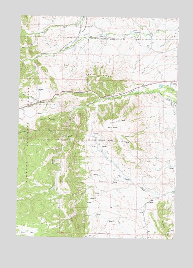
North Ridge, WY USGS Topographic Map
Click on map above to begin viewing in our Map Viewer.

This topographic map contains these locations and features:
Feature Name Type Latitude Longitude GNIS ID View Map
Bald RidgeRidgeN44.3119°W106.8009°1597894View Map
Brush CreekStreamN44.3100°W106.8681°1598422View Map
Cross DitchCanalN44.3264°W106.7520°1599037View Map
Eagle DitchCanalN44.3577°W106.8517°1599441View Map
Grommund CreekStreamN44.3064°W106.8356°1600113View Map
Grouse MountainSummitN44.3155°W106.8531°1600127View Map
Hay GulchValleyN44.3261°W106.8589°1600248View Map
Johnson County DitchCanalN44.3241°W106.7531°1600636View Map
KLGT-FM (Buffalo)TowerN44.3411°W106.8126°1608902View Map
Moeller DitchCanalN44.3680°W106.8209°1601505View Map
Moeller Ditch Number 1CanalN44.3625°W106.7562°1605384View Map
Mosier GulchValleyN44.3286°W106.8114°1601571View Map
Mosier Gulch MineMineN44.3319°W106.8512°1726489View Map
North RidgeRidgeN44.3422°W106.8128°1601859View Map
Trail SideLocaleN44.3258°W106.8584°1603746View Map
Willow CreekStreamN44.3489°W106.8723°1604211View Map

Note: Coordinates in the location and feature list above are referenced to NAD83 datum.


Copyright (C) 2008-2024 Ryan Niemi / Sunset Dynamics ... All Rights Reserved