TopoQuest Logo
Do you find TopoQuest useful?
Help keep TopoQuest running and adding new maps/features by donating!
Bitcoin:  19c7KJd3qBynnjoSw5npx9KScwjBe4ifkT
Litecoin:  LXs6TkuXGGXo1vDsWCkWVdjQX94eUKd6ui
Home View Maps Find Maps Find Places Resources & Links


La Farge, Wisconsin Topographic Map

USGS Map Title: La Farge, WI
USGS Map MRC: 43090E6
DRG (GeoTIFF) Download: o43090e6.tif


Neighboring USGS Topographic Map Quads:


  Westby, WI  
43090F7
 

  Dell, WI  
43090F6
 

  Ontario, WI  
43090F5
 

  Avalanche, WI  
43090E7
 

  La Farge, WI  
43090E6
 

  West Lima, WI  
43090E5
 

  Readstown, WI  
43090D7
 

  Sugar Grove, WI  
43090D6
 

  Sabin, WI  
43090D5


Map MRC Location:

N44°
W91°
N44°
W90°
H8 H7 H6 H5 H4 H3 H2 H1
G8 G7 G6 G5 G4 G3 G2 G1
F8 F7 F6 F5 F4 F3 F2 F1
E8 E7 E6 E5 E4 E3 E2 E1
D8 D7 D6 D5 D4 D3 D2 D1
C8 C7 C6 C5 C4 C3 C2 C1
B8 B7 B6 B5 B4 B3 B2 B1
A8 A7 A6 A5 A4 A3 A2 A1
N43°
W91°
N43°
W90°

La Farge, WI USGS 1:24K Topographic Map Preview:
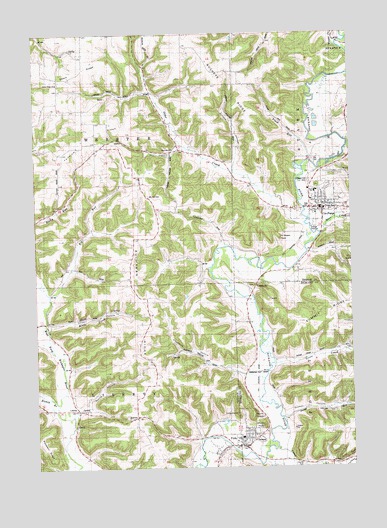
La Farge, WI USGS Topographic Map
Click on map above to begin viewing in our Map Viewer.

This topographic map contains these locations and features:
Feature Name Type Latitude Longitude GNIS ID View Map
272 ReservoirReservoirN43.5866°W90.6435°1792077View Map
Ames School (historical)SchoolN43.5439°W90.7057°1840830View Map
Bear CreekStreamN43.5666°W90.6360°1561353View Map
Birds CreekStreamN43.5397°W90.7457°1834440View Map
Bishop BranchStreamN43.5186°W90.7421°1561828View Map
Buchanan RidgeRidgeN43.5403°W90.7057°1562319View Map
Buckeye RidgeRidgeN43.6147°W90.6776°1562331View Map
Camp CreekStreamN43.5058°W90.6554°1562593View Map
Cedar Grove FarmLocaleN43.5236°W90.6587°1957156View Map
Chadwick HollowValleyN43.5267°W90.6670°1562916View Map
Chapel Hill CemeteryCemeteryN43.5822°W90.6407°1562943View Map
Dry HollowValleyN43.5920°W90.6919°1564121View Map
Elk RunStreamN43.5500°W90.7435°1564529View Map
Elk Run School (historical)SchoolN43.5500°W90.7440°1840834View Map
Elms Spring FarmLocaleN43.5339°W90.6412°1957187View Map
Elmwood FarmLocaleN43.5225°W90.6649°1957189View Map
Fairview RidgeRidgeN43.5889°W90.7393°1564819View Map
Fairview School (historical)SchoolN43.5919°W90.7254°1840835View Map
Festina Hereford Stock FarmLocaleN43.5008°W90.6410°1957075View Map
Fort Wales RockPillarN43.5647°W90.6618°1565155View Map
Goose CreekStreamN43.5294°W90.6557°1565643View Map
Greene HollowValleyN43.5871°W90.6706°1565839View Map
Hillside FarmLocaleN43.5508°W90.6460°1957206View Map
Hillview FarmLocaleN43.5311°W90.6646°1958179View Map
IndianheadSummitN43.5155°W90.6712°1834467View Map
Kickapoo Valley Rescue SquadBuildingN43.5075°W90.6675°2698396View Map
La FargePopulated PlaceN43.5747°W90.6404°1567689View Map
La Farge 1840C48 DamDamN43.5866°W90.6435°1792076View Map
La Farge Area Emergency Medical ServicesBuildingN43.5723°W90.6384°2698229View Map
La Farge Elementary SchoolSchoolN43.5794°W90.6393°2715741View Map
La Farge Fire DepartmentBuildingN43.5727°W90.6391°2697725View Map
La Farge High SchoolSchoolN43.5794°W90.6393°1834471View Map
La Farge Middle SchoolSchoolN43.5793°W90.6393°2715827View Map
La Farge Police DepartmentBuildingN43.5741°W90.6368°2759691View Map
Laurel Hill Sheep FarmLocaleN43.5089°W90.6274°1957208View Map
Lawton CemeteryCemeteryN43.5527°W90.6662°1834382View Map
LibertyPopulated PlaceN43.5164°W90.7340°1577703View Map
Lyons School (historical)SchoolN43.5739°W90.6996°1840839View Map
Maple Dale FarmLocaleN43.5333°W90.6487°1957211View Map
Maple Park Stock FarmLocaleN43.5497°W90.6640°1957214View Map
Meadow Stock FarmLocaleN43.5561°W90.6626°1957218View Map
Mount NeboSummitN43.5119°W90.6608°1570129View Map
Mount SheldonSummitN43.5151°W90.6649°1834424View Map
Mount Zion CemeteryCemeteryN43.5780°W90.7043°1569865View Map
Norris HollowValleyN43.5189°W90.7306°1570342View Map
Oak Glen FarmLocaleN43.5439°W90.6279°1957222View Map
Oakland FarmLocaleN43.5297°W90.6607°1957225View Map
Otter CreekStreamN43.5689°W90.6418°1570893View Map
Ottervale ChurchChurchN43.5916°W90.6951°1570921View Map
Ottervale School (historical)SchoolN43.5908°W90.6904°1840846View Map
Plainview School (historical)SchoolN43.5111°W90.7104°1840847View Map
Plum RunStreamN43.5878°W90.6404°1571699View Map
Ruby FarmLocaleN43.5025°W90.6293°1957129View Map
Salem RidgeRidgeN43.6169°W90.7482°1573631View Map
Salem Ridge ChurchChurchN43.6111°W90.7410°1573632View Map
Salem School (historical)SchoolN43.6116°W90.7407°1840848View Map
Scott HollowValleyN43.5412°W90.7451°1573842View Map
Shady Lawn Stock FarmLocaleN43.5511°W90.6518°1957235View Map
Spring Brook FarmLocaleN43.5380°W90.6626°1957291View Map
Spring Glen FarmLocaleN43.5189°W90.6551°1957294View Map
Star CemeteryCemeteryN43.5883°W90.6382°1574800View Map
Star Valley School (historical)SchoolN43.6066°W90.6357°1840852View Map
Town of LibertyCivilN43.5245°W90.7316°1583553View Map
Town of WebsterCivilN43.5959°W90.7306°1584392View Map
TunnelvillePopulated PlaceN43.5530°W90.6585°1577860View Map
Tunnelville School (historical)SchoolN43.5525°W90.6668°1840829View Map
Valleyview FarmLocaleN43.5369°W90.6676°1958302View Map
Village of La FargeCivilN43.5782°W90.6381°1583501View Map
Village of ViolaCivilN43.5070°W90.6734°1584334View Map
ViolaPopulated PlaceN43.5061°W90.6682°1576108View Map
Viola CemeteryCemeteryN43.5077°W90.6623°1834433View Map
Viola Elementary SchoolSchoolN43.5086°W90.6690°1834434View Map
Viola Police DepartmentBuildingN43.5086°W90.6690°2759514View Map
Viola Volunteer Fire DepartmentBuildingN43.5074°W90.6681°2697842View Map
Waggoners Stock FarmLocaleN43.5016°W90.6574°1957132View Map
Weister CreekStreamN43.6208°W90.6276°1576409View Map
Welker HollowValleyN43.5143°W90.6517°1576413View Map
Willowdale FarmLocaleN43.5108°W90.6518°1957307View Map

Note: Coordinates in the location and feature list above are referenced to NAD83 datum.


Copyright (C) 2008-2025 Ryan Niemi / Sunset Dynamics ... All Rights Reserved