TopoQuest Logo
Do you find TopoQuest useful?
Help keep TopoQuest running and adding new maps/features by donating!
Bitcoin:  19c7KJd3qBynnjoSw5npx9KScwjBe4ifkT
Litecoin:  LXs6TkuXGGXo1vDsWCkWVdjQX94eUKd6ui
Home View Maps Find Maps Find Places Resources & Links


Lean-to Point, Idaho Topographic Map

USGS Map Title: Lean-to Point, ID
USGS Map MRC: 46115E4
DRG (GeoTIFF) Download: o46115e4.tif


Neighboring USGS Topographic Map Quads:


  Clarke Mountain, ID  
46115F5
 

  Pot Mountain, ID  
46115F4
 

  Junction Mountain, ID  
46115F3
 

  Larch Butte, ID  
46115E5
 

  Lean-to Point, ID  
46115E4
 

  Cook Mountain, ID  
46115E3
 

  Snowy Summit, ID  
46115D5
 

  Weitas Butte, ID  
46115D4
 

  Liz Butte, ID  
46115D3


Map MRC Location:

N47°
W116°
N47°
W115°
H8 H7 H6 H5 H4 H3 H2 H1
G8 G7 G6 G5 G4 G3 G2 G1
F8 F7 F6 F5 F4 F3 F2 F1
E8 E7 E6 E5 E4 E3 E2 E1
D8 D7 D6 D5 D4 D3 D2 D1
C8 C7 C6 C5 C4 C3 C2 C1
B8 B7 B6 B5 B4 B3 B2 B1
A8 A7 A6 A5 A4 A3 A2 A1
N46°
W116°
N46°
W115°

Lean-to Point, ID USGS 1:24K Topographic Map Preview:
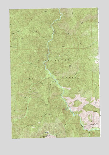
Lean-to Point, ID USGS Topographic Map
Click on map above to begin viewing in our Map Viewer.

This topographic map contains these locations and features:
Feature Name Type Latitude Longitude GNIS ID View Map
Bennett CreekStreamN46.5221°W115.4071°377364View Map
Bighorn CreekStreamN46.5941°W115.4443°377622View Map
Bighorn PointSummitN46.6227°W115.4518°377623View Map
Buck CreekStreamN46.5996°W115.4076°378370View Map
Burst CreekStreamN46.5266°W115.4768°378573View Map
Cabin CreekStreamN46.5716°W115.4532°378637View Map
Cabin PointSummitN46.5960°W115.4854°396205View Map
Doris ButteSummitN46.5691°W115.4179°380726View Map
Doris CreekStreamN46.5491°W115.4290°380727View Map
Hemlock CreekStreamN46.5627°W115.4457°383089View Map
Horse CampLocaleN46.5782°W115.3768°383359View Map
Horse Pack BridgeBridgeN46.5271°W115.4237°393975View Map
Johnagan MountainSummitN46.5244°W115.3849°383958View Map
Johnny ButteSummitN46.5877°W115.4282°383960View Map
Johnny CreekStreamN46.6130°W115.4354°383962View Map
Larch CreekStreamN46.5530°W115.4668°384436View Map
Lean CreekStreamN46.5352°W115.4240°384503View Map
Lean-to PointSummitN46.5224°W115.4485°384505View Map
Lean-To RidgeRidgeN46.5149°W115.4629°384504View Map
Little Weitas CreekStreamN46.5057°W115.3924°384989View Map
Middle CreekStreamN46.5207°W115.4126°386788View Map
Sand CreekStreamN46.5285°W115.4168°389889View Map
Slick CreekStreamN46.5763°W115.4465°390594View Map
Station CreekStreamN46.5530°W115.4360°391375View Map
Warm CreekStreamN46.5369°W115.4735°392844View Map
Wedge CampLocaleN46.5119°W115.4701°392978View Map
Weitas Work CenterLocaleN46.5541°W115.4382°398331View Map

Note: Coordinates in the location and feature list above are referenced to NAD83 datum.


Copyright (C) 2008-2024 Ryan Niemi / Sunset Dynamics ... All Rights Reserved