TopoQuest Logo
Do you find TopoQuest useful?
Help keep TopoQuest running and adding new maps/features by donating!
Bitcoin:  19c7KJd3qBynnjoSw5npx9KScwjBe4ifkT
Litecoin:  LXs6TkuXGGXo1vDsWCkWVdjQX94eUKd6ui
Home View Maps Find Maps Find Places Resources & Links


Lima Center, Wisconsin Topographic Map

USGS Map Title: Lima Center, WI
USGS Map MRC: 42088G7
DRG (GeoTIFF) Download: o42088g7.tif


Neighboring USGS Topographic Map Quads:


  Busseyville, WI  
42088H8
 

  Fort Atkinson, WI  
42088H7
 

  Rome, WI  
42088H6
 

  Milton, WI  
42088G8
 

  Lima Center, WI  
42088G7
 

  Whitewater, WI  
42088G6
 

  Janesville East, WI  
42088F8
 

  Avalon, WI  
42088F7
 

  Delavan, WI  
42088F6


Map MRC Location:

N43°
W89°
N43°
W88°
H8 H7 H6 H5 H4 H3 H2 H1
G8 G7 G6 G5 G4 G3 G2 G1
F8 F7 F6 F5 F4 F3 F2 F1
E8 E7 E6 E5 E4 E3 E2 E1
D8 D7 D6 D5 D4 D3 D2 D1
C8 C7 C6 C5 C4 C3 C2 C1
B8 B7 B6 B5 B4 B3 B2 B1
A8 A7 A6 A5 A4 A3 A2 A1
N42°
W89°
N42°
W88°

Lima Center, WI USGS 1:24K Topographic Map Preview:
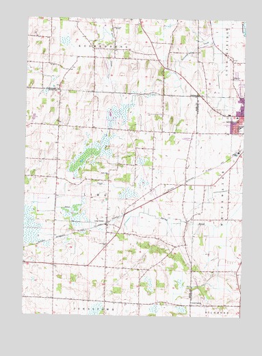
Lima Center, WI USGS Topographic Map
Click on map above to begin viewing in our Map Viewer.

This topographic map contains these locations and features:
Feature Name Type Latitude Longitude GNIS ID View Map
Gutzmer's Twin Oaks AirportAirportN42.8559°W88.7598°1582270View Map
Koshkonong Union CemeteryCemeteryN42.8656°W88.8397°1575863View Map
Lauer Willis FarmLocaleN42.8275°W88.8539°2632181View Map
Lima Bog State Natural AreaParkN42.8158°W88.8415°1988790View Map
Lima CenterPopulated PlaceN42.7895°W88.8273°1568054View Map
Lima Center CemeteryCemeteryN42.7803°W88.8273°1568055View Map
North Lima ChurchChurchN42.8095°W88.8271°1570461View Map
Onyx Valley Metal LandfillLocaleN42.8531°W88.8047°2635558View Map
Pond Hill Dairy FarmLocaleN42.8675°W88.8692°2706379View Map
Saint Patricks Catholic ChurchChurchN42.8342°W88.7540°1851328View Map
Town of LimaCivilN42.8002°W88.8369°1583557View Map
Twin Lakes Mobile Home ParkPopulated PlaceN42.8519°W88.7550°2508624View Map
Utters CornersLocaleN42.7550°W88.7790°1576012View Map
Utters Corners CemeteryCemeteryN42.7556°W88.7840°2002679View Map
Whitewater High SchoolSchoolN42.8255°W88.7539°1851362View Map
Whitewater Middle SchoolSchoolN42.8301°W88.7521°2716638View Map
Wolf's Mobile Home ParkPopulated PlaceN42.8542°W88.7969°2508625View Map
Wright's Mobile Home ParkPopulated PlaceN42.8247°W88.7828°2508626View Map
WSJY-FM (Fort Atkinson)TowerN42.8467°W88.8546°1582598View Map

Note: Coordinates in the location and feature list above are referenced to NAD83 datum.


Copyright (C) 2008-2025 Ryan Niemi / Sunset Dynamics ... All Rights Reserved