TopoQuest Logo
Do you find TopoQuest useful?
Help keep TopoQuest running and adding new maps/features by donating!
Bitcoin:  19c7KJd3qBynnjoSw5npx9KScwjBe4ifkT
Litecoin:  LXs6TkuXGGXo1vDsWCkWVdjQX94eUKd6ui
Home View Maps Find Maps Find Places Resources & Links


Rome, Wisconsin Topographic Map

USGS Map Title: Rome, WI
USGS Map MRC: 42088H6
DRG (GeoTIFF) Download: o42088h6.tif


Neighboring USGS Topographic Map Quads:


  Jefferson, WI  
43088A7
 

  Helenville, WI  
43088A6
 

  Oconomowoc West, WI  
43088A5
 

  Fort Atkinson, WI  
42088H7
 

  Rome, WI  
42088H6
 

  Palmyra, WI  
42088H5
 

  Lima Center, WI  
42088G7
 

  Whitewater, WI  
42088G6
 

  Little Prairie, WI  
42088G5


Map MRC Location:

N43°
W89°
N43°
W88°
H8 H7 H6 H5 H4 H3 H2 H1
G8 G7 G6 G5 G4 G3 G2 G1
F8 F7 F6 F5 F4 F3 F2 F1
E8 E7 E6 E5 E4 E3 E2 E1
D8 D7 D6 D5 D4 D3 D2 D1
C8 C7 C6 C5 C4 C3 C2 C1
B8 B7 B6 B5 B4 B3 B2 B1
A8 A7 A6 A5 A4 A3 A2 A1
N42°
W89°
N42°
W88°

Rome, WI USGS 1:24K Topographic Map Preview:
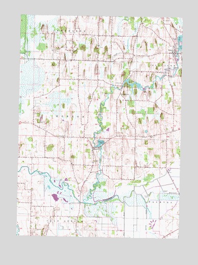
Rome, WI USGS Topographic Map
Click on map above to begin viewing in our Map Viewer.

This topographic map contains these locations and features:
Feature Name Type Latitude Longitude GNIS ID View Map
Cedar Ridge FarmLocaleN42.9900°W88.6486°2706320View Map
Crowder CemeteryCemeteryN42.9982°W88.6402°2781321View Map
Cushman CemeteryCemeteryN42.9622°W88.6713°1563641View Map
Cushman DamDamN42.9608°W88.6709°1792769View Map
Cushman Lake 122ReservoirN42.9632°W88.6661°1792770View Map
Cushman Mill SchoolSchoolN42.9561°W88.6723°1563642View Map
Cushman PondReservoirN42.9614°W88.6636°1563643View Map
Duck CreekStreamN42.9608°W88.6784°1564142View Map
Green Isle LakeReservoirN42.9283°W88.6866°1565814View Map
HebronPopulated PlaceN42.9253°W88.6926°1566257View Map
Hebron 2WP441 DamDamN42.9267°W88.6884°1791938View Map
Hebron CemeteryCemeteryN42.9179°W88.6912°1566258View Map
Hebron Census Designated PlaceCensusN42.9232°W88.6916°2393044View Map
Hickory Oaks FarmLocaleN42.9836°W88.6728°2706321View Map
Hoffman CemeteryCemeteryN42.9881°W88.6297°1566511View Map
Maple Run FarmLocaleN42.9922°W88.7031°2706323View Map
McLery CemeteryCemeteryN42.9322°W88.6556°1569266View Map
Monroe CemeteryCemeteryN42.9320°W88.7191°1570033View Map
Mud CreekStreamN42.9003°W88.6368°1569888View Map
Princes Point WLA Number 1 H2.117 DamDamN42.8900°W88.6968°1793568View Map
Princes Point WLA Number 2 H2.117 DamDamN42.9000°W88.6668°1793569View Map
Princess Point BridgeBridgeN42.8947°W88.7018°1571940View Map
Riverview CemeteryCemeteryN42.9701°W88.6350°1572383View Map
RomePopulated PlaceN42.9803°W88.6312°1572557View Map
Rome 3WR1668 DamDamN42.9820°W88.6279°1792160View Map
Rome Census Designated PlaceCensusN42.9823°W88.6389°2393212View Map
Rome Fire DepartmentBuildingN42.9800°W88.6303°2697563View Map
Royal Betschler FarmsLocaleN42.9950°W88.6814°2706319View Map
Saint Luke's CemeteryCemeteryN42.9977°W88.6404°1573223View Map
Schelm FarmsLocaleN42.9772°W88.6556°2706324View Map
Scuppernong RiverStreamN42.8942°W88.6973°1573861View Map
SlabtownPopulated PlaceN42.9670°W88.6351°1577824View Map
Slabtown PondSwampN42.9708°W88.6329°1574261View Map
Spring CreekStreamN42.8953°W88.6512°1574632View Map
Steel BrookStreamN42.8953°W88.6682°1574843View Map
Town of Cold SpringCivilN42.8769°W88.7213°1582999View Map
Town of HebronCivilN42.9391°W88.7158°1583375View Map

Note: Coordinates in the location and feature list above are referenced to NAD83 datum.


Copyright (C) 2008-2025 Ryan Niemi / Sunset Dynamics ... All Rights Reserved