TopoQuest Logo
Do you find TopoQuest useful?
Help keep TopoQuest running and adding new maps/features by donating!
Bitcoin:  19c7KJd3qBynnjoSw5npx9KScwjBe4ifkT
Litecoin:  LXs6TkuXGGXo1vDsWCkWVdjQX94eUKd6ui
Home View Maps Find Maps Find Places Resources & Links


Littlerock, Washington Topographic Map

USGS Map Title: Littlerock, WA
USGS Map MRC: 46123H1
DRG (GeoTIFF) Download: o46123h1.tif


Neighboring USGS Topographic Map Quads:


  Kamilche Valley, WA  
47123A2
 

  Summit Lake, WA  
47123A1
 

  Tumwater, WA  
47122A8
 

  Capitol Peak, WA  
46123H2
 

  Littlerock, WA  
46123H1
 

  Maytown, WA  
46122H8
 

  Oakville, WA  
46123G2
 

  Rochester, WA  
46123G1
 

  Violet Prairie, WA  
46122G8


Map MRC Location:

N47°
W124°
N47°
W123°
H8 H7 H6 H5 H4 H3 H2 H1
G8 G7 G6 G5 G4 G3 G2 G1
F8 F7 F6 F5 F4 F3 F2 F1
E8 E7 E6 E5 E4 E3 E2 E1
D8 D7 D6 D5 D4 D3 D2 D1
C8 C7 C6 C5 C4 C3 C2 C1
B8 B7 B6 B5 B4 B3 B2 B1
A8 A7 A6 A5 A4 A3 A2 A1
N46°
W124°
N46°
W123°

Littlerock, WA USGS 1:24K Topographic Map Preview:
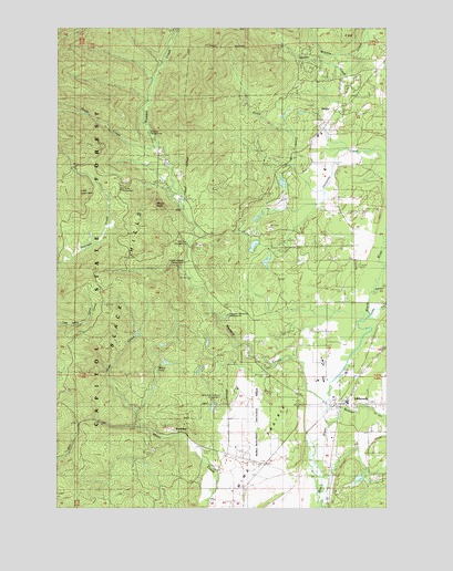
Littlerock, WA USGS Topographic Map
Click on map above to begin viewing in our Map Viewer.

This topographic map contains these locations and features:
Feature Name Type Latitude Longitude GNIS ID View Map
Bade Rotor and Wing Service HeliportAirportN46.9248°W123.0124°1533821View Map
Beatty CreekStreamN46.9920°W123.0232°1511606View Map
Beaver CreekStreamN46.8965°W123.0218°1511607View Map
Blooms DitchCanalN46.9251°W123.0071°1511609View Map
BordeauxPopulated PlaceN46.8948°W123.0801°1511610View Map
Bordeaux CampgroundLocaleN46.9729°W123.0918°1511629View Map
Darlin CreekStreamN46.9540°W123.0279°1512940View Map
DelphiPopulated PlaceN46.9790°W123.0188°1511611View Map
Lake LucindaReservoirN46.9595°W123.0408°1532925View Map
Lake Lucinda DamDamN46.9581°W123.0403°1532924View Map
Little Larch MountainSummitN46.9570°W123.1151°1512394View Map
LittlerockPopulated PlaceN46.9018°W123.0179°1512396View Map
Margaret McKenny CampgroundLocaleN46.9251°W123.0615°1511626View Map
Middle Waddel CampgroundLocaleN46.9390°W123.0779°1511623View Map
Mill CreekStreamN46.8962°W123.0943°1511615View Map
Mima FallsFallsN46.9112°W123.0879°1511625View Map
Mima Mounds Natural AreaParkN46.8970°W123.0507°1511631View Map
Mima PrairieFlatN46.8890°W123.0524°1511617View Map
Mina Falls Trailhead CampgroundLocaleN46.9029°W123.0640°1511622View Map
Mount MollySummitN46.9537°W123.0896°1511627View Map
Mount Molly CampgroundLocaleN46.9576°W123.1021°1511628View Map
Noski CreekStreamN46.9684°W123.0849°1513180View Map
Rutledge FarmLocaleN46.8865°W123.0232°1531878View Map
Salmon CreekStreamN46.9329°W123.0038°1511618View Map
Stony CreekStreamN46.9612°W123.0301°1511620View Map
Thurston Co Fire District 11 station 5BuildingN46.9428°W123.0140°2619539View Map
Thurston County Fire District 5 Station 52BuildingN46.9885°W123.0052°2619696View Map
Waddell CreekStreamN46.9029°W123.0229°1511621View Map
Walentiny DamDamN46.8898°W123.0113°1532715View Map
Yew Tree CampgroundLocaleN46.9437°W123.0771°1511624View Map

Note: Coordinates in the location and feature list above are referenced to NAD83 datum.


Copyright (C) 2008-2024 Ryan Niemi / Sunset Dynamics ... All Rights Reserved