TopoQuest Logo
Do you find TopoQuest useful?
Help keep TopoQuest running and adding new maps/features by donating!
Bitcoin:  19c7KJd3qBynnjoSw5npx9KScwjBe4ifkT
Litecoin:  LXs6TkuXGGXo1vDsWCkWVdjQX94eUKd6ui
Home View Maps Find Maps Find Places Resources & Links


Lovelaceville, Kentucky Topographic Map

USGS Map Title: Lovelaceville, KY
USGS Map MRC: 36088H7
DRG (GeoTIFF) Download: o36088h7.tif


Neighboring USGS Topographic Map Quads:


  La Center, KY  
37088A8
 

  Heath, KY  
37088A7
 

  Paducah West, KY  
37088A6
 

  Blandville, KY  
36088H8
 

  Lovelaceville, KY  
36088H7
 

  Melber, KY  
36088H6
 

  Milburn, KY  
36088G8
 

  Fancy Farm, KY  
36088G7
 

  Hickory, KY  
36088G6


Map MRC Location:

N37°
W89°
N37°
W88°
H8 H7 H6 H5 H4 H3 H2 H1
G8 G7 G6 G5 G4 G3 G2 G1
F8 F7 F6 F5 F4 F3 F2 F1
E8 E7 E6 E5 E4 E3 E2 E1
D8 D7 D6 D5 D4 D3 D2 D1
C8 C7 C6 C5 C4 C3 C2 C1
B8 B7 B6 B5 B4 B3 B2 B1
A8 A7 A6 A5 A4 A3 A2 A1
N36°
W89°
N36°
W88°

Lovelaceville, KY USGS 1:24K Topographic Map Preview:
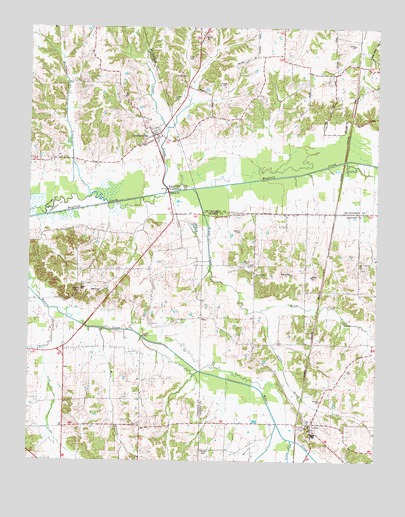
Lovelaceville, KY USGS Topographic Map
Click on map above to begin viewing in our Map Viewer.

This topographic map contains these locations and features:
Feature Name Type Latitude Longitude GNIS ID View Map
Barn BranchStreamN36.9128°W88.8489°486369View Map
Bethel ChurchChurchN36.9317°W88.7962°486960View Map
Bethlehem CemeteryCemeteryN36.9239°W88.8489°487006View Map
Billington CreekStreamN36.9514°W88.8528°487309View Map
Brush CreekStreamN36.9531°W88.8162°488073View Map
California HillsPopulated PlaceN36.9375°W88.8534°2743895View Map
Camelia DivisionCivilN36.9889°W88.7607°1937120View Map
Cross CemeteryCemeteryN36.9911°W88.8159°490394View Map
Fort Holt (historical)Populated PlaceN36.9735°W88.8006°2743772View Map
GlissonvillePopulated PlaceN36.9978°W88.8147°2743774View Map
Goose CreekStreamN36.8812°W88.7801°493008View Map
Granite BranchStreamN36.9734°W88.8278°493106View Map
Hebron CemeteryCemeteryN36.8781°W88.8126°493987View Map
Heflin CreekStreamN36.9184°W88.8676°494000View Map
Jones CemeteryCemeteryN36.9253°W88.8556°495467View Map
Lick CreekStreamN36.9067°W88.8689°496478View Map
Little Brush CreekStreamN36.9184°W88.7912°496647View Map
LovelacevillePopulated PlaceN36.9687°W88.8309°497219View Map
Lovelaceville Census Designated PlaceCensusN36.9672°W88.8334°2629642View Map
Lovelaceville Fire DepartmentBuildingN36.9705°W88.8305°2636577View Map
LowesPopulated PlaceN36.8856°W88.7739°497318View Map
Lowes CemeteryCemeteryN36.8820°W88.7736°2775528View Map
Lowes Census Designated PlaceCensusN36.8828°W88.7706°2629643View Map
New Concord ChurchChurchN36.9312°W88.7556°499306View Map
Owens ChapelChurchN36.9289°W88.7937°500072View Map
Palestine Methodist ChurchChurchN36.9145°W88.8314°500133View Map
Scotts CornerPopulated PlaceN36.9303°W88.8381°2743918View Map
ShawLocaleN36.9162°W88.8128°509043View Map
Sugar CreekStreamN36.9534°W88.8253°504653View Map
Terry FieldAirportN36.8987°W88.8467°517359View Map
WilsonPopulated PlaceN36.9213°W88.8716°2743928View Map
Yellow Dog RoadPopulated PlaceN36.9413°W88.8511°2743929View Map
Zoar (historical)Populated PlaceN36.8849°W88.8348°2743931View Map
Zoar Baptist ChurchChurchN36.8854°W88.8349°507303View Map
Zoar CemeteryCemeteryN36.8853°W88.8342°2775657View Map

Note: Coordinates in the location and feature list above are referenced to NAD83 datum.


Copyright (C) 2008-2025 Ryan Niemi / Sunset Dynamics ... All Rights Reserved