TopoQuest Logo
Do you find TopoQuest useful?
Help keep TopoQuest running and adding new maps/features by donating!
Bitcoin:  19c7KJd3qBynnjoSw5npx9KScwjBe4ifkT
Litecoin:  LXs6TkuXGGXo1vDsWCkWVdjQX94eUKd6ui
Home View Maps Find Maps Find Places Resources & Links


Kensington, Minnesota Topographic Map

USGS Map Title: Kensington, MN
USGS Map MRC: 45095G6
DRG (GeoTIFF) Download: o45095g6.tif


Neighboring USGS Topographic Map Quads:


  Erdahl, MN  
45095H7
 

  Quam Lake, MN  
45095H6
 

  Brandon, MN  
45095H5
 

  Hoffman, MN  
45095G7
 

  Kensington, MN  
45095G6
 

  Farwell, MN  
45095G5
 

  Pomme De Terre Lakes, MN  
45095F7
 

  Starbuck NW, MN  
45095F6
 

  Lowry, MN  
45095F5


Map MRC Location:

N46°
W96°
N46°
W95°
H8 H7 H6 H5 H4 H3 H2 H1
G8 G7 G6 G5 G4 G3 G2 G1
F8 F7 F6 F5 F4 F3 F2 F1
E8 E7 E6 E5 E4 E3 E2 E1
D8 D7 D6 D5 D4 D3 D2 D1
C8 C7 C6 C5 C4 C3 C2 C1
B8 B7 B6 B5 B4 B3 B2 B1
A8 A7 A6 A5 A4 A3 A2 A1
N45°
W96°
N45°
W95°

Kensington, MN USGS 1:24K Topographic Map Preview:
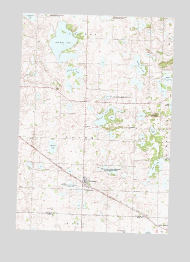
Kensington, MN USGS Topographic Map
Click on map above to begin viewing in our Map Viewer.

This topographic map contains these locations and features:
Feature Name Type Latitude Longitude GNIS ID View Map
City of KensingtonCivilN45.7783°W95.6969°2395510View Map
Eng LakeLakeN45.8152°W95.6829°643375View Map
Eng Lake State Wildlife Management AreaParkN45.8280°W95.6767°643376View Map
Hegg Lake State Wildlife Management AreaParkN45.7872°W95.6742°644832View Map
Jorgenson LakeLakeN45.8736°W95.7445°645739View Map
KensingtonPopulated PlaceN45.7780°W95.6962°646106View Map
KensingtonLocaleN45.7778°W95.6944°2069676View Map
Kensington CemeteryCemeteryN45.7750°W95.6911°2069681View Map
Kensington Fire and Rescue DepartmentBuildingN45.7799°W95.6945°2666217View Map
Kensington Post OfficePost OfficeN45.7803°W95.6956°2069677View Map
Kensington State Wildlife Management AreaParkN45.7755°W95.7075°646107View Map
Long LakeLakeN45.7911°W95.6370°647066View Map
Lookout MountainSummitN45.8188°W95.6392°647157View Map
Nora Lutheran ChurchChurchN45.7775°W95.6964°2069680View Map
North Lake OscarLakeN45.8392°W95.6275°648664View Map
Ostlund LakeLakeN45.8399°W95.7391°649029View Map
Our Lady of the Runestone ChurchChurchN45.7756°W95.6911°2069679View Map
Red Rock Golf CourseLocaleN45.8500°W95.7306°2069785View Map
Red Rock LakeLakeN45.8554°W95.7146°649881View Map
Roland LakeLakeN45.7984°W95.7224°650228View Map
Runestone County ParkParkN45.8153°W95.6667°2069784View Map
Runestone HillSummitN45.8111°W95.6606°650385View Map
Schnepf State Wildlife Management AreaParkN45.8738°W95.6814°651304View Map
Solem CemeteryCemeteryN45.8111°W95.6955°2069682View Map
Solem ChurchChurchN45.8108°W95.6959°652238View Map
Solem LakeLakeN45.8095°W95.6402°652240View Map
South Elementary SchoolSchoolN45.7808°W95.6953°2069678View Map
Township of SolemCivilN45.8037°W95.6964°665639View Map
Wally LakeLakeN45.8470°W95.6537°653741View Map
Wennesborg CemeteryCemeteryN45.8027°W95.7356°653912View Map

Note: Coordinates in the location and feature list above are referenced to NAD83 datum.


Copyright (C) 2008-2025 Ryan Niemi / Sunset Dynamics ... All Rights Reserved