TopoQuest Logo
Do you find TopoQuest useful?
Help keep TopoQuest running and adding new maps/features by donating!
Bitcoin:  19c7KJd3qBynnjoSw5npx9KScwjBe4ifkT
Litecoin:  LXs6TkuXGGXo1vDsWCkWVdjQX94eUKd6ui
Home View Maps Find Maps Find Places Resources & Links


Macon, Montana Topographic Map

USGS Map Title: Macon, MT
USGS Map MRC: 48105A5
DRG (GeoTIFF) Download: o48105a5.tif


Neighboring USGS Topographic Map Quads:


  Wolf Point NW, MT  
48105B6
 

  Wolf Point NE, MT  
48105B5
 

  Chelsea NW, MT  
48105B4
 

  Wolf Point, MT  
48105A6
 

  Macon, MT  
48105A5
 

  Chelsea SW, MT  
48105A4
 

  Antelope Creek Reservoir, MT  
47105H6
 

  Rock Creek, MT  
47105H5
 

  Gady Coulee, MT  
47105H4


Map MRC Location:

N49°
W106°
N49°
W105°
H8 H7 H6 H5 H4 H3 H2 H1
G8 G7 G6 G5 G4 G3 G2 G1
F8 F7 F6 F5 F4 F3 F2 F1
E8 E7 E6 E5 E4 E3 E2 E1
D8 D7 D6 D5 D4 D3 D2 D1
C8 C7 C6 C5 C4 C3 C2 C1
B8 B7 B6 B5 B4 B3 B2 B1
A8 A7 A6 A5 A4 A3 A2 A1
N48°
W106°
N48°
W105°

Macon, MT USGS 1:24K Topographic Map Preview:
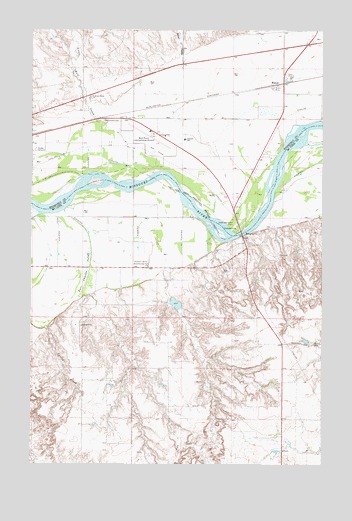
Macon, MT USGS Topographic Map
Click on map above to begin viewing in our Map Viewer.

This topographic map contains these locations and features:
Feature Name Type Latitude Longitude GNIS ID View Map
26N48E09ACA_01 WellWellN48.0278°W105.5200°825636View Map
26N48E15BCCC01 WellWellN48.0058°W105.5164°825477View Map
27N47E11CC__01 WellWellN48.1025°W105.6225°826248View Map
27N47E11CC__02 WellWellN48.1025°W105.6225°826249View Map
27N47E12CC__01 WellWellN48.1025°W105.6008°826246View Map
27N47E12CC__02 WellWellN48.1025°W105.6008°826247View Map
27N47E13AB__01 WellWellN48.0989°W105.5900°826210View Map
27N47E13AB__02 WellWellN48.0989°W105.5900°826211View Map
27N47E13BA__01 WellWellN48.0989°W105.5956°826212View Map
27N47E13BA__02 WellWellN48.0989°W105.5956°826213View Map
27N47E13BA__03 WellWellN48.0989°W105.5956°826214View Map
27N47E13BA__04 WellWellN48.0989°W105.5956°826215View Map
27N47E13BB__01 WellWellN48.0989°W105.6008°826216View Map
27N47E13CB__01 WellWellN48.0917°W105.6008°826150View Map
27N47E13DA__01 WellWellN48.0917°W105.5847°826148View Map
27N47E13DA__02 WellWellN48.0917°W105.5847°826149View Map
27N47E14AA__01 WellWellN48.0989°W105.6061°826217View Map
27N47E14BB__01 WellWellN48.0989°W105.6225°826218View Map
27N47E14CB__01 WellWellN48.0917°W105.6225°826152View Map
27N47E14CB__02 WellWellN48.0917°W105.6225°826153View Map
27N47E14CB__03 WellWellN48.0917°W105.6225°826154View Map
27N47E14CB__04 WellWellN48.0917°W105.6225°826155View Map
27N47E14CC__01 WellWellN48.0881°W105.6225°826114View Map
27N47E14DA__01 WellWellN48.0917°W105.6061°826151View Map
27N47E23BB__01 WellWellN48.0847°W105.6225°826099View Map
27N47E23DD__01 WellWellN48.0739°W105.6061°826035View Map
27N47E24CA__01 WellWellN48.0775°W105.5956°826053View Map
27N47E24CC__01 WellWellN48.0739°W105.6008°826034View Map
27N47E25BA__01 WellWellN48.0703°W105.5956°825993View Map
27N47E25DD__01 WellWellN48.0595°W105.5847°825898View Map
27N47E25DD__02 WellWellN48.0595°W105.5847°825899View Map
27N47E26DC__01 WellWellN48.0595°W105.6117°825900View Map
27N47E35AB__01 WellWellN48.0559°W105.6117°825873View Map
27N47E35BA__01 WellWellN48.0559°W105.6169°825874View Map
27N47E35DB__01 WellWellN48.0486°W105.6117°825818View Map
27N47E36AD__01 WellWellN48.0522°W105.5847°825842View Map
27N48E03DC__01 WellWellN48.1172°W105.5036°826403View Map
27N48E04DACB01 WellWellN48.1186°W105.5222°826420View Map
27N48E04DACC01 WellWellN48.1181°W105.5231°826415View Map
27N48E05CC__01 WellWellN48.1172°W105.5578°826404View Map
27N48E05CC__02 WellWellN48.1172°W105.5578°826405View Map
27N48E06DA__01 WellWellN48.1209°W105.5631°826437View Map
27N48E09AD__01 WellWellN48.1100°W105.5200°826324View Map
27N48E09DC__01 WellWellN48.1028°W105.5253°826255View Map
27N48E10BD__02 WellWellN48.1100°W105.5092°826323View Map
27N48E10CB__01 WellWellN48.1064°W105.5144°826290View Map
27N48E10CB__02 WellWellN48.1064°W105.5144°826291View Map
27N48E10CB__03 WellWellN48.1064°W105.5144°826292View Map
27N48E10DB__01 WellWellN48.1064°W105.5036°826289View Map
27N48E15CA__01 WellWellN48.0920°W105.5092°826159View Map
27N48E16DB__01 WellWellN48.0920°W105.5253°826160View Map
27N48E17BA__01 WellWellN48.0992°W105.5522°826221View Map
27N48E17BA__02 WellWellN48.0992°W105.5522°826222View Map
27N48E17CD__01 WellWellN48.0884°W105.5522°826124View Map
27N48E17DD__01 WellWellN48.0884°W105.5417°826123View Map
27N48E18DD__01 WellWellN48.0884°W105.5631°826125View Map
27N48E19DB__01 WellWellN48.0778°W105.5686°826055View Map
27N48E19DB__02 WellWellN48.0778°W105.5686°826056View Map
27N48E20CC__01 WellWellN48.0742°W105.5578°826045View Map
27N48E20CCCA01 WellWellN48.0717°W105.5583°826010View Map
27N48E20DC__01 WellWellN48.0742°W105.5469°826044View Map
27N48E21CC__01 WellWellN48.0742°W105.5361°826043View Map
27N48E22BB__01 WellWellN48.0850°W105.5144°826104View Map
27N48E22BC__01 WellWellN48.0814°W105.5144°826082View Map
27N48E27ACAA01 WellWellN48.0670°W105.5028°825959View Map
27N48E27BA__01 WellWellN48.0706°W105.5092°825999View Map
27N48E28AA__01 WellWellN48.0706°W105.5200°826000View Map
27N48E28BB__01 WellWellN48.0706°W105.5361°826001View Map
27N48E28BB__02 WellWellN48.0706°W105.5361°826002View Map
27N48E28BB__03 WellWellN48.0706°W105.5361°826003View Map
27N48E28BD__01 WellWellN48.0670°W105.5308°825960View Map
27N48E30BC__01 WellWellN48.0670°W105.5794°825961View Map
27N48E30CC__01 WellWellN48.0597°W105.5794°825905View Map
27N48E30DB__01 WellWellN48.0634°W105.5686°825933View Map
27N48E31BC__01 WellWellN48.0525°W105.5794°825849View Map
27N48E31CA__01 WellWellN48.0489°W105.5739°825823View Map
27N48E32BA__01 WellWellN48.0561°W105.5522°825876View Map
Airport Golf ClubLocaleN48.0906°W105.5714°1669263View Map
Balder Reservoir DamDamN48.0467°W105.5639°796054View Map
Bridge Park Fishing Access SiteLocaleN48.0681°W105.5372°1744305View Map
Brown CouleeValleyN48.1145°W105.5592°769265View Map
Courchene CemeteryCemeteryN48.0995°W105.5933°770208View Map
Fort Charles CutoffCanalN48.0567°W105.6011°771509View Map
Frontier SchoolSchoolN48.0933°W105.5599°771649View Map
L M Clayton AirportAirportN48.0959°W105.5744°806556View Map
Lewis and Clark BridgeBridgeN48.0667°W105.5353°1669333View Map
Lewis and Clark ParkParkN48.0695°W105.5378°773316View Map
Little Wolf CreekStreamN48.0978°W105.5939°773503View Map
MaconPopulated PlaceN48.1097°W105.5189°773793View Map
MaconLocaleN48.1097°W105.5189°1669374View Map
Macon School (historical)SchoolN48.1134°W105.5025°1669120View Map
Peavey Company ElevatorLocaleN48.1097°W105.5189°1669174View Map
Pleasant Valley (historical)Populated PlaceN48.0570°W105.5811°1716177View Map
Pleasant Valley Community HallLocaleN48.0575°W105.5806°775284View Map
Spring CreekStreamN48.0406°W105.6175°777008View Map
Stampede GroundsLocaleN48.0906°W105.6236°1669155View Map
U P CreekStreamN48.0584°W105.5644°1716254View Map
Vine AirportAirportN48.0422°W105.6067°806558View Map

Note: Coordinates in the location and feature list above are referenced to NAD83 datum.


Copyright (C) 2008-2024 Ryan Niemi / Sunset Dynamics ... All Rights Reserved