TopoQuest Logo
Do you find TopoQuest useful?
Help keep TopoQuest running and adding new maps/features by donating!
Bitcoin:  19c7KJd3qBynnjoSw5npx9KScwjBe4ifkT
Litecoin:  LXs6TkuXGGXo1vDsWCkWVdjQX94eUKd6ui
Home View Maps Find Maps Find Places Resources & Links


Chelsea NW, Montana Topographic Map

USGS Map Title: Chelsea NW, MT
USGS Map MRC: 48105B4
DRG (GeoTIFF) Download: o48105b4.tif


Neighboring USGS Topographic Map Quads:


  Tule Valley East, MT  
48105C5
 

  Sims Spring, MT  
48105C4
 

  Long Creek West, MT  
48105C3
 

  Wolf Point NE, MT  
48105B5
 

  Chelsea NW, MT  
48105B4
 

  Chelsea, MT  
48105B3
 

  Macon, MT  
48105A5
 

  Chelsea SW, MT  
48105A4
 

  Nickwall, MT  
48105A3


Map MRC Location:

N49°
W106°
N49°
W105°
H8 H7 H6 H5 H4 H3 H2 H1
G8 G7 G6 G5 G4 G3 G2 G1
F8 F7 F6 F5 F4 F3 F2 F1
E8 E7 E6 E5 E4 E3 E2 E1
D8 D7 D6 D5 D4 D3 D2 D1
C8 C7 C6 C5 C4 C3 C2 C1
B8 B7 B6 B5 B4 B3 B2 B1
A8 A7 A6 A5 A4 A3 A2 A1
N48°
W106°
N48°
W105°

Chelsea NW, MT USGS 1:24K Topographic Map Preview:
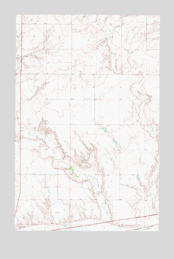
Chelsea NW, MT USGS Topographic Map
Click on map above to begin viewing in our Map Viewer.

This topographic map contains these locations and features:
Feature Name Type Latitude Longitude GNIS ID View Map
27N48E02BA__01 WellWellN48.1281°W105.4875°826504View Map
27N49E05AB__01 WellWellN48.1275°W105.4186°826503View Map
28N48E01DA__01 WellWellN48.2075°W105.4575°1634117View Map
28N48E11DDAB01 SpringSpringN48.1897°W105.4768°1633980View Map
28N48E12CCCC01 SpringSpringN48.1870°W105.4742°1633955View Map
28N48E25CB__01 WellWellN48.1495°W105.4736°826734View Map
28N48E25CBBA01 WellWellN48.1500°W105.4728°826739View Map
28N48E36DD__01 WellWellN48.1314°W105.4575°826540View Map
28N48E36DD__02 WellWellN48.1314°W105.4575°826541View Map
28N49E15BACA01 WellWellN48.1845°W105.3803°1633932View Map
28N49E16BA__01 WellWellN48.1853°W105.4025°1633938View Map
28N49E16BA__02 WellWellN48.1853°W105.4025°1633939View Map
28N49E17AA__01 WellWellN48.1853°W105.4133°1633940View Map
28N49E17AA__02 WellWellN48.1853°W105.4133°1633941View Map
28N49E18BD__01 WellWellN48.1817°W105.4455°1633899View Map
28N49E33DD__01 WellWellN48.1309°W105.3919°826535View Map
28N49E34BC__01 WellWellN48.1381°W105.3864°826602View Map
28N49E34DC__01 WellWellN48.1309°W105.3758°826534View Map
29N48E22DDDD01 WellWellN48.2447°W105.4525°1634379View Map
Anderson Reservoir Number 1 DamDamN48.1834°W105.4239°796306View Map
Divide School (historical)SchoolN48.2425°W105.4436°1669122View Map
L Sayer-Magdelena DamDamN48.1550°W105.3939°798306View Map
South School (historical)SchoolN48.1695°W105.4917°1669121View Map
Tule Creek BridgeBridgeN48.1828°W105.4958°1669328View Map

Note: Coordinates in the location and feature list above are referenced to NAD83 datum.


Copyright (C) 2008-2025 Ryan Niemi / Sunset Dynamics ... All Rights Reserved