TopoQuest Logo
Do you find TopoQuest useful?
Help keep TopoQuest running and adding new maps/features by donating!
Bitcoin:  19c7KJd3qBynnjoSw5npx9KScwjBe4ifkT
Litecoin:  LXs6TkuXGGXo1vDsWCkWVdjQX94eUKd6ui
Home View Maps Find Maps Find Places Resources & Links


McTarnahan Hill, Nevada Topographic Map

USGS Map Title: McTarnahan Hill, NV
USGS Map MRC: 39119A6
DRG (GeoTIFF) Download: o39119a6.tif


Neighboring USGS Topographic Map Quads:


  Carson City, NV  
39119B7
 

  New Empire, NV  
39119B6
 

  Dayton, NV  
39119B5
 

  Genoa, NV  
39119A7
 

  McTarnahan Hill, NV  
39119A6
 

  Mineral Peak, NV  
39119A5
 

  Minden, NV  
38119H7
 

  Gardnerville, NV  
38119H6
 

  Mount Siegel, NV  
38119H5


Map MRC Location:

N40°
W120°
N40°
W119°
H8 H7 H6 H5 H4 H3 H2 H1
G8 G7 G6 G5 G4 G3 G2 G1
F8 F7 F6 F5 F4 F3 F2 F1
E8 E7 E6 E5 E4 E3 E2 E1
D8 D7 D6 D5 D4 D3 D2 D1
C8 C7 C6 C5 C4 C3 C2 C1
B8 B7 B6 B5 B4 B3 B2 B1
A8 A7 A6 A5 A4 A3 A2 A1
N39°
W120°
N39°
W119°

McTarnahan Hill, NV USGS 1:24K Topographic Map Preview:
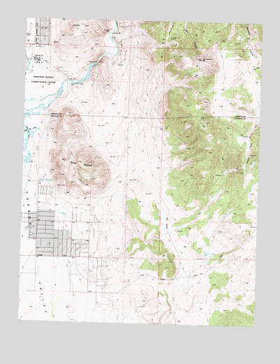
McTarnahan Hill, NV USGS Topographic Map
Click on map above to begin viewing in our Map Viewer.

This topographic map contains these locations and features:
Feature Name Type Latitude Longitude GNIS ID View Map
Alex Eske MineMineN39.0924°W119.6549°855534View Map
Buckbrush WellWellN39.0438°W119.7277°839133View Map
Bunker Hill MineMineN39.1177°W119.6752°839193View Map
Capitol MineMineN39.1194°W119.6896°858554View Map
Carson ValleyValleyN39.0930°W119.7357°859161View Map
Clear CreekStreamN39.0963°W119.7324°859255View Map
Delaware Mining DistrictCivilN39.1085°W119.6641°855536View Map
East Fork Fire and Paramedic Districts Station 6 Johnson Lane Volunteer Fire DepartmentBuildingN39.0416°W119.7279°2581381View Map
Hot Springs MountainSummitN39.0660°W119.7216°841162View Map
Johnson LanePopulated PlaceN39.0480°W119.7221°1867348View Map
Johnson Lane Census Designated PlaceCensusN39.0489°W119.7245°2408448View Map
McTarnahan BridgeLocaleN39.0996°W119.7277°842036View Map
McTarnahan HillSummitN39.1094°W119.6580°848585View Map
Mexican DamDamN39.1197°W119.7071°842064View Map
Northern Nevada Correctional CenterBuildingN39.1088°W119.7443°2740053View Map
Onion ValleyBasinN39.1049°W119.6410°857334View Map
Pinon Hills Elementary SchoolSchoolN39.0406°W119.7258°2076257View Map
Quilici Dam (historical)DamN39.1246°W119.7046°855480View Map
Saratoga Hot SpringSpringN39.0575°W119.7427°843510View Map
Smith Brothers MineMineN39.1085°W119.6641°855366View Map
Stewart Smoke Stack (historical)LocaleN39.1027°W119.7482°848048View Map
United Mining Company MineMineN39.1085°W119.6641°855367View Map
Valley View MineMineN39.1105°W119.6721°855535View Map
Williams Canyon WellWellN39.0285°W119.6538°844888View Map
Yerington MineMineN39.1169°W119.6327°855540View Map

Note: Coordinates in the location and feature list above are referenced to NAD83 datum.


Copyright (C) 2008-2024 Ryan Niemi / Sunset Dynamics ... All Rights Reserved