TopoQuest Logo
Do you find TopoQuest useful?
Help keep TopoQuest running and adding new maps/features by donating!
Bitcoin:  19c7KJd3qBynnjoSw5npx9KScwjBe4ifkT
Litecoin:  LXs6TkuXGGXo1vDsWCkWVdjQX94eUKd6ui
Home View Maps Find Maps Find Places Resources & Links


Arch Mesa, New Mexico Topographic Map

USGS Map Title: Arch Mesa, NM
USGS Map MRC: 35107B2
DRG (GeoTIFF) Download: o35107b2.tif


Neighboring USGS Topographic Map Quads:


  Marquez, NM  
35107C3
 

  La Gotera, NM  
35107C2
 

  Puerco Dam, NM  
35107C1
 

  Moquino, NM  
35107B3
 

  Arch Mesa, NM  
35107B2
 

  Herrera, NM  
35107B1
 

  Mesita, NM  
35107A3
 

  Mesa Gigante, NM  
35107A2
 

  Canoncito School, NM  
35107A1


Map MRC Location:

N36°
W108°
N36°
W107°
H8 H7 H6 H5 H4 H3 H2 H1
G8 G7 G6 G5 G4 G3 G2 G1
F8 F7 F6 F5 F4 F3 F2 F1
E8 E7 E6 E5 E4 E3 E2 E1
D8 D7 D6 D5 D4 D3 D2 D1
C8 C7 C6 C5 C4 C3 C2 C1
B8 B7 B6 B5 B4 B3 B2 B1
A8 A7 A6 A5 A4 A3 A2 A1
N35°
W108°
N35°
W107°

Arch Mesa, NM USGS 1:24K Topographic Map Preview:
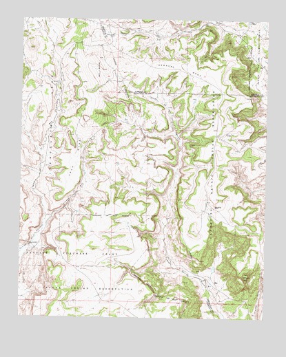
Arch Mesa, NM USGS Topographic Map
Click on map above to begin viewing in our Map Viewer.

This topographic map contains these locations and features:
Feature Name Type Latitude Longitude GNIS ID View Map
Arch MesaSummitN35.2014°W107.2256°885868View Map
Arroyo ZiaStreamN35.1631°W107.2387°900306View Map
Caņada de San AntonioStreamN35.1631°W107.2387°898259View Map
Caņoncito 5 Water WellWellN35.2023°W107.1462°921475View Map
Hackberry Water WellWellN35.2431°W107.2067°921947View Map
Hackberry WindmillLocaleN35.2434°W107.2067°889708View Map
Herrera MesaSummitN35.2312°W107.1642°898659View Map
Herrera Mesa WindmillLocaleN35.2025°W107.1462°889925View Map
Jose Manuel SpringSpringN35.1306°W107.1387°902553View Map
Meyer Water WellWellN35.2234°W107.2312°919807View Map
Meyer WindmillLocaleN35.2234°W107.2312°891927View Map
Number 61 Water WellWellN35.1881°W107.2375°919804View Map
Piedra LumbrePopulated PlaceN35.1559°W107.2409°898688View Map
Plate MesaSummitN35.1428°W107.1342°893355View Map
RWP12 Water WellWellN35.1406°W107.1509°918672View Map
RWP5 Water WellWellN35.2020°W107.1462°919870View Map
Seboyeta Irrigation System DamDamN35.2100°W107.2273°924117View Map
Seboyeta ReservoirReservoirN35.2100°W107.2273°924118View Map
Standing RockCliffN35.1717°W107.1514°895297View Map

Note: Coordinates in the location and feature list above are referenced to NAD83 datum.


Copyright (C) 2008-2025 Ryan Niemi / Sunset Dynamics ... All Rights Reserved