TopoQuest Logo
Do you find TopoQuest useful?
Help keep TopoQuest running and adding new maps/features by donating!
Bitcoin:  19c7KJd3qBynnjoSw5npx9KScwjBe4ifkT
Litecoin:  LXs6TkuXGGXo1vDsWCkWVdjQX94eUKd6ui
Home View Maps Find Maps Find Places Resources & Links


Nankin, Georgia Topographic Map

USGS Map Title: Nankin, GA
USGS Map MRC: 30083F4
DRG (GeoTIFF) Download: o30083f4.tif


Neighboring USGS Topographic Map Quads:


  Quitman, GA  
30083G5
 

  Ousley, GA  
30083G4
 

  Valdosta, GA  
30083G3
 

  Baden, GA  
30083F5
 

  Nankin, GA  
30083F4
 

  Clyattville, GA  
30083F3
 

  Hamburg, FL  
30083E5
 

  Cherry Lake, FL  
30083E4
 

  Pinetta, FL  
30083E3


Map MRC Location:

N31°
W84°
N31°
W83°
H8 H7 H6 H5 H4 H3 H2 H1
G8 G7 G6 G5 G4 G3 G2 G1
F8 F7 F6 F5 F4 F3 F2 F1
E8 E7 E6 E5 E4 E3 E2 E1
D8 D7 D6 D5 D4 D3 D2 D1
C8 C7 C6 C5 C4 C3 C2 C1
B8 B7 B6 B5 B4 B3 B2 B1
A8 A7 A6 A5 A4 A3 A2 A1
N30°
W84°
N30°
W83°

Nankin, GA USGS 1:24K Topographic Map Preview:
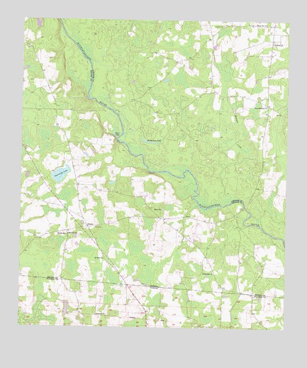
Nankin, GA USGS Topographic Map
Click on map above to begin viewing in our Map Viewer.

This topographic map contains these locations and features:
Feature Name Type Latitude Longitude GNIS ID View Map
Antioch ChurchChurchN30.6302°W83.4638°277914View Map
Beulah ChurchChurchN30.6624°W83.4779°354697View Map
Clyattville Volunteer Fire Department Station 2ABuildingN30.7384°W83.3832°2604989View Map
Columbia Primitive Baptist ChurchChurchN30.6624°W83.4771°355250View Map
Columbia Primitive Baptist Church CemeteryCemeteryN30.6621°W83.4763°1955373View Map
Elam ChurchChurchN30.6730°W83.4332°355654View Map
Fearnside LakeLakeN30.6871°W83.4813°314092View Map
Godwin BluffCliffN30.6780°W83.4193°345546View Map
Horne School (historical)SchoolN30.6471°W83.4082°345553View Map
Knight Bridge (historical)BridgeN30.7108°W83.4546°346278View Map
Langdale Company LakeReservoirN30.7484°W83.4929°341701View Map
Montgomery PondLakeN30.7005°W83.4391°318405View Map
Mud LakeLakeN30.7038°W83.4565°319117View Map
NankinPopulated PlaceN30.6660°W83.4679°332463View Map
New Haven Church (historical)ChurchN30.6685°W83.4702°345576View Map
New Redland ChurchChurchN30.7155°W83.3852°319520View Map
Ochlawilla ChurchChurchN30.6471°W83.4082°319886View Map
Redland CemeteryCemeteryN30.7480°W83.4049°321419View Map
Redland ChurchChurchN30.7410°W83.3824°321420View Map
Redland CreekStreamN30.6796°W83.4035°321421View Map
Redland School (historical)SchoolN30.7485°W83.3852°346329View Map
Rocky Ford BridgeBridgeN30.6749°W83.3946°346333View Map
Saint Paul ChurchChurchN30.6530°W83.4599°322227View Map
Silver Run ChurchChurchN30.7483°W83.3849°322992View Map
Sims LakeSwampN30.6744°W83.4068°345613View Map
Wade CemeteryCemeteryN30.6683°W83.4702°345622View Map

Note: Coordinates in the location and feature list above are referenced to NAD83 datum.


Copyright (C) 2008-2025 Ryan Niemi / Sunset Dynamics ... All Rights Reserved