TopoQuest Logo
Do you find TopoQuest useful?
Help keep TopoQuest running and adding new maps/features by donating!
Bitcoin:  19c7KJd3qBynnjoSw5npx9KScwjBe4ifkT
Litecoin:  LXs6TkuXGGXo1vDsWCkWVdjQX94eUKd6ui
Home View Maps Find Maps Find Places Resources & Links


Newland, North Carolina Topographic Map

USGS Map Title: Newland, NC
USGS Map MRC: 36081A8
DRG (GeoTIFF) Download: o36081a8.tif


Neighboring USGS Topographic Map Quads:


  White Rocks Mountain, TN  
36082B1
 

  Elk Park, NC  
36081B8
 

  Valle Crucis, NC  
36081B7
 

  Carvers Gap, NC  
36082A1
 

  Newland, NC  
36081A8
 

  Grandfather Mountain, NC  
36081A7
 

  Spruce Pine, NC  
35082H1
 

  Linville Falls, NC  
35081H8
 

  Chestnut Mountain, NC  
35081H7


Map MRC Location:

N37°
W82°
N37°
W81°
H8 H7 H6 H5 H4 H3 H2 H1
G8 G7 G6 G5 G4 G3 G2 G1
F8 F7 F6 F5 F4 F3 F2 F1
E8 E7 E6 E5 E4 E3 E2 E1
D8 D7 D6 D5 D4 D3 D2 D1
C8 C7 C6 C5 C4 C3 C2 C1
B8 B7 B6 B5 B4 B3 B2 B1
A8 A7 A6 A5 A4 A3 A2 A1
N36°
W82°
N36°
W81°

Newland, NC USGS 1:24K Topographic Map Preview:
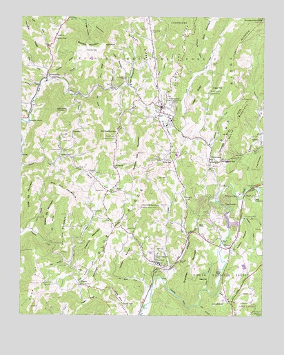
Newland, NC USGS Topographic Map
Click on map above to begin viewing in our Map Viewer.

This topographic map contains these locations and features:
Feature Name Type Latitude Longitude GNIS ID View Map
Aaron ChurchChurchN36.0660°W81.9026°980011View Map
Anthony CreekStreamN36.0415°W81.8837°980201View Map
Anthony MountainSummitN36.0301°W81.8859°1018831View Map
Ashley BranchStreamN36.0654°W81.9801°980326View Map
Ashley CemeteryCemeteryN36.0732°W81.9743°980327View Map
Ashley ChapelChurchN36.0693°W81.9790°980329View Map
Avery CountyCivilN36.0766°W81.9226°1008536View Map
Avery County Emergency Medical Services - NewlandBuildingN36.0882°W81.9282°2720700View Map
Avery County High SchoolSchoolN36.0818°W81.9215°1003549View Map
Avery County Sheriff's OfficeBuildingN36.0864°W81.9268°2769920View Map
Banjo BranchStreamN36.0960°W81.9532°980518View Map
Belview ChurchChurchN36.1173°W81.9815°980974View Map
Belview MountainSummitN36.1138°W81.9567°1019084View Map
Benfield CemeteryCemeteryN36.0135°W81.9898°980986View Map
Big BranchStreamN36.1110°W81.9979°1009274View Map
Big Elk MountainSummitN36.0501°W81.9732°1019131View Map
Big Haw MountainSummitN36.0765°W81.9590°1019137View Map
Big Meadow ChurchChurchN36.0137°W81.9684°981425View Map
Bill White CreekStreamN36.0032°W81.9365°981482View Map
Birchfield CreekStreamN36.0885°W81.9948°1009416View Map
Blood Camp BranchStreamN36.1012°W81.9318°981601View Map
Briggs HollowValleyN36.1233°W81.9683°1009605View Map
Buchanan CemeteryCemeteryN36.0860°W81.9968°1009729View Map
Buck HillSummitN36.0035°W81.9946°1019357View Map
Buck Hill ChurchChurchN36.0135°W81.9837°1009743View Map
Buckwheat BranchStreamN36.0001°W81.9382°1009789View Map
Bunt CreekStreamN36.0371°W81.8921°1009815View Map
Burleson CemeteryCemeteryN36.0526°W81.9504°1009828View Map
Calloway CemeteryCemeteryN36.0054°W81.8815°1009922View Map
Calvary ChurchChurchN36.0746°W81.9068°1009928View Map
Camp CarolinaLocaleN36.0471°W81.8887°1009943View Map
Camp Linn-HavenLocaleN36.0504°W81.8873°1009969View Map
Camp YonahnokaLocaleN36.0501°W81.8787°1009981View Map
Carpenter BottomPopulated PlaceN36.0826°W81.9962°1019537View Map
Charles A Cannon Junior Memorial HospitalHospitalN36.0604°W81.8892°2701537View Map
Chestnut DalePopulated PlaceN36.0665°W81.9798°1019625View Map
Chestnut MountainSummitN36.0312°W81.9637°1019651View Map
Clark BranchStreamN36.0190°W81.9229°1010288View Map
Clark CemeteryCemeteryN36.0276°W81.9262°1010292View Map
Clark CemeteryCemeteryN36.0435°W81.9023°1010293View Map
Clark CemeteryCemeteryN36.0465°W81.9237°1010294View Map
Cliff HillSummitN36.0979°W81.9496°1019697View Map
Cow BranchStreamN36.0046°W81.9076°1010516View Map
Cow Camp CreekStreamN36.0857°W81.9473°1010517View Map
Cow Camp GapGapN36.0626°W81.9521°1010518View Map
Cranberry GapPopulated PlaceN36.1162°W81.9826°1019845View Map
CrossnorePopulated PlaceN36.0218°W81.9296°1019869View Map
Crossnore CreekStreamN36.0185°W81.9226°1010594View Map
Crossnore Elementary SchoolSchoolN36.0218°W81.9276°1017511View Map
Crossnore Post OfficePost OfficeN36.0225°W81.9312°2766609View Map
Crossnore Volunteer Fire DepartmentBuildingN36.0225°W81.9303°2639650View Map
Crossnore-Newland Middle SchoolSchoolN36.0798°W81.9209°1017510View Map
Cuthbertson CemeteryCemeteryN36.0262°W81.9337°1010630View Map
Cuthbertson CemeteryCemeteryN36.0743°W81.9518°1010631View Map
Daniels CemeteryCemeteryN36.0523°W81.9612°1010650View Map
Fall BranchStreamN36.0312°W81.9873°1011153View Map
Fall BranchStreamN36.0990°W81.9790°1011155View Map
Fletcher ChapelChurchN36.0754°W81.9512°1011280View Map
Forest Home ChurchChurchN36.0910°W81.8871°1011308View Map
Fork MountainSummitN36.1068°W81.9504°1020319View Map
Fork Mountain CemeteryCemeteryN36.1001°W81.9451°1011316View Map
Franklin CemeteryCemeteryN36.0185°W81.9668°1011378View Map
Gooseneck BranchStreamN36.0962°W81.9904°1011567View Map
Grandmother CreekStreamN36.0537°W81.8832°1011599View Map
Guy CemeteryCemeteryN36.0951°W81.9523°1011785View Map
Handpole BranchStreamN36.0785°W81.9257°1011831View Map
Hartley GapGapN36.1112°W81.9676°1011895View Map
Hartley RidgeRidgeN36.1040°W81.9771°1011897View Map
Haw BranchStreamN36.0940°W81.9643°1011903View Map
Haw GapGapN36.0773°W81.9734°1011908View Map
Hawshaw Lookout TowerTowerN36.0454°W81.9373°1023645View Map
Hawshaw MountainSummitN36.0454°W81.9373°1020651View Map
Hickorynut BranchStreamN36.1029°W81.9057°1012018View Map
High Point CliffCliffN36.1135°W81.9568°1012043View Map
Horse CreekStreamN36.0990°W81.9862°1012195View Map
Houston RidgeRidgeN36.1210°W81.9985°1012237View Map
HughesPopulated PlaceN36.0598°W81.9643°1020860View Map
Isaae BranchStreamN36.0357°W81.9937°1012375View Map
Ivy Heights ChurchChurchN36.0926°W81.9707°1012389View Map
Jenny BranchStreamN36.0110°W81.9037°1012464View Map
Johnson CemeteryCemeteryN36.0362°W81.9451°1012526View Map
Johnson CemeteryCemeteryN36.0660°W81.9282°1012527View Map
Kentucky CreekStreamN36.0837°W81.9284°1012613View Map
Lake KawahnaReservoirN36.0529°W81.8771°1012600View Map
Land Harbors LakeReservoirN36.0388°W81.8912°1017331View Map
Land Harbors Lake DamDamN36.0368°W81.8915°999945View Map
Ledford CemeteryCemeteryN36.0546°W81.8965°1012785View Map
Linville - Central Rescue SquadBuildingN36.0409°W81.8865°2720699View Map
Linville QuarryMineN36.0597°W81.8864°2649053View Map
Little Elk MountainSummitN36.0546°W81.9934°1021185View Map
Little Haw MountainSummitN36.0854°W81.9818°1021194View Map
Little Horse CreekStreamN36.1021°W81.9862°1012976View Map
Little Plumtree ChurchChurchN36.0437°W81.9623°1013009View Map
Little Plumtree CreekStreamN36.0140°W81.9704°1013010View Map
Little Whiteoak CreekStreamN36.0962°W81.9446°1013042View Map
Locust KnobSummitN36.0051°W81.9004°1021260View Map
Loggy GapGapN36.0946°W81.9029°1013084View Map
Loggy RidgeRidgeN36.0950°W81.9066°1013085View Map
Long Ridge ChurchChurchN36.0012°W81.8757°1013173View Map
Marley KnobSummitN36.0182°W81.8989°1021351View Map
Middle Elk MountainSummitN36.0415°W81.9851°1021424View Map
Midway ChurchChurchN36.0498°W81.9151°1013526View Map
Mill Timber CreekStreamN36.0154°W81.9262°1013573View Map
Miller GapGapN36.0651°W81.9215°1013588View Map
Miller HollowValleyN36.1221°W81.9643°1013591View Map
MinneapolisPopulated PlaceN36.0993°W81.9871°1021490View Map
Minneapolis Elementary SchoolSchoolN36.0982°W81.9868°1017512View Map
Minneapolis Post OfficePost OfficeN36.1010°W81.9870°2767915View Map
MontezumaPopulated PlaceN36.0651°W81.9026°1013656View Map
Montezuma GapGapN36.0651°W81.8965°1013657View Map
Montezuma Post OfficePost OfficeN36.0643°W81.9024°2774211View Map
Moore MountainSummitN36.0793°W81.8896°1021525View Map
Mount PleasantPopulated PlaceN36.0521°W81.9554°1023584View Map
Mount Pleasant ChurchChurchN36.0521°W81.9540°1013765View Map
Negro HillSummitN36.0148°W81.9073°1021612View Map
New Cross ChurchChurchN36.0682°W81.9229°1013917View Map
NewlandPopulated PlaceN36.0873°W81.9273°1013943View Map
Newland CemeteryCemeteryN36.0835°W81.9321°1013944View Map
Newland Elementary SchoolSchoolN36.0962°W81.9298°1017509View Map
Newland Police DepartmentBuildingN36.0888°W81.9279°2769569View Map
Newland Post OfficePost OfficeN36.0872°W81.9259°2767913View Map
Newland Volunteer Fire DepartmentBuildingN36.0881°W81.9299°2639225View Map
Oak Grove ChurchChurchN36.0651°W81.9226°1014058View Map
Perry RidgeRidgeN36.1023°W81.9573°1014344View Map
Pine BranchStreamN36.0229°W81.9776°1014411View Map
PineolaPopulated PlaceN36.0285°W81.8915°1021936View Map
Pineola Post OfficePost OfficeN36.0286°W81.8936°2774065View Map
Pinnacle of the SugarPillarN36.1246°W81.8759°1014468View Map
Pixie MountainSummitN36.0618°W81.8768°1021993View Map
PyattePopulated PlaceN36.0129°W81.9690°1022115View Map
Rogers RidgeRidgeN36.0043°W81.9671°1015070View Map
Row BranchStreamN36.0921°W81.9726°1015120View Map
Sloop ChapelChurchN36.0237°W81.9298°1015596View Map
Sloop DamDamN36.0118°W81.9232°1017330View Map
Smoky Valley ChapelChurchN36.1193°W81.9332°1015620View Map
Snakeden MountainSummitN36.0110°W81.9137°1018109View Map
Soapstone MountainSummitN36.0237°W81.9440°1022695View Map
Spanish Oak MountainSummitN36.0682°W81.9398°1022726View Map
Stacey CreekStreamN36.0104°W81.8976°1015772View Map
Stamey TownPopulated PlaceN36.0048°W81.9465°1022772View Map
Stover RidgeRidgeN36.1126°W81.9379°1015871View Map
Sugar MountainSummitN36.1246°W81.8757°1022827View Map
Sugar Mountain ChurchChurchN36.0910°W81.8868°1015926View Map
Summerow CemeteryCemeteryN36.0935°W81.9023°1015947View Map
Taylor CemeteryCemeteryN36.0132°W81.9834°1016046View Map
Taylor CemeteryCemeteryN36.0579°W81.9248°1016047View Map
Town of CrossnoreCivilN36.0222°W81.9308°2406340View Map
Town of NewlandCivilN36.0880°W81.9274°2406987View Map
Township of AltamontCivilN36.0004°W81.9406°1026398View Map
Township of HughesCivilN36.0584°W81.9680°2405087View Map
Township of MontezumaCivilN36.0900°W81.8979°2405094View Map
Township of Newland Number 1CivilN36.1088°W81.9375°2405095View Map
Township of Newland Number 2CivilN36.0761°W81.9467°2405096View Map
Township of PineolaCivilN36.0242°W81.8903°2405110View Map
Township of PyatteCivilN36.0205°W81.9692°2405112View Map
Trim BranchStreamN36.0401°W81.9629°1016225View Map
ValePopulated PlaceN36.0971°W81.9451°1023058View Map
Webb CemeteryCemeteryN36.0371°W81.8751°1016488View Map
Whitaker BranchStreamN36.0743°W81.9993°1016576View Map
White Pine CreekStreamN36.0337°W81.9134°1016599View Map
Whiteoak CreekStreamN36.0965°W81.9468°1016616View Map
WJTP-AM (Newland)TowerN36.0776°W81.9162°1018538View Map
WJTP-AM (Newland)TowerN36.0826°W81.8987°1018540View Map

Note: Coordinates in the location and feature list above are referenced to NAD83 datum.


Copyright (C) 2008-2025 Ryan Niemi / Sunset Dynamics ... All Rights Reserved