TopoQuest Logo
Do you find TopoQuest useful?
Help keep TopoQuest running and adding new maps/features by donating!
Bitcoin:  19c7KJd3qBynnjoSw5npx9KScwjBe4ifkT
Litecoin:  LXs6TkuXGGXo1vDsWCkWVdjQX94eUKd6ui
Home View Maps Find Maps Find Places Resources & Links


Oreana, Nevada Topographic Map

USGS Map Title: Oreana, NV
USGS Map MRC: 40118C3
DRG (GeoTIFF) Download: o40118c3.tif


Neighboring USGS Topographic Map Quads:


  Oreana NW, NV  
40118D4
 

  Rye Patch Dam, NV  
40118D3
 

  Congress Canyon, NV  
40118D2
 

  Arabia, NV  
40118C4
 

  Oreana, NV  
40118C3
 

  Rochester, NV  
40118C2
 

  Lovelock, NV  
40118B4
 

  Coal Canyon, NV  
40118B3
 

  Buffalo Mountain, NV  
40118B2


Map MRC Location:

N41°
W119°
N41°
W118°
H8 H7 H6 H5 H4 H3 H2 H1
G8 G7 G6 G5 G4 G3 G2 G1
F8 F7 F6 F5 F4 F3 F2 F1
E8 E7 E6 E5 E4 E3 E2 E1
D8 D7 D6 D5 D4 D3 D2 D1
C8 C7 C6 C5 C4 C3 C2 C1
B8 B7 B6 B5 B4 B3 B2 B1
A8 A7 A6 A5 A4 A3 A2 A1
N40°
W119°
N40°
W118°

Oreana, NV USGS 1:24K Topographic Map Preview:
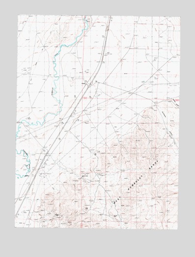
Oreana, NV USGS Topographic Map
Click on map above to begin viewing in our Map Viewer.

This topographic map contains these locations and features:
Feature Name Type Latitude Longitude GNIS ID View Map
Adriene MineMineN40.2571°W118.3001°854758View Map
Cerini RanchLocaleN40.3407°W118.3424°839407View Map
Cole RanchLocaleN40.3552°W118.2765°839629View Map
County Fish Holding PondReservoirN40.3427°W118.2688°839786View Map
Crystal Lakes Trout FarmLocaleN40.3377°W118.3285°839888View Map
Dad Lees (historical)LocaleN40.3346°W118.3154°856552View Map
Etna (historical)LocaleN40.3710°W118.3204°858346View Map
Etna Post OfficePost OfficeN40.3710°W118.3204°864668View Map
Horse Caņon CreekStreamN40.3538°W118.2682°846201View Map
Johnson Heizer MineMineN40.2799°W118.3251°863323View Map
Junction House (historical)LocaleN40.2871°W118.3613°858341View Map
Junction Station (historical)LocaleN40.3369°W118.3185°848446View Map
Limerick CanyonValleyN40.3277°W118.2574°841638View Map
Limerick WashStreamN40.3221°W118.2693°846218View Map
OreanaPopulated PlaceN40.3344°W118.3224°848605View Map
Oreana (historical)Populated PlaceN40.3107°W118.3704°848204View Map
Oreana Post OfficePost OfficeN40.3344°W118.3224°864394View Map
Oreana Post Office (historical)Post OfficeN40.3107°W118.3704°864667View Map
Rochester CanyonValleyN40.3232°W118.2693°843261View Map
Rosal MineMineN40.2619°W118.3218°854603View Map
Sanborn (historical)Populated PlaceN40.2924°W118.3490°856983View Map
Sanborn Post Office (historical)Post OfficeN40.2924°W118.3490°864871View Map
Sheppard RanchLocaleN40.3591°W118.2688°843659View Map
Smith Ford (historical)LocaleN40.2827°W118.3610°846239View Map
Torreytown (historical)Populated PlaceN40.3588°W118.3290°846350View Map
Willard Mine (historical)MineN40.2580°W118.3446°844885View Map
WoolseyPopulated PlaceN40.2810°W118.3646°845047View Map
Zola (historical)LocaleN40.3635°W118.3093°846241View Map

Note: Coordinates in the location and feature list above are referenced to NAD83 datum.


Copyright (C) 2008-2024 Ryan Niemi / Sunset Dynamics ... All Rights Reserved