TopoQuest Logo
Do you find TopoQuest useful?
Help keep TopoQuest running and adding new maps/features by donating!
Bitcoin:  19c7KJd3qBynnjoSw5npx9KScwjBe4ifkT
Litecoin:  LXs6TkuXGGXo1vDsWCkWVdjQX94eUKd6ui
Home View Maps Find Maps Find Places Resources & Links


Parnell West, Missouri Topographic Map

USGS Map Title: Parnell West, MO
USGS Map MRC: 40094D6
DRG (GeoTIFF) Download: o40094d6.tif


Neighboring USGS Topographic Map Quads:


  Hopkins, MO  
40094E7
 

  Bedford SW, MO  
40094E6
 

  Sheridan, MO  
40094E5
 

  Pickering, MO  
40094D7
 

  Parnell West, MO  
40094D6
 

  Parnell East, MO  
40094D5
 

  Maryville East, MO  
40094C7
 

  Ravenwood, MO  
40094C6
 

  Alanthus Grove, MO  
40094C5


Map MRC Location:

N41°
W95°
N41°
W94°
H8 H7 H6 H5 H4 H3 H2 H1
G8 G7 G6 G5 G4 G3 G2 G1
F8 F7 F6 F5 F4 F3 F2 F1
E8 E7 E6 E5 E4 E3 E2 E1
D8 D7 D6 D5 D4 D3 D2 D1
C8 C7 C6 C5 C4 C3 C2 C1
B8 B7 B6 B5 B4 B3 B2 B1
A8 A7 A6 A5 A4 A3 A2 A1
N40°
W95°
N40°
W94°

Parnell West, MO USGS 1:24K Topographic Map Preview:
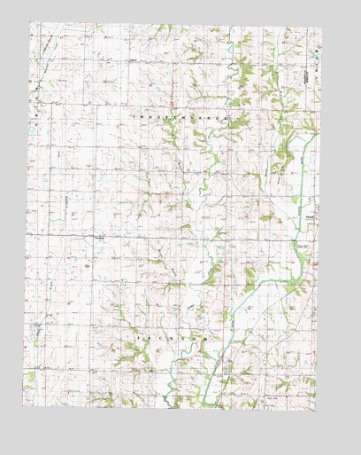
Parnell West, MO USGS Topographic Map
Click on map above to begin viewing in our Map Viewer.

This topographic map contains these locations and features:
Feature Name Type Latitude Longitude GNIS ID View Map
Brushy CreekStreamN40.4330°W94.6347°714906View Map
Bunker HillSummitN40.4530°W94.6427°715049View Map
Bunker Hill School (historical)SchoolN40.4675°W94.6475°715052View Map
Champaign School (historical)SchoolN40.4022°W94.7216°715712View Map
Common Sense School (historical)SchoolN40.4297°W94.7030°716154View Map
Elm Grove SchoolSchoolN40.4314°W94.6558°717524View Map
GaynorPopulated PlaceN40.4878°W94.7080°740868View Map
Harmony SchoolSchoolN40.3861°W94.7225°719124View Map
Hog BranchStreamN40.4397°W94.6783°719670View Map
Keever Bridge Access AreaLocaleN40.4292°W94.6352°741738View Map
Logan School (historical)SchoolN40.4511°W94.6830°721426View Map
Long Branch CemeteryCemeteryN40.4872°W94.7180°721529View Map
Long Branch SchoolSchoolN40.4311°W94.7411°721537View Map
McLaughlin CemeteryCemeteryN40.4850°W94.6466°722152View Map
Morgan BranchStreamN40.4150°W94.6802°722608View Map
Morning View School (historical)SchoolN40.3978°W94.6466°722630View Map
Number 30 DamReservoirN40.4905°W94.6266°760764View Map
OrrsburgPopulated PlaceN40.4308°W94.7214°741126View Map
Platte River Tributaries Watershed Dam Number 5-BDamN40.4917°W94.6252°760763View Map
Schmitz Brothers LakeReservoirN40.4155°W94.6604°762500View Map
Schmitz Brothers Lake DamDamN40.4167°W94.6602°762499View Map
Snowball School (historical)SchoolN40.4525°W94.7205°726676View Map
Township of IndependenceCivilN40.4989°W94.6840°767089View Map
Wilcox CemeteryCemeteryN40.3911°W94.6838°728822View Map
Wilcox School (historical)SchoolN40.4019°W94.6844°728825View Map
Wilson LakeReservoirN40.4650°W94.7483°761097View Map

Note: Coordinates in the location and feature list above are referenced to NAD83 datum.


Copyright (C) 2008-2025 Ryan Niemi / Sunset Dynamics ... All Rights Reserved