TopoQuest Logo
Do you find TopoQuest useful?
Help keep TopoQuest running and adding new maps/features by donating!
Bitcoin:  19c7KJd3qBynnjoSw5npx9KScwjBe4ifkT
Litecoin:  LXs6TkuXGGXo1vDsWCkWVdjQX94eUKd6ui
Home View Maps Find Maps Find Places Resources & Links


Pittsview, Alabama Topographic Map

USGS Map Title: Pittsview, AL
USGS Map MRC: 32085B2
DRG (GeoTIFF) Download: o32085b2.tif


Neighboring USGS Topographic Map Quads:


  Hatchechubbee, AL  
32085C3
 

  Seale, AL  
32085C2
 

  Fort Mitchell, AL  
32085C1
 

  Rutherford, AL  
32085B3
 

  Pittsview, AL  
32085B2
 

  Omaha, GA  
32085B1
 

  Batesville, AL  
32085A3
 

  Howe, AL  
32085A2
 

  Twin Springs, AL  
32085A1


Map MRC Location:

N33°
W86°
N33°
W85°
H8 H7 H6 H5 H4 H3 H2 H1
G8 G7 G6 G5 G4 G3 G2 G1
F8 F7 F6 F5 F4 F3 F2 F1
E8 E7 E6 E5 E4 E3 E2 E1
D8 D7 D6 D5 D4 D3 D2 D1
C8 C7 C6 C5 C4 C3 C2 C1
B8 B7 B6 B5 B4 B3 B2 B1
A8 A7 A6 A5 A4 A3 A2 A1
N32°
W86°
N32°
W85°

Pittsview, AL USGS 1:24K Topographic Map Preview:
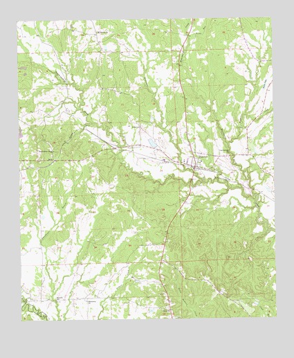
Pittsview, AL USGS Topographic Map
Click on map above to begin viewing in our Map Viewer.

This topographic map contains these locations and features:
Feature Name Type Latitude Longitude GNIS ID View Map
B B Burts DamDamN32.1968°W85.1849°130267View Map
Balfore Lake DamDamN32.1785°W85.1299°130238View Map
Benevolence Grove ChurchChurchN32.1954°W85.2330°113913View Map
Bethel ChurchChurchN32.2052°W85.1899°114049View Map
Burkes Lake DamDamN32.2202°W85.1316°130310View Map
Burts LakeReservoirN32.2221°W85.1288°115286View Map
Comers PondReservoirN32.1287°W85.1862°133228View Map
Cool Springs Baptist ChurchChurchN32.1935°W85.1469°116546View Map
Cottonton-Seale DivisionCivilN32.2179°W85.1464°161621View Map
GlenvillePopulated PlaceN32.1288°W85.1769°119045View Map
Glenville Historic DistrictParkN32.1290°W85.1769°158666View Map
HooksPopulated PlaceN32.1918°W85.2324°156491View Map
John O'Neall DamDamN32.2052°W85.2483°130287View Map
Macedonia ChurchChurchN32.1332°W85.2174°122154View Map
Mitchell Church (historical)ChurchN32.1335°W85.2330°133284View Map
Mitchell CreekStreamN32.1977°W85.1474°152350View Map
Mitchell SchoolSchoolN32.1335°W85.2324°122908View Map
Mount Moriah ChurchChurchN32.2449°W85.2105°123255View Map
Perrys Well (historical)LocaleN32.1324°W85.2352°133304View Map
PittsviewPopulated PlaceN32.1882°W85.1633°152965View Map
Pittsview CemeteryCemeteryN32.1889°W85.1552°138722View Map
Pittsview CemeteryCemeteryN32.1935°W85.1480°133308View Map
Pittsview Post OfficePost OfficeN32.1882°W85.1631°168697View Map
Pittsview Volunteer Fire DepartmentBuildingN32.1888°W85.1635°2691448View Map
Silver RunStreamN32.2415°W85.1655°126856View Map
Thompsons Store (historical)LocaleN32.1363°W85.1516°133339View Map
Watermelon CreekStreamN32.1979°W85.1472°155294View Map
Weolustee CreekStreamN32.1821°W85.1599°155299View Map

Note: Coordinates in the location and feature list above are referenced to NAD83 datum.


Copyright (C) 2008-2025 Ryan Niemi / Sunset Dynamics ... All Rights Reserved