TopoQuest Logo
Do you find TopoQuest useful?
Help keep TopoQuest running and adding new maps/features by donating!
Bitcoin:  19c7KJd3qBynnjoSw5npx9KScwjBe4ifkT
Litecoin:  LXs6TkuXGGXo1vDsWCkWVdjQX94eUKd6ui
Home View Maps Find Maps Find Places Resources & Links


Batesville, Alabama Topographic Map

USGS Map Title: Batesville, AL
USGS Map MRC: 32085A3
DRG (GeoTIFF) Download: o32085a3.tif


Neighboring USGS Topographic Map Quads:


  Hurtsboro, AL  
32085B4
 

  Rutherford, AL  
32085B3
 

  Pittsview, AL  
32085B2
 

  Comer, AL  
32085A4
 

  Batesville, AL  
32085A3
 

  Howe, AL  
32085A2
 

  Clayton North, AL  
31085H4
 

  White Oak, AL  
31085H3
 

  Eufaula North, AL  
31085H2


Map MRC Location:

N33°
W86°
N33°
W85°
H8 H7 H6 H5 H4 H3 H2 H1
G8 G7 G6 G5 G4 G3 G2 G1
F8 F7 F6 F5 F4 F3 F2 F1
E8 E7 E6 E5 E4 E3 E2 E1
D8 D7 D6 D5 D4 D3 D2 D1
C8 C7 C6 C5 C4 C3 C2 C1
B8 B7 B6 B5 B4 B3 B2 B1
A8 A7 A6 A5 A4 A3 A2 A1
N32°
W86°
N32°
W85°

Batesville, AL USGS 1:24K Topographic Map Preview:
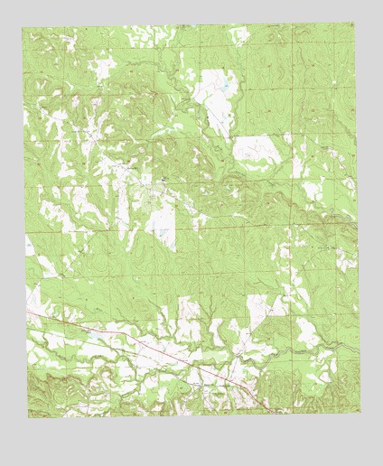
Batesville, AL USGS Topographic Map
Click on map above to begin viewing in our Map Viewer.

This topographic map contains these locations and features:
Feature Name Type Latitude Longitude GNIS ID View Map
BatesvillePopulated PlaceN32.0090°W85.3110°156034View Map
Batesville United Methodist ChurchChurchN32.0079°W85.3091°155832View Map
Bear CreekStreamN32.0190°W85.2977°113661View Map
Bronson CreekStreamN32.0115°W85.3324°114946View Map
Cole Ridge (historical)Populated PlaceN32.1238°W85.2685°155356View Map
Cole Ridge ChurchChurchN32.1246°W85.2772°116407View Map
Comer High SchoolSchoolN32.0754°W85.3230°116470View Map
Dismukes PondLakeN32.0262°W85.3491°117300View Map
Fairmount (historical)Populated PlaceN32.0260°W85.3374°134779View Map
Friendship CemeteryCemeteryN32.0071°W85.3049°118654View Map
Friendship ChurchChurchN32.0096°W85.2991°118675View Map
Humble Zion ChurchChurchN32.0915°W85.3522°151819View Map
Macedonia ChurchChurchN32.0010°W85.2822°122153View Map
Mount Calvary ChurchChurchN32.0535°W85.2610°123153View Map
New Hope ChurchChurchN32.0890°W85.2960°123812View Map
Poplar Springs (historical)Populated PlaceN32.0393°W85.2749°1805348View Map
Reynolds Store (historical)LocaleN32.1196°W85.3541°134815View Map
Spring HillPopulated PlaceN32.0793°W85.3369°155254View Map
Spring Hill ChurchChurchN32.0802°W85.3394°134827View Map
Spring Hill Volunteer Fire DepartmentBuildingN32.0743°W85.3280°2691114View Map
Spring Hill Zion ChurchChurchN32.0746°W85.3272°134828View Map
Upshur BranchStreamN32.0807°W85.2960°134832View Map
Wilburn CreekStreamN32.0215°W85.2580°134836View Map

Note: Coordinates in the location and feature list above are referenced to NAD83 datum.


Copyright (C) 2008-2025 Ryan Niemi / Sunset Dynamics ... All Rights Reserved