TopoQuest Logo
Do you find TopoQuest useful?
Help keep TopoQuest running and adding new maps/features by donating!
Bitcoin:  19c7KJd3qBynnjoSw5npx9KScwjBe4ifkT
Litecoin:  LXs6TkuXGGXo1vDsWCkWVdjQX94eUKd6ui
Home View Maps Find Maps Find Places Resources & Links


Rimrock, Montana Topographic Map

USGS Map Title: Rimrock, MT
USGS Map MRC: 45108G6
DRG (GeoTIFF) Download: o45108g6.tif


Neighboring USGS Topographic Map Quads:


  Comanche, MT  
45108H7
 

  Acton, MT  
45108H6
 

  Hickson Ranch, MT  
45108H5
 

  Two Pine School, MT  
45108G7
 

  Rimrock, MT  
45108G6
 

  Billings West, MT  
45108G5
 

  Laurel, MT  
45108F7
 

  Mossmain, MT  
45108F6
 

  Yegen, MT  
45108F5


Map MRC Location:

N46°
W109°
N46°
W108°
H8 H7 H6 H5 H4 H3 H2 H1
G8 G7 G6 G5 G4 G3 G2 G1
F8 F7 F6 F5 F4 F3 F2 F1
E8 E7 E6 E5 E4 E3 E2 E1
D8 D7 D6 D5 D4 D3 D2 D1
C8 C7 C6 C5 C4 C3 C2 C1
B8 B7 B6 B5 B4 B3 B2 B1
A8 A7 A6 A5 A4 A3 A2 A1
N45°
W109°
N45°
W108°

Rimrock, MT USGS 1:24K Topographic Map Preview:
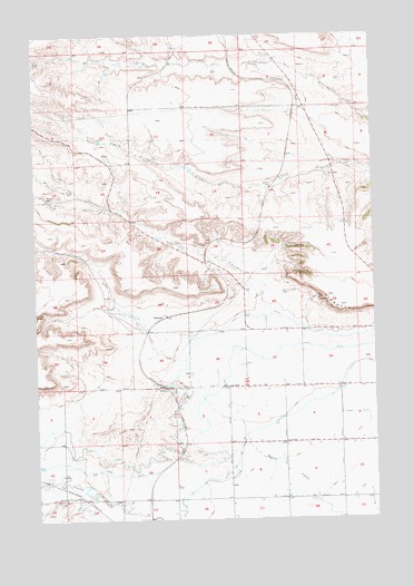
Rimrock, MT USGS Topographic Map
Click on map above to begin viewing in our Map Viewer.

This topographic map contains these locations and features:
Feature Name Type Latitude Longitude GNIS ID View Map
01N24E10C___01 WellWellN45.8458°W108.7307°812703View Map
01N24E11D___01 WellWellN45.8458°W108.6996°812702View Map
01N25E04C___01 WellWellN45.8588°W108.6263°812806View Map
01N25E17CADB01 WellWellN45.8291°W108.6465°812538View Map
01N25E31BABA01 WellWellN45.7977°W108.6668°812139View Map
01N25E32CCCC01 WellWellN45.7844°W108.6518°811996View Map
01S24E13AADD01 WellWellN45.7525°W108.7010°811665View Map
01S24E14AAAD01 WellWellN45.7533°W108.7207°811679View Map
01S24E15AAAB01 WellWellN45.7544°W108.7429°811692View Map
01S25E05CD__01 WellWellN45.7697°W108.6699°811836View Map
01S25E06AABB01 WellWellN45.7836°W108.6843°811988View Map
01S25E08DDCC01 WellWellN45.7555°W108.6638°811699View Map
01S25E09AAAB01 WellWellN45.7691°W108.6404°811830View Map
01S25E09BBBB01 WellWellN45.7691°W108.6585°811831View Map
01S25E15BBAA01 WellWellN45.7541°W108.6329°811688View Map
01S25E17AAAA01 WellWellN45.7550°W108.6596°811695View Map
01S25E17BBBC01 WellWellN45.7541°W108.6788°811689View Map
01S25E18B___01 WellWellN45.7516°W108.6943°811661View Map
Base Line School (historical)SchoolN45.7841°W108.6765°768539View Map
BaselinePopulated PlaceN45.7838°W108.7032°768540View Map
Billings Fire Department Station 7BuildingN45.7858°W108.6522°2546462View Map
Cove CreekStreamN45.8025°W108.6665°770210View Map
Cove DitchCanalN45.7647°W108.7193°770211View Map
Dusty CreekStreamN45.8686°W108.6615°770924View Map
Haynes Ranch AirportAirportN45.8619°W108.6478°2770384View Map
Iran SpringSpringN45.8353°W108.7364°772715View Map
Little Cove CreekStreamN45.7911°W108.6957°773436View Map
RimrockPopulated PlaceN45.8022°W108.7029°775771View Map
Skywagon Ranch AirportAirportN45.7870°W108.7276°2770381View Map
Stewart RanchLocaleN45.7844°W108.6257°777212View Map
Wilcox AirportAirportN45.7884°W108.6850°2650672View Map

Note: Coordinates in the location and feature list above are referenced to NAD83 datum.


Copyright (C) 2008-2025 Ryan Niemi / Sunset Dynamics ... All Rights Reserved