TopoQuest Logo
Do you find TopoQuest useful?
Help keep TopoQuest running and adding new maps/features by donating!
Bitcoin:  19c7KJd3qBynnjoSw5npx9KScwjBe4ifkT
Litecoin:  LXs6TkuXGGXo1vDsWCkWVdjQX94eUKd6ui
Home View Maps Find Maps Find Places Resources & Links


Risher, Arkansas Topographic Map

USGS Map Title: Risher, AR
USGS Map MRC: 35090F8
DRG (GeoTIFF) Download: o35090f8.tif


Neighboring USGS Topographic Map Quads:


  Swifton East, AR  
35091G1
 

  Cash, AR  
35090G8
 

  Herman, AR  
35090G7
 

  Grubbs, AR  
35091F1
 

  Risher, AR  
35090F8
 

  Otwell, AR  
35090F7
 

  Amagon, AR  
35091E1
 

  Weiner, AR  
35090E8
 

  Powers Slough, AR  
35090E7


Map MRC Location:

N36°
W91°
N36°
W90°
H8 H7 H6 H5 H4 H3 H2 H1
G8 G7 G6 G5 G4 G3 G2 G1
F8 F7 F6 F5 F4 F3 F2 F1
E8 E7 E6 E5 E4 E3 E2 E1
D8 D7 D6 D5 D4 D3 D2 D1
C8 C7 C6 C5 C4 C3 C2 C1
B8 B7 B6 B5 B4 B3 B2 B1
A8 A7 A6 A5 A4 A3 A2 A1
N35°
W91°
N35°
W90°

Risher, AR USGS 1:24K Topographic Map Preview:
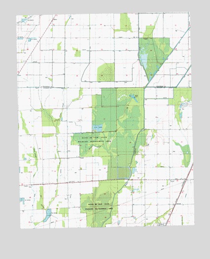
Risher, AR USGS Topographic Map
Click on map above to begin viewing in our Map Viewer.

This topographic map contains these locations and features:
Feature Name Type Latitude Longitude GNIS ID View Map
Angle Ditch Lateral Number 4CanalN35.7423°W90.9476°81963View Map
Ash SpreadStreamN35.6354°W90.9815°45949View Map
Big CreekStreamN35.7151°W90.9004°46543View Map
Big Creek Ditch Main DitchCanalN35.7342°W90.8829°46547View Map
Cooper Haines ChurchChurchN35.6517°W90.9648°48012View Map
Cooper Haines School (historical)SchoolN35.6517°W90.9651°65771View Map
Coward SloughStreamN35.7356°W90.9057°64438View Map
Elm DitchCanalN35.7406°W90.8932°48871View Map
Farley DitchCanalN35.7442°W90.9343°49005View Map
Gum SloughStreamN35.6265°W90.9898°49726View Map
Hood LakeLakeN35.7004°W90.9185°75736View Map
Long Pond Or-Cache DitchCanalN35.7101°W90.9354°51441View Map
Maple SloughStreamN35.6962°W90.9682°51659View Map
McDanielPopulated PlaceN35.6373°W90.8890°65794View Map
Morgan SloughStreamN35.6440°W90.9321°52195View Map
O K LakeReservoirN35.6833°W90.9430°65801View Map
RisherPopulated PlaceN35.7467°W90.9737°58494View Map
Township of DobsonCivilN35.6643°W90.9844°68974View Map
Township of West PrairieCivilN35.6317°W90.9037°68982View Map
Walker CemeteryCemeteryN35.6876°W90.9698°55960View Map

Note: Coordinates in the location and feature list above are referenced to NAD83 datum.


Copyright (C) 2008-2025 Ryan Niemi / Sunset Dynamics ... All Rights Reserved