TopoQuest Logo
Do you find TopoQuest useful?
Help keep TopoQuest running and adding new maps/features by donating!
Bitcoin:  19c7KJd3qBynnjoSw5npx9KScwjBe4ifkT
Litecoin:  LXs6TkuXGGXo1vDsWCkWVdjQX94eUKd6ui
Home View Maps Find Maps Find Places Resources & Links


Weiner, Arkansas Topographic Map

USGS Map Title: Weiner, AR
USGS Map MRC: 35090E8
DRG (GeoTIFF) Download: o35090e8.tif


Neighboring USGS Topographic Map Quads:


  Grubbs, AR  
35091F1
 

  Risher, AR  
35090F8
 

  Otwell, AR  
35090F7
 

  Amagon, AR  
35091E1
 

  Weiner, AR  
35090E8
 

  Powers Slough, AR  
35090E7
 

  Beedeville, AR  
35091D1
 

  Hickory Ridge, AR  
35090D8
 

  Cherry Valley West, AR  
35090D7


Map MRC Location:

N36°
W91°
N36°
W90°
H8 H7 H6 H5 H4 H3 H2 H1
G8 G7 G6 G5 G4 G3 G2 G1
F8 F7 F6 F5 F4 F3 F2 F1
E8 E7 E6 E5 E4 E3 E2 E1
D8 D7 D6 D5 D4 D3 D2 D1
C8 C7 C6 C5 C4 C3 C2 C1
B8 B7 B6 B5 B4 B3 B2 B1
A8 A7 A6 A5 A4 A3 A2 A1
N35°
W91°
N35°
W90°

Weiner, AR USGS 1:24K Topographic Map Preview:
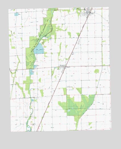
Weiner, AR USGS Topographic Map
Click on map above to begin viewing in our Map Viewer.

This topographic map contains these locations and features:
Feature Name Type Latitude Longitude GNIS ID View Map
Bayou De View State Wildlife Management AreaParkN35.6229°W90.9468°65762View Map
Bayou DeView Public Hunting AreaParkN35.6040°W90.9551°46174View Map
Beautiful Home School (historical)SchoolN35.6220°W90.9660°82737View Map
Brushy Lake School (historical)SchoolN35.5648°W90.8798°82741View Map
City of WeinerCivilN35.6198°W90.9055°2405702View Map
Flag Slough DitchCanalN35.6120°W90.9912°49086View Map
Harmony Grove ChurchChurchN35.6004°W90.9851°49876View Map
Horst Landing Strip (historical)AirportN35.5448°W90.9257°65787View Map
Lake HogueReservoirN35.5832°W90.9630°81237View Map
Lake Hogue DamDamN35.5784°W90.9668°81236View Map
Long CreekStreamN35.5979°W90.9960°51423View Map
Mink SloughStreamN35.5590°W90.9968°52093View Map
Sally Wofford AirportAirportN35.5932°W90.9135°65816View Map
Town of WaldenburgCivilN35.5653°W90.9346°2406818View Map
Township of OwenCivilN35.5110°W90.9308°68979View Map
Ukana School (historical)SchoolN35.5351°W90.9551°82765View Map
WaldenburgPopulated PlaceN35.5654°W90.9337°58812View Map
Waldenburg Post OfficePost OfficeN35.5657°W90.9312°2781902View Map
WeinerPopulated PlaceN35.6204°W90.8985°58845View Map
Weiner Elementary SchoolSchoolN35.6239°W90.9059°65814View Map
Weiner Fire Department Station 1BuildingN35.6199°W90.9011°2117284View Map
Weiner Fire Department Station 2BuildingN35.6188°W90.8984°2117285View Map
Weiner High SchoolSchoolN35.6226°W90.9051°65815View Map
Weiner Police DepartmentBuildingN35.6201°W90.9006°2118588View Map
Zion CemeteryCemeteryN35.5631°W90.9373°65819View Map

Note: Coordinates in the location and feature list above are referenced to NAD83 datum.


Copyright (C) 2008-2024 Ryan Niemi / Sunset Dynamics ... All Rights Reserved