TopoQuest Logo
Do you find TopoQuest useful?
Help keep TopoQuest running and adding new maps/features by donating!
Bitcoin:  19c7KJd3qBynnjoSw5npx9KScwjBe4ifkT
Litecoin:  LXs6TkuXGGXo1vDsWCkWVdjQX94eUKd6ui
Home View Maps Find Maps Find Places Resources & Links


Rush Lake, Michigan Topographic Map

USGS Map Title: Rush Lake, MI
USGS Map MRC: 43083H2
DRG (GeoTIFF) Download: o43083h2.tif


Neighboring USGS Topographic Map Quads:


  Port Austin West, MI  
44083A1
 

  Caseville, MI  
43083H3
 

  Rush Lake, MI  
43083H2
 

  Kinde West, MI  
43083H1
 

  Bay Port East, MI  
43083G3
 

  Elkton, MI  
43083G2
 

  Bad Axe West, MI  
43083G1


Map MRC Location:

N44°
W84°
N44°
W83°
H8 H7 H6 H5 H4 H3 H2 H1
G8 G7 G6 G5 G4 G3 G2 G1
F8 F7 F6 F5 F4 F3 F2 F1
E8 E7 E6 E5 E4 E3 E2 E1
D8 D7 D6 D5 D4 D3 D2 D1
C8 C7 C6 C5 C4 C3 C2 C1
B8 B7 B6 B5 B4 B3 B2 B1
A8 A7 A6 A5 A4 A3 A2 A1
N43°
W84°
N43°
W83°

Rush Lake, MI USGS 1:24K Topographic Map Preview:
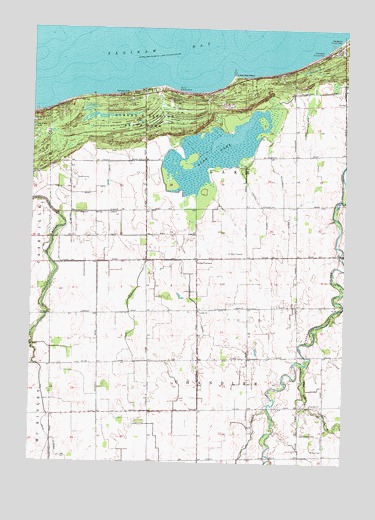
Rush Lake, MI USGS Topographic Map
Click on map above to begin viewing in our Map Viewer.

This topographic map contains these locations and features:
Feature Name Type Latitude Longitude GNIS ID View Map
Albert E Sleeper State ParkParkN43.9733°W83.2044°619903View Map
Albert E Sleeper State Park CampgroundLocaleN43.9797°W83.2125°2548293View Map
Bad Axe CreekStreamN43.9039°W83.1408°620422View Map
Caseville Golf CourseLocaleN43.9569°W83.2300°2548475View Map
Chandler ChurchChurchN43.8922°W83.1377°623065View Map
Chandler ChurchChurchN43.9189°W83.1816°623066View Map
Chandler Township CemeteryCemeteryN43.8917°W83.1403°2548572View Map
Conkey DrainCanalN43.9495°W83.1577°623696View Map
Depener FarmsLocaleN43.9583°W83.2361°2743332View Map
Fisher DrainCanalN43.9178°W83.2097°626057View Map
Fisher DrainCanalN43.9470°W83.2238°626058View Map
Gotts CornersLocaleN43.9339°W83.1836°627017View Map
Gotts Post Office (historical)Post OfficeN43.9339°W83.1836°2548597View Map
Harrison DrainCanalN43.9675°W83.1413°627853View Map
Little Oak PointCapeN43.9864°W83.1694°630715View Map
McCormick DrainCanalN43.9508°W83.1491°631786View Map
McKay CemeteryCemeteryN43.8792°W83.1327°631932View Map
Musselman DrainCanalN43.9822°W83.1344°633184View Map
Oak Beach County ParkLocaleN43.9964°W83.1275°633811View Map
Phillip County ParkLocaleN43.9820°W83.1916°634756View Map
Roundtree DairyLocaleN43.8814°W83.1997°2743331View Map
Rush LakeLakeN43.9644°W83.1778°636391View Map
Rush Lake DrainCanalN43.9542°W83.2236°636395View Map
Tait FarmsLocaleN43.9294°W83.1461°2743333View Map
Thompson County ParkLocaleN43.9928°W83.1344°1614762View Map
Thompson DrainCanalN43.9200°W83.1830°1614767View Map
Township of ChandlerCivilN43.8904°W83.1821°1626057View Map
Van DrainCanalN43.8770°W83.2427°1615470View Map

Note: Coordinates in the location and feature list above are referenced to NAD83 datum.


Copyright (C) 2008-2024 Ryan Niemi / Sunset Dynamics ... All Rights Reserved