TopoQuest Logo
Do you find TopoQuest useful?
Help keep TopoQuest running and adding new maps/features by donating!
Bitcoin:  19c7KJd3qBynnjoSw5npx9KScwjBe4ifkT
Litecoin:  LXs6TkuXGGXo1vDsWCkWVdjQX94eUKd6ui
Home View Maps Find Maps Find Places Resources & Links


Kinde West, Michigan Topographic Map

USGS Map Title: Kinde West, MI
USGS Map MRC: 43083H1
DRG (GeoTIFF) Download: o43083h1.tif


Neighboring USGS Topographic Map Quads:


  Port Austin West, MI  
44083A1
 

  Port Austin East, MI  
44082A8
 

  Rush Lake, MI  
43083H2
 

  Kinde West, MI  
43083H1
 

  Kinde East, MI  
43082H8
 

  Elkton, MI  
43083G2
 

  Bad Axe West, MI  
43083G1
 

  Bad Axe East, MI  
43082G8


Map MRC Location:

N44°
W84°
N44°
W83°
H8 H7 H6 H5 H4 H3 H2 H1
G8 G7 G6 G5 G4 G3 G2 G1
F8 F7 F6 F5 F4 F3 F2 F1
E8 E7 E6 E5 E4 E3 E2 E1
D8 D7 D6 D5 D4 D3 D2 D1
C8 C7 C6 C5 C4 C3 C2 C1
B8 B7 B6 B5 B4 B3 B2 B1
A8 A7 A6 A5 A4 A3 A2 A1
N43°
W84°
N43°
W83°

Kinde West, MI USGS 1:24K Topographic Map Preview:
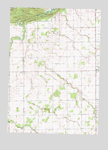
Kinde West, MI USGS Topographic Map
Click on map above to begin viewing in our Map Viewer.

This topographic map contains these locations and features:
Feature Name Type Latitude Longitude GNIS ID View Map
Arthur DrainCanalN43.9364°W83.1125°620255View Map
Bortman CreekStreamN43.9495°W83.1047°621749View Map
Case DrainCanalN43.9178°W83.0713°622832View Map
Casey DrainCanalN43.9589°W83.0919°622839View Map
Crown Post Office (historical)Post OfficeN43.8800°W83.0431°2548603View Map
FilionPopulated PlaceN43.8956°W83.0036°625947View Map
Filion Post OfficePost OfficeN43.8958°W83.0036°2548448View Map
Kinde Post OfficePost OfficeN43.9389°W83.0019°2548424View Map
Meade Township HallBuildingN43.8933°W83.0681°2548447View Map
Moore CreekStreamN43.9528°W83.1019°632637View Map
North Huron Elementary SchoolSchoolN43.9406°W83.0019°2548425View Map
North Huron High SchoolSchoolN43.9397°W83.0042°2548426View Map
PinnebogPopulated PlaceN43.9353°W83.1038°635021View Map
Pinnebog ChurchChurchN43.9250°W83.1044°635022View Map
Pinnebog Post Office (historical)Post OfficeN43.9353°W83.1039°2548535View Map
Ruth DrainCanalN43.9708°W83.0813°636420View Map
Saint Edwards CemeteryCemeteryN43.9531°W83.0022°636625View Map
Saint Felix CemeteryCemeteryN43.9197°W83.1241°636632View Map
Saint Felix ChurchChurchN43.9206°W83.1236°636633View Map
Schram BranchStreamN43.9975°W83.0666°637431View Map
Schram DrainCanalN43.9670°W83.0369°637432View Map
Taft DrainCanalN43.9764°W83.0913°1614537View Map
Todd DrainCanalN43.8764°W83.0177°1614915View Map
Township of HumeCivilN43.9800°W83.0661°1626504View Map
Township of MeadeCivilN43.8937°W83.0632°1626714View Map
WLEW-FM (Bad Axe)TowerN43.8911°W83.1238°1625345View Map

Note: Coordinates in the location and feature list above are referenced to NAD83 datum.


Copyright (C) 2008-2024 Ryan Niemi / Sunset Dynamics ... All Rights Reserved