TopoQuest Logo
Do you find TopoQuest useful?
Help keep TopoQuest running and adding new maps/features by donating!
Bitcoin:  19c7KJd3qBynnjoSw5npx9KScwjBe4ifkT
Litecoin:  LXs6TkuXGGXo1vDsWCkWVdjQX94eUKd6ui
Home View Maps Find Maps Find Places Resources & Links


Rushville North, Illinois Topographic Map

USGS Map Title: Rushville North, IL
USGS Map MRC: 40090B5
DRG (GeoTIFF) Download: o40090b5.tif


Neighboring USGS Topographic Map Quads:


  Doddsville, IL  
40090C6
 

  Industry, IL  
40090C5
 

  Vermont, IL  
40090C4
 

  Erwin, IL  
40090B6
 

  Rushville North, IL  
40090B5
 

  Ray, IL  
40090B4
 

  Ripley, IL  
40090A6
 

  Rushville South, IL  
40090A5
 

  Beardstown, IL  
40090A4


Map MRC Location:

N41°
W91°
N41°
W90°
H8 H7 H6 H5 H4 H3 H2 H1
G8 G7 G6 G5 G4 G3 G2 G1
F8 F7 F6 F5 F4 F3 F2 F1
E8 E7 E6 E5 E4 E3 E2 E1
D8 D7 D6 D5 D4 D3 D2 D1
C8 C7 C6 C5 C4 C3 C2 C1
B8 B7 B6 B5 B4 B3 B2 B1
A8 A7 A6 A5 A4 A3 A2 A1
N40°
W91°
N40°
W90°

Rushville North, IL USGS 1:24K Topographic Map Preview:
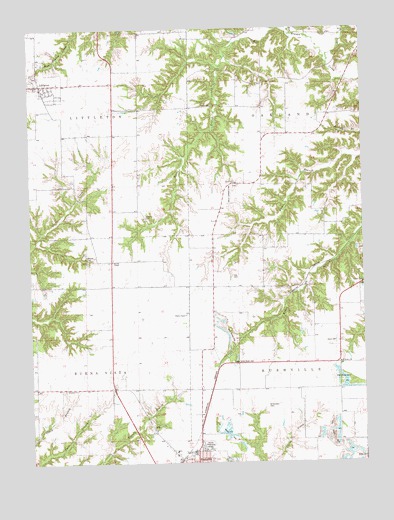
Rushville North, IL USGS Topographic Map
Click on map above to begin viewing in our Map Viewer.

This topographic map contains these locations and features:
Feature Name Type Latitude Longitude GNIS ID View Map
Ackman School (historical)SchoolN40.1931°W90.5096°403335View Map
Antioch Church (historical)ChurchN40.1462°W90.5976°403559View Map
Bauer BranchStreamN40.2456°W90.5482°404645View Map
Bauer CemeteryCemeteryN40.2278°W90.5562°1720647View Map
Bethany CemeteryCemeteryN40.1956°W90.5821°1720650View Map
Bethany Church (historical)ChurchN40.1962°W90.5832°404256View Map
Davis CemeteryCemeteryN40.1598°W90.5107°1720663View Map
Ebenezer ChurchChurchN40.1462°W90.6085°407742View Map
Garrison School (historical)SchoolN40.2125°W90.5854°408914View Map
Gay CemeteryCemeteryN40.1789°W90.5490°1720676View Map
Gill LakeReservoirN40.1863°W90.5024°1691987View Map
Gill Lake DamDamN40.1884°W90.5018°1691986View Map
Gillenwater CemeteryCemeteryN40.1414°W90.5368°1720677View Map
Hall School (historical)SchoolN40.1753°W90.5448°409664View Map
Hickory School (historical)SchoolN40.2375°W90.5851°410187View Map
Houston CemeteryCemeteryN40.2050°W90.5473°1984498View Map
Houston ChurchChurchN40.2056°W90.5476°1965947View Map
Houston School (historical)SchoolN40.2059°W90.5473°410602View Map
Industry Fire StationBuildingN40.2331°W90.6207°2640852View Map
Kinderhook School (historical)SchoolN40.1539°W90.5090°411482View Map
LittletonPopulated PlaceN40.2339°W90.6224°412443View Map
Littleton CemeteryCemeteryN40.2361°W90.6218°1984528View Map
Littleton Post OfficePost OfficeN40.2338°W90.6204°2788786View Map
McTyeire ChurchChurchN40.1537°W90.5093°1720701View Map
Milby CemeteryCemeteryN40.1259°W90.5018°1984579View Map
Milby CemeteryCemeteryN40.1264°W90.5004°1965948View Map
Moore CemeteryCemeteryN40.1845°W90.6040°1720705View Map
Moores ChapelChurchN40.1831°W90.5948°413783View Map
Oakland CenterPopulated PlaceN40.2339°W90.5085°423029View Map
Oakland Center School (historical)SchoolN40.2339°W90.5085°1965949View Map
Olive Branch School (historical)SchoolN40.2050°W90.6237°415089View Map
Parrott School (historical)SchoolN40.1762°W90.5910°415420View Map
Pokeberry School (historical)SchoolN40.1309°W90.5007°415981View Map
Randolph M Wells Airport (historical)AirportN40.1959°W90.5335°427775View Map
Rushville High SchoolSchoolN40.1278°W90.5646°1720720View Map
Schuyler CountyCivilN40.1580°W90.6151°1785037View Map
Schuyler County FairgroundParkN40.1292°W90.5598°1720725View Map
Sugar Grove North CemeteryCemeteryN40.1539°W90.5498°1720737View Map
Sugar Grove School (historical)SchoolN40.1539°W90.5493°419313View Map
Tolans BranchStreamN40.2478°W90.5268°419758View Map
Township of Buena VistaCivilN40.1464°W90.6229°428730View Map
Township of LittletonCivilN40.2345°W90.6216°429267View Map
Township of OaklandCivilN40.2336°W90.5078°429470View Map
Township of RushvilleCivilN40.1458°W90.5095°429685View Map
Tullis School (historical)SchoolN40.1464°W90.5851°419914View Map
Village of LittletonCivilN40.2340°W90.6223°2398455View Map
West Branch Sugar CreekStreamN40.2423°W90.5140°420798View Map
West Center School (historical)SchoolN40.2345°W90.5482°420804View Map

Note: Coordinates in the location and feature list above are referenced to NAD83 datum.


Copyright (C) 2008-2024 Ryan Niemi / Sunset Dynamics ... All Rights Reserved