TopoQuest Logo
Do you find TopoQuest useful?
Help keep TopoQuest running and adding new maps/features by donating!
Bitcoin:  19c7KJd3qBynnjoSw5npx9KScwjBe4ifkT
Litecoin:  LXs6TkuXGGXo1vDsWCkWVdjQX94eUKd6ui
Home View Maps Find Maps Find Places Resources & Links


Erwin, Illinois Topographic Map

USGS Map Title: Erwin, IL
USGS Map MRC: 40090B6
DRG (GeoTIFF) Download: o40090b6.tif


Neighboring USGS Topographic Map Quads:


  Fandon, IL  
40090C7
 

  Doddsville, IL  
40090C6
 

  Industry, IL  
40090C5
 

  Camden, IL  
40090B7
 

  Erwin, IL  
40090B6
 

  Rushville North, IL  
40090B5
 

  Lake Mount Sterling, IL  
40090A7
 

  Ripley, IL  
40090A6
 

  Rushville South, IL  
40090A5


Map MRC Location:

N41°
W91°
N41°
W90°
H8 H7 H6 H5 H4 H3 H2 H1
G8 G7 G6 G5 G4 G3 G2 G1
F8 F7 F6 F5 F4 F3 F2 F1
E8 E7 E6 E5 E4 E3 E2 E1
D8 D7 D6 D5 D4 D3 D2 D1
C8 C7 C6 C5 C4 C3 C2 C1
B8 B7 B6 B5 B4 B3 B2 B1
A8 A7 A6 A5 A4 A3 A2 A1
N40°
W91°
N40°
W90°

Erwin, IL USGS 1:24K Topographic Map Preview:
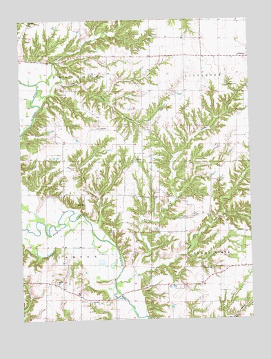
Erwin, IL USGS Topographic Map
Click on map above to begin viewing in our Map Viewer.

This topographic map contains these locations and features:
Feature Name Type Latitude Longitude GNIS ID View Map
Bethany ChurchChurchN40.1334°W90.7179°1720651View Map
Blackburn CemeteryCemeteryN40.2498°W90.7450°404512View Map
Brushy CreekStreamN40.1403°W90.7001°405053View Map
Corinth School (historical)SchoolN40.2198°W90.6651°406587View Map
Davis School (historical)SchoolN40.1403°W90.7340°406983View Map
Egypt School (historical)SchoolN40.1653°W90.6940°407817View Map
ErwinPopulated PlaceN40.1320°W90.7090°422676View Map
Fowler BranchStreamN40.2217°W90.7312°408607View Map
Gray CemeteryCemeteryN40.1353°W90.7187°1720681View Map
Hale CemeteryCemeteryN40.1671°W90.6610°1984469View Map
Hale Ridge (historical)Populated PlaceN40.1800°W90.6465°1821133View Map
Hale Ridge School (historical)SchoolN40.1667°W90.6618°409627View Map
Honey BranchStreamN40.2234°W90.7326°403304View Map
Hughes CemeteryCemeteryN40.1462°W90.6465°1720689View Map
Independence School (historical)SchoolN40.1773°W90.7274°410819View Map
Marlow CemeteryCemeteryN40.1409°W90.7315°1720699View Map
Mount Zion Church (historical)ChurchN40.1470°W90.6621°414139View Map
Muley School (historical)SchoolN40.2273°W90.6979°414224View Map
Neidy CemeteryCemeteryN40.2128°W90.6737°1720707View Map
Oakwood School (historical)SchoolN40.1384°W90.6707°414943View Map
Pit 1 Cedar Creek MineMineN40.1448°W90.7385°1967579View Map
Pit 5 Cedar Creek MineMineN40.1395°W90.7390°1967582View Map
Pit 7 Cedar Creek MineMineN40.1362°W90.7296°1967583View Map
Spring CreekStreamN40.1584°W90.7060°418933View Map
Stony CreekStreamN40.1439°W90.6871°419185View Map
Taggart CemeteryCemeteryN40.1737°W90.7165°1720738View Map
Thompson CemeteryCemeteryN40.2225°W90.6368°1720740View Map
Township of BrooklynCivilN40.2361°W90.7360°428715View Map
Township of CamdenCivilN40.1484°W90.7378°428753View Map
Walker School (historical)SchoolN40.2423°W90.6554°420409View Map
WaylandPopulated PlaceN40.2045°W90.7071°423293View Map
West Union School (historical)SchoolN40.1912°W90.7271°420939View Map
White Frame School (historical)SchoolN40.2275°W90.6610°421039View Map
White Oak CemeteryCemeteryN40.1914°W90.6882°1720749View Map
White Sulphur School (historical)SchoolN40.1909°W90.6526°421082View Map
Whiteoak School (historical)SchoolN40.1950°W90.6882°421098View Map
WKXQ-FM (Rushville)TowerN40.1389°W90.6574°428294View Map
Young School (historical)SchoolN40.1464°W90.6301°421598View Map

Note: Coordinates in the location and feature list above are referenced to NAD83 datum.


Copyright (C) 2008-2025 Ryan Niemi / Sunset Dynamics ... All Rights Reserved