TopoQuest Logo
Do you find TopoQuest useful?
Help keep TopoQuest running and adding new maps/features by donating!
Bitcoin:  19c7KJd3qBynnjoSw5npx9KScwjBe4ifkT
Litecoin:  LXs6TkuXGGXo1vDsWCkWVdjQX94eUKd6ui
Home View Maps Find Maps Find Places Resources & Links


San Vicente Reservoir, California Topographic Map

USGS Map Title: San Vicente Reservoir, CA
USGS Map MRC: 32116H8
DRG (GeoTIFF) Download: o32116h8.tif


Neighboring USGS Topographic Map Quads:


  Escondido, CA  
33117A1
 

  San Pasqual, CA  
33116A8
 

  Ramona, CA  
33116A7
 

  Poway, CA  
32117H1
 

  San Vicente Reservoir, CA  
32116H8
 

  El Cajon Mountain, CA  
32116H7
 

  La Mesa, CA  
32117G1
 

  El Cajon, CA  
32116G8
 

  Alpine, CA  
32116G7


Map MRC Location:

N33°
W117°
N33°
W116°
H8 H7 H6 H5 H4 H3 H2 H1
G8 G7 G6 G5 G4 G3 G2 G1
F8 F7 F6 F5 F4 F3 F2 F1
E8 E7 E6 E5 E4 E3 E2 E1
D8 D7 D6 D5 D4 D3 D2 D1
C8 C7 C6 C5 C4 C3 C2 C1
B8 B7 B6 B5 B4 B3 B2 B1
A8 A7 A6 A5 A4 A3 A2 A1
N32°
W117°
N32°
W116°

San Vicente Reservoir, CA USGS 1:24K Topographic Map Preview:
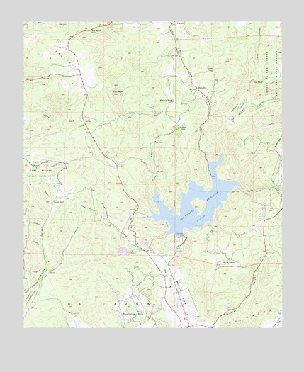
San Vicente Reservoir, CA USGS Topographic Map
Click on map above to begin viewing in our Map Viewer.

This topographic map contains these locations and features:
Feature Name Type Latitude Longitude GNIS ID View Map
Barona Baptist ChurchChurchN32.9323°W116.8771°2456453View Map
Barona ValleyValleyN32.9323°W116.8953°238996View Map
Boulder OaksPopulated PlaceN32.9573°W116.9256°252858View Map
Clark CanyonValleyN32.8981°W116.9909°240658View Map
Daney CanyonValleyN32.9737°W116.8861°241251View Map
Dos Picos County ParkParkN32.9981°W116.9389°1869353View Map
Eucalyptus HillsPopulated PlaceN32.8798°W116.9467°1660625View Map
Eucalyptus Hills Census Designated PlaceCensusN32.8850°W116.9453°2628813View Map
Eucalyptus Hills Elementary SchoolSchoolN32.8856°W116.9414°1869354View Map
FernbrookPopulated PlaceN32.9681°W116.9117°242220View Map
FosterPopulated PlaceN32.9084°W116.9261°252891View Map
Foster CanyonValleyN32.9320°W116.9373°242392View Map
Foster Truck TrailTrailN32.9537°W116.9348°242400View Map
Friendship Presbyterian ChurchChurchN32.9741°W116.9189°2456223View Map
Goat PeakSummitN32.9589°W116.9775°242763View Map
Goat RanchLocaleN32.9756°W116.8850°242764View Map
Goodan RanchLocaleN32.9273°W116.9864°242844View Map
Iron MountainSummitN32.9709°W116.9553°243887View Map
Irvings CrestPopulated PlaceN32.9798°W116.9123°1660805View Map
KECR-AM (El Cajon)TowerN32.8939°W116.9272°1662603View Map
Kimball ValleyValleyN32.9464°W116.9047°244303View Map
KIRS-AM (San Diego)TowerN32.9059°W116.9286°1662720View Map
Lakeside Fire Administration OfficeBuildingN32.8810°W116.9392°2664903View Map
Longs GulchValleyN32.9670°W116.8939°245097View Map
Louis A Stelzer County ParkParkN32.8789°W116.8967°1869355View Map
Mussey Grove (historical)Populated PlaceN32.9278°W116.9064°1702018View Map
Muth ValleyValleyN32.8959°W116.9247°246409View Map
Oak Oasis County ParkParkN32.9173°W116.8878°1869356View Map
Padre Barona CreekStreamN32.9325°W116.8953°247098View Map
Rock Haven (historical)Populated PlaceN32.9964°W116.9686°1702019View Map
Rock Haven SpringSpringN32.9963°W116.9685°248277View Map
San Vicente 8-009 DamDamN32.9123°W116.9250°1663337View Map
San Vicente ReservoirReservoirN32.9308°W116.9061°248974View Map
Santee Lake Regional ParkParkN32.8809°W116.9989°1869339View Map
Shady DellPopulated PlaceN32.9728°W116.9170°1661427View Map
Slaughterhouse CanyonValleyN32.8967°W116.9320°249564View Map
Slaughterhouse Canyon QuarryMineN32.9056°W116.9447°2703880View Map
Sycamore Canyon Open Space PreserveParkN32.9192°W116.9806°1869346View Map
Tekakwitcha ChurchChurchN32.9325°W116.8769°2456856View Map
VallecitosAreaN32.9839°W116.9814°250903View Map
Warren RanchLocaleN32.9987°W116.9989°1702020View Map
West Branch San Vicente CreekStreamN32.9431°W116.9117°251320View Map
Wildcat CanyonValleyN32.8759°W116.9064°251547View Map
Wildwood RanchLocaleN32.9681°W116.9289°251571View Map

Note: Coordinates in the location and feature list above are referenced to NAD83 datum.


Copyright (C) 2008-2024 Ryan Niemi / Sunset Dynamics ... All Rights Reserved