TopoQuest Logo
Do you find TopoQuest useful?
Help keep TopoQuest running and adding new maps/features by donating!
Bitcoin:  19c7KJd3qBynnjoSw5npx9KScwjBe4ifkT
Litecoin:  LXs6TkuXGGXo1vDsWCkWVdjQX94eUKd6ui
Home View Maps Find Maps Find Places Resources & Links


Shady Cove, Oregon Topographic Map

USGS Map Title: Shady Cove, OR
USGS Map MRC: 42122E7
DRG (GeoTIFF) Download: o42122e7.tif


Neighboring USGS Topographic Map Quads:


  Cleveland Ridge, OR  
42122F8
 

  Trail, OR  
42122F7
 

  McLeod, OR  
42122F6
 

  Boswell Mountain, OR  
42122E8
 

  Shady Cove, OR  
42122E7
 

  Obenchain Mountain, OR  
42122E6
 

  Sams Valley, OR  
42122D8
 

  Eagle Point, OR  
42122D7
 

  Brownsboro, OR  
42122D6


Map MRC Location:

N43°
W123°
N43°
W122°
H8 H7 H6 H5 H4 H3 H2 H1
G8 G7 G6 G5 G4 G3 G2 G1
F8 F7 F6 F5 F4 F3 F2 F1
E8 E7 E6 E5 E4 E3 E2 E1
D8 D7 D6 D5 D4 D3 D2 D1
C8 C7 C6 C5 C4 C3 C2 C1
B8 B7 B6 B5 B4 B3 B2 B1
A8 A7 A6 A5 A4 A3 A2 A1
N42°
W123°
N42°
W122°

Shady Cove, OR USGS 1:24K Topographic Map Preview:
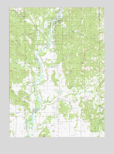
Shady Cove, OR USGS Topographic Map
Click on map above to begin viewing in our Map Viewer.

This topographic map contains these locations and features:
Feature Name Type Latitude Longitude GNIS ID View Map
Ball SpringSpringN42.5165°W122.7856°1135463View Map
Betts HoleChannelN42.5882°W122.8250°1135027View Map
City of Shady CoveCivilN42.6115°W122.8178°2411872View Map
Conover GulchValleyN42.5860°W122.8248°1132695View Map
Debenger GapGapN42.5468°W122.8745°1119778View Map
Dodge BridgeBridgeN42.5253°W122.8426°1119987View Map
Dodge Bridge County ParkParkN42.5262°W122.8423°1637984View Map
Dodge Bridge Jackson County Park Boat RampLocaleN42.5261°W122.8425°2699330View Map
Dry CreekStreamN42.5565°W122.8414°1120130View Map
East Oregon Cattle Company AirportAirportN42.5022°W122.8573°2646014View Map
Etna (historical)Populated PlaceN42.5971°W122.8192°1159020View Map
Etna Post Office (historical)Post OfficeN42.5971°W122.8192°1165228View Map
Gates ReservoirReservoirN42.5336°W122.8304°1135449View Map
Hamel Dam Number 2 (historical)DamN42.5415°W122.8162°1131417View Map
Hamel Reservoir Number 2 (historical)ReservoirN42.5415°W122.8162°1131416View Map
Hammel LateralCanalN42.5498°W122.7731°1121541View Map
Hammel ReservoirReservoirN42.5434°W122.8085°1135451View Map
Hog CreekStreamN42.5012°W122.8487°1121870View Map
Humphrey ReservoirsReservoirN42.5426°W122.7754°1135453View Map
Indian CreekStreamN42.6126°W122.8142°1122211View Map
Jackson County Fire District 3 Dodge Bridge StationBuildingN42.5265°W122.8457°2576679View Map
Jackson County Fire District 4 Shady Cove StationBuildingN42.6080°W122.8141°2576612View Map
Johnson CemeteryCemeteryN42.6120°W122.8126°1155002View Map
Langel CreekStreamN42.5615°W122.8331°1122949View Map
Long BranchStreamN42.5887°W122.8248°1145384View Map
Mosser MountainSummitN42.5258°W122.8088°1135025View Map
Mountain View Air Park (historical)AirportN42.5082°W122.8178°1131645View Map
Murderer GulchValleyN42.5568°W122.8059°1124545View Map
Nichols GapGapN42.5215°W122.7573°1124680View Map
North Fork Reese CreekStreamN42.5437°W122.7803°1124800View Map
Pettegrew LateralCanalN42.5179°W122.7873°1125336View Map
Reese CreekStreamN42.5318°W122.8342°1125932View Map
Reese Creek CemeteryCemeteryN42.5318°W122.7984°1132694View Map
Reese Creek School (historical)SchoolN42.5326°W122.7964°1125933View Map
Robinson ReservoirReservoirN42.5701°W122.8115°1135454View Map
School House Gap (historical)LocaleN42.5182°W122.7839°1699660View Map
Shady CovePopulated PlaceN42.6107°W122.8125°1158474View Map
Shady Cove AirparkAirportN42.6062°W122.8295°1131700View Map
Shady Cove Branch LibraryBuildingN42.6236°W122.8090°2699805View Map
Shady Cove City HallBuildingN42.6233°W122.8090°2699806View Map
Shady Cove Municipal CourtBuildingN42.6233°W122.8090°2699807View Map
Shady Cove Police DepartmentBuildingN42.6233°W122.8090°2737714View Map
Shady Cove Post OfficePost OfficeN42.6193°W122.8116°1165932View Map
Shady Cove Public Works Department OfficeBuildingN42.5831°W122.8407°2699808View Map
Shady Cove SchoolSchoolN42.6224°W122.8099°2440214View Map
Shady Cove Sewage Treatment PlantLocaleN42.5831°W122.8407°2697170View Map
Sims ReservoirReservoirN42.5127°W122.7700°1135452View Map
South Fork Reese CreekStreamN42.5437°W122.7803°1127312View Map
Takelma County ParkParkN42.5762°W122.8414°1135026View Map
Takelma Jackson County Park Boat RampLocaleN42.5767°W122.8401°2699859View Map
Todd ReservoirReservoirN42.5409°W122.8094°1135450View Map
Upper Rogue Regional County ParkParkN42.6137°W122.8148°1637985View Map
Upper Rogue Regional Jackson County Park Boat RampLocaleN42.6134°W122.8140°2699901View Map
Vestal ButteSummitN42.5821°W122.7750°1128530View Map
Weltman ReservoirReservoirN42.5832°W122.8409°1135365View Map

Note: Coordinates in the location and feature list above are referenced to NAD83 datum.


Copyright (C) 2008-2024 Ryan Niemi / Sunset Dynamics ... All Rights Reserved