TopoQuest Logo
Do you find TopoQuest useful?
Help keep TopoQuest running and adding new maps/features by donating!
Bitcoin:  19c7KJd3qBynnjoSw5npx9KScwjBe4ifkT
Litecoin:  LXs6TkuXGGXo1vDsWCkWVdjQX94eUKd6ui
Home View Maps Find Maps Find Places Resources & Links


Obenchain Mountain, Oregon Topographic Map

USGS Map Title: Obenchain Mountain, OR
USGS Map MRC: 42122E6
DRG (GeoTIFF) Download: o42122e6.tif


Neighboring USGS Topographic Map Quads:


  Trail, OR  
42122F7
 

  McLeod, OR  
42122F6
 

  Cascade Gorge, OR  
42122F5
 

  Shady Cove, OR  
42122E7
 

  Obenchain Mountain, OR  
42122E6
 

  Butte Falls, OR  
42122E5
 

  Eagle Point, OR  
42122D7
 

  Brownsboro, OR  
42122D6
 

  Lakecreek, OR  
42122D5


Map MRC Location:

N43°
W123°
N43°
W122°
H8 H7 H6 H5 H4 H3 H2 H1
G8 G7 G6 G5 G4 G3 G2 G1
F8 F7 F6 F5 F4 F3 F2 F1
E8 E7 E6 E5 E4 E3 E2 E1
D8 D7 D6 D5 D4 D3 D2 D1
C8 C7 C6 C5 C4 C3 C2 C1
B8 B7 B6 B5 B4 B3 B2 B1
A8 A7 A6 A5 A4 A3 A2 A1
N42°
W123°
N42°
W122°

Obenchain Mountain, OR USGS 1:24K Topographic Map Preview:
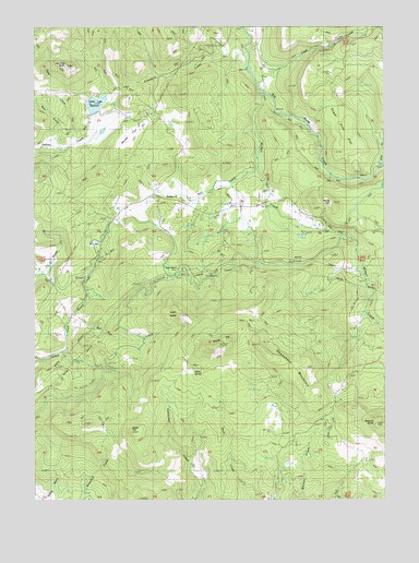
Obenchain Mountain, OR USGS Topographic Map
Click on map above to begin viewing in our Map Viewer.

This topographic map contains these locations and features:
Feature Name Type Latitude Longitude GNIS ID View Map
Bear GulchValleyN42.5960°W122.7434°1117378View Map
Bull Run CreekStreamN42.5487°W122.7378°1118290View Map
Cattail CreekStreamN42.5610°W122.6345°1161669View Map
Cedar ButtesSummitN42.5485°W122.6986°1118720View Map
Clark CreekStreamN42.6098°W122.6711°1139751View Map
Crowfoot CreekStreamN42.6221°W122.6739°1119586View Map
Daley SpringSpringN42.5336°W122.6945°1132698View Map
Deer CreekStreamN42.5937°W122.7362°1161342View Map
Deer Lick SpringSpringN42.5054°W122.7428°1132699View Map
Derby (historical)Populated PlaceN42.5790°W122.6998°1132697View Map
Derby Post Office (historical)Post OfficeN42.5790°W122.6998°1165149View Map
Derby SchoolLocaleN42.5790°W122.6978°1119873View Map
Derby StationLocaleN42.5612°W122.7003°1119874View Map
Duprays Mill (historical)LocaleN42.5610°W122.6409°1699661View Map
Eagle Point Irrigation CanalCanalN42.5618°W122.6578°1141486View Map
Edsalla (historical)Populated PlaceN42.5457°W122.6373°1161670View Map
Geppert ButteSummitN42.5207°W122.6295°1142618View Map
Gray CreekStreamN42.5876°W122.6264°1142999View Map
Green TopSummitN42.5178°W122.7170°1136341View Map
Indian Lake ReservoirReservoirN42.6044°W122.7291°1158823View Map
Joe Dyer ButteSummitN42.6143°W122.7393°1122438View Map
McNeil CreekStreamN42.6068°W122.6692°1146031View Map
Mucky FlatFlatN42.5957°W122.7150°1124441View Map
Mucky Flat AirportAirportN42.5962°W122.7151°2646011View Map
Neil CreekStreamN42.5882°W122.6706°1124642View Map
Obenchain MountainSummitN42.5408°W122.6710°1136598View Map
Quartz CreekStreamN42.5832°W122.6817°1162484View Map
Rocky HillSummitN42.5783°W122.6445°1126240View Map
Round TopSummitN42.5409°W122.6849°1126334View Map
Sugar Pine FlatFlatN42.5987°W122.6417°1127689View Map

Note: Coordinates in the location and feature list above are referenced to NAD83 datum.


Copyright (C) 2008-2024 Ryan Niemi / Sunset Dynamics ... All Rights Reserved