TopoQuest Logo
Do you find TopoQuest useful?
Help keep TopoQuest running and adding new maps/features by donating!
Bitcoin:  19c7KJd3qBynnjoSw5npx9KScwjBe4ifkT
Litecoin:  LXs6TkuXGGXo1vDsWCkWVdjQX94eUKd6ui
Home View Maps Find Maps Find Places Resources & Links


Boswell Mountain, Oregon Topographic Map

USGS Map Title: Boswell Mountain, OR
USGS Map MRC: 42122E8
DRG (GeoTIFF) Download: o42122e8.tif


Neighboring USGS Topographic Map Quads:


  Skeleton Mountain, OR  
42123F1
 

  Cleveland Ridge, OR  
42122F8
 

  Trail, OR  
42122F7
 

  McConville Peak, OR  
42123E1
 

  Boswell Mountain, OR  
42122E8
 

  Shady Cove, OR  
42122E7
 

  Gold Hill, OR  
42123D1
 

  Sams Valley, OR  
42122D8
 

  Eagle Point, OR  
42122D7


Map MRC Location:

N43°
W123°
N43°
W122°
H8 H7 H6 H5 H4 H3 H2 H1
G8 G7 G6 G5 G4 G3 G2 G1
F8 F7 F6 F5 F4 F3 F2 F1
E8 E7 E6 E5 E4 E3 E2 E1
D8 D7 D6 D5 D4 D3 D2 D1
C8 C7 C6 C5 C4 C3 C2 C1
B8 B7 B6 B5 B4 B3 B2 B1
A8 A7 A6 A5 A4 A3 A2 A1
N42°
W123°
N42°
W122°

Boswell Mountain, OR USGS 1:24K Topographic Map Preview:
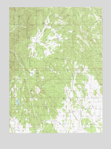
Boswell Mountain, OR USGS Topographic Map
Click on map above to begin viewing in our Map Viewer.

This topographic map contains these locations and features:
Feature Name Type Latitude Longitude GNIS ID View Map
Antioch CemeteryCemeteryN42.5176°W122.9048°1130319View Map
BeaglePopulated PlaceN42.5346°W122.9253°1159293View Map
Beagle Post Office (historical)Post OfficeN42.5346°W122.9253°1164895View Map
Beagle Sky Ranch AirportAirportN42.5412°W122.9038°1131443View Map
Bingham ReservoirReservoirN42.5092°W122.9337°1130321View Map
Boswell MountainSummitN42.6219°W122.9125°1117955View Map
Chimney Rock ButteSummitN42.5560°W122.9634°1136147View Map
Cinnabar MountainSummitN42.5733°W122.9345°1132693View Map
Cinnabar Mountain MineMineN42.5732°W122.9317°1135444View Map
Cliff RanchLocaleN42.5318°W122.9881°1119020View Map
Coulter Reservoir Number OneReservoirN42.5599°W122.9737°1130372View Map
Coulter Reservoir Number TwoReservoirN42.5567°W122.9698°1130374View Map
Despain ReservoirReservoirN42.5168°W122.9289°1130320View Map
Drake RanchLocaleN42.5851°W122.9748°1120073View Map
Firefly Ranch AirfieldAirportN42.5118°W122.9236°2646013View Map
Gribble ReservoirReservoirN42.5402°W122.9922°1130378View Map
Hull MountainSummitN42.5899°W122.9924°1122122View Map
Hunt ReservoirReservoirN42.5982°W122.9635°1135442View Map
Kirkham ReservoirReservoirN42.5457°W122.9892°1130376View Map
Lucky HollowValleyN42.6054°W122.9789°1132691View Map
Mack ReservoirReservoirN42.5136°W122.9896°1130317View Map
Meadow GravesCemeteryN42.6068°W122.9484°1130371View Map
Meadows School (historical)SchoolN42.6065°W122.9484°1124039View Map
Mill HollowValleyN42.6187°W122.9500°1124176View Map
Moore ReservoirReservoirN42.5087°W122.9280°1158654View Map
Mountain King MineMineN42.5690°W122.9956°1124423View Map
Mystery CreekStreamN42.5943°W122.9637°1158658View Map
Neil RockPillarN42.5415°W122.9696°1124644View Map
Patillo DitchesCanalN42.6054°W122.9817°1135443View Map
Peffley CreekStreamN42.5035°W122.9873°1133130View Map
Price ReservoirReservoirN42.5420°W122.9947°1130377View Map
Rexrood SpringsSpringN42.6026°W122.9373°1130370View Map
Sams Valley DamDamN42.5282°W122.9912°1133668View Map
Sams Valley DivisionCivilN42.5111°W122.9810°1938111View Map
Sams Valley ReservoirReservoirN42.5308°W122.9896°1133669View Map
Schmidt ReservoirsReservoirN42.5113°W122.9417°1135446View Map
Secluded Lake ReservoirReservoirN42.5136°W122.9758°1130318View Map
Short CreekStreamN42.5123°W122.9775°1158653View Map
Simpson DamDamN42.5598°W122.9712°1133680View Map
Simpson ReservoirReservoirN42.5585°W122.9698°1130373View Map
Snider Creek AirportAirportN42.5403°W122.9235°2646012View Map
Spignet CreekStreamN42.6037°W122.9923°1150149View Map
Spikenard (historical)Populated PlaceN42.6093°W122.9528°1159292View Map
Spikenard Post Office (historical)Post OfficeN42.6093°W122.9528°1165972View Map
Straus SpringSpringN42.5568°W122.9817°1130375View Map
The MeadowsFlatN42.5915°W122.9512°1132692View Map
Thomas Mill Post Office (historical)Post OfficeN42.6193°W122.9525°1164720View Map
Turtle RockPillarN42.5432°W122.9892°1128325View Map
War Eagle MineMineN42.6221°W122.9639°1135445View Map

Note: Coordinates in the location and feature list above are referenced to NAD83 datum.


Copyright (C) 2008-2025 Ryan Niemi / Sunset Dynamics ... All Rights Reserved