TopoQuest Logo
Do you find TopoQuest useful?
Help keep TopoQuest running and adding new maps/features by donating!
Bitcoin:  19c7KJd3qBynnjoSw5npx9KScwjBe4ifkT
Litecoin:  LXs6TkuXGGXo1vDsWCkWVdjQX94eUKd6ui
Home View Maps Find Maps Find Places Resources & Links


Claryville, New York Topographic Map

USGS Map Title: Claryville, NY
USGS Map MRC: 41074H5
DRG (GeoTIFF) Download: o41074h5.tif


Neighboring USGS Topographic Map Quads:


  Arena, NY  
42074A6
 

  Seager, NY  
42074A5
 

  Shandaken, NY  
42074A4
 

  Willowemoc, NY  
41074H6
 

  Claryville, NY  
41074H5
 

  Peekamoose Mountain, NY  
41074H4
 

  Liberty East, NY  
41074G6
 

  Grahamsville, NY  
41074G5
 

  Rondout Reservoir, NY  
41074G4


Map MRC Location:

N42°
W75°
N42°
W74°
H8 H7 H6 H5 H4 H3 H2 H1
G8 G7 G6 G5 G4 G3 G2 G1
F8 F7 F6 F5 F4 F3 F2 F1
E8 E7 E6 E5 E4 E3 E2 E1
D8 D7 D6 D5 D4 D3 D2 D1
C8 C7 C6 C5 C4 C3 C2 C1
B8 B7 B6 B5 B4 B3 B2 B1
A8 A7 A6 A5 A4 A3 A2 A1
N41°
W75°
N41°
W74°

Claryville, NY USGS 1:24K Topographic Map Preview:
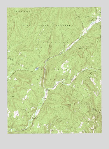
Claryville, NY USGS Topographic Map
Click on map above to begin viewing in our Map Viewer.

This topographic map contains these locations and features:
Feature Name Type Latitude Longitude GNIS ID View Map
Biscuit BrookStreamN41.9865°W74.5007°944038View Map
Blue HillSummitN41.9118°W74.6190°944305View Map
Camp PineLocaleN41.9045°W74.5824°945640View Map
Camp WawayandaLocaleN41.9906°W74.5188°945682View Map
ClaryvillePopulated PlaceN41.9184°W74.5724°946797View Map
Claryville Volunteer Fire Department Main StationBuildingN41.9252°W74.5561°2735447View Map
Claryville Volunteer Fire Department West Branch SubstationBuildingN41.9761°W74.5207°2718468View Map
Clear CreekStreamN41.9698°W74.5274°1777334View Map
Denman MountainSummitN41.9029°W74.5396°948300View Map
Dry BrookStreamN41.8801°W74.6190°948663View Map
Dry CreekStreamN41.9701°W74.5140°1777338View Map
East Branch Neversink RiverStreamN41.9162°W74.5746°949009View Map
East Delaware AqueductCanalN41.8973°W74.5999°949057View Map
East Moor BrookStreamN41.9729°W74.5082°1777342View Map
Fall BrookStreamN41.9501°W74.5679°949871View Map
Flat BrookStreamN41.9556°W74.5485°950232View Map
Frost ValleyPopulated PlaceN41.9870°W74.5104°950767View Map
Halls Mills Covered BridgeBridgeN41.8903°W74.5897°2097331View Map
High FallsFallsN41.9809°W74.5246°970205View Map
High Falls BrookStreamN41.9743°W74.5215°952735View Map
LadletonPopulated PlaceN41.9409°W74.5182°972698View Map
North Shelter CreekStreamN41.9715°W74.5093°1777336View Map
Pigeon BrookStreamN41.9926°W74.5027°960371View Map
Red HillSummitN41.9243°W74.5177°962287View Map
Round PondLakeN41.9391°W74.5857°962988View Map
Seep BrookStreamN41.9690°W74.5124°1777340View Map
Shelter CreekStreamN41.9740°W74.5213°1777335View Map
South Shelter CreekStreamN41.9715°W74.5093°1777337View Map
West Branch Neversink RiverStreamN41.9162°W74.5746°969129View Map
West Dry CreekStreamN41.9684°W74.5121°1777339View Map
West Moor BrookStreamN41.9723°W74.5090°1777341View Map

Note: Coordinates in the location and feature list above are referenced to NAD83 datum.


Copyright (C) 2008-2024 Ryan Niemi / Sunset Dynamics ... All Rights Reserved