TopoQuest Logo
Do you find TopoQuest useful?
Help keep TopoQuest running and adding new maps/features by donating!
Bitcoin:  19c7KJd3qBynnjoSw5npx9KScwjBe4ifkT
Litecoin:  LXs6TkuXGGXo1vDsWCkWVdjQX94eUKd6ui
Home View Maps Find Maps Find Places Resources & Links


Shop Gulch, Oregon Topographic Map

USGS Map Title: Shop Gulch, OR
USGS Map MRC: 44119D3
DRG (GeoTIFF) Download: o44119d3.tif


Neighboring USGS Topographic Map Quads:


  Sheep Ridge, OR  
44119E4
 

  Donaldson Creek, OR  
44119E3
 

  Belshaw Meadows, OR  
44119E2
 

  Aldrich Mountain North, OR  
44119D4
 

  Shop Gulch, OR  
44119D3
 

  Wolfinger Butte, OR  
44119D2
 

  Aldrich Mountain South, OR  
44119C4
 

  Big Weasel Springs, OR  
44119C3
 

  McClellan Mountain, OR  
44119C2


Map MRC Location:

N45°
W120°
N45°
W119°
H8 H7 H6 H5 H4 H3 H2 H1
G8 G7 G6 G5 G4 G3 G2 G1
F8 F7 F6 F5 F4 F3 F2 F1
E8 E7 E6 E5 E4 E3 E2 E1
D8 D7 D6 D5 D4 D3 D2 D1
C8 C7 C6 C5 C4 C3 C2 C1
B8 B7 B6 B5 B4 B3 B2 B1
A8 A7 A6 A5 A4 A3 A2 A1
N44°
W120°
N44°
W119°

Shop Gulch, OR USGS 1:24K Topographic Map Preview:
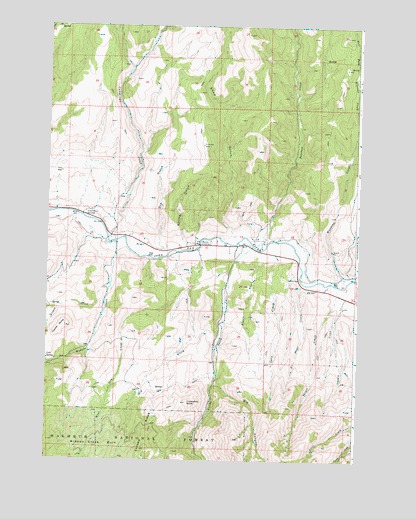
Shop Gulch, OR USGS Topographic Map
Click on map above to begin viewing in our Map Viewer.

This topographic map contains these locations and features:
Feature Name Type Latitude Longitude GNIS ID View Map
Belshaw CreekStreamN44.4371°W119.2930°1137905View Map
Big CanyonValleyN44.3968°W119.3077°1137990View Map
Coyote ButteSummitN44.4132°W119.3675°1140312View Map
Cummings CreekStreamN44.4382°W119.3477°1140548View Map
Dry CreekStreamN44.4354°W119.3152°1141302View Map
Dry GulchValleyN44.4357°W119.3289°1141330View Map
Dustin CreekStreamN44.4227°W119.2569°1141421View Map
East Fork Warrens CreekStreamN44.4713°W119.2502°1141615View Map
Eddington DitchCanalN44.4277°W119.2552°1153717View Map
Fields CreekStreamN44.4365°W119.2927°1142084View Map
Glascock RanchLocaleN44.3954°W119.3372°1156187View Map
Goen CreekStreamN44.4324°W119.2836°1142799View Map
Grouse CreekStreamN44.4249°W119.3497°1143126View Map
Horseshoe ButteSummitN44.3915°W119.3183°1143802View Map
John Day DivisionCivilN44.4511°W119.2675°1938034View Map
Lick SpringSpringN44.4040°W119.3749°1144991View Map
Magpie CreekStreamN44.4329°W119.2902°1145737View Map
Moores CrossingLocaleN44.4368°W119.3139°1146436View Map
Mountain View School (historical)SchoolN44.4356°W119.3292°1156186View Map
No Name CreekStreamN44.4251°W119.2730°1146853View Map
Picnic CreekStreamN44.4229°W119.2577°1147652View Map
Shop GulchValleyN44.4393°W119.3000°1149421View Map
Spring GulchValleyN44.4379°W119.3211°1150186View Map
Warrens CreekStreamN44.4268°W119.2541°1151916View Map
West Dry CreekStreamN44.4243°W119.3180°1152043View Map
West Fork Warrens CreekStreamN44.4715°W119.2505°1152123View Map
Widows CreekStreamN44.4374°W119.3475°1152319View Map
Widows Creek BurnAreaN44.3782°W119.3522°1129038View Map

Note: Coordinates in the location and feature list above are referenced to NAD83 datum.


Copyright (C) 2008-2024 Ryan Niemi / Sunset Dynamics ... All Rights Reserved