TopoQuest Logo
Do you find TopoQuest useful?
Help keep TopoQuest running and adding new maps/features by donating!
Bitcoin:  19c7KJd3qBynnjoSw5npx9KScwjBe4ifkT
Litecoin:  LXs6TkuXGGXo1vDsWCkWVdjQX94eUKd6ui
Home View Maps Find Maps Find Places Resources & Links


Aldrich Mountain South, Oregon Topographic Map

USGS Map Title: Aldrich Mountain South, OR
USGS Map MRC: 44119C4
DRG (GeoTIFF) Download: o44119c4.tif


Neighboring USGS Topographic Map Quads:


  Dayville, OR  
44119D5
 

  Aldrich Mountain North, OR  
44119D4
 

  Shop Gulch, OR  
44119D3
 

  Aldrich Gulch, OR  
44119C5
 

  Aldrich Mountain South, OR  
44119C4
 

  Big Weasel Springs, OR  
44119C3
 

  Suplee Butte, OR  
44119B5
 

  Graylock Butte, OR  
44119B4
 

  Flagtail Mountain, OR  
44119B3


Map MRC Location:

N45°
W120°
N45°
W119°
H8 H7 H6 H5 H4 H3 H2 H1
G8 G7 G6 G5 G4 G3 G2 G1
F8 F7 F6 F5 F4 F3 F2 F1
E8 E7 E6 E5 E4 E3 E2 E1
D8 D7 D6 D5 D4 D3 D2 D1
C8 C7 C6 C5 C4 C3 C2 C1
B8 B7 B6 B5 B4 B3 B2 B1
A8 A7 A6 A5 A4 A3 A2 A1
N44°
W120°
N44°
W119°

Aldrich Mountain South, OR USGS 1:24K Topographic Map Preview:
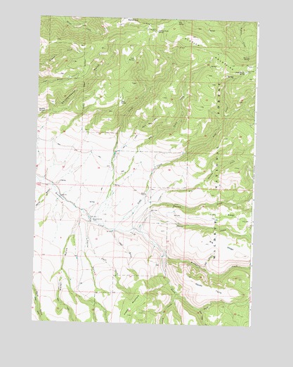
Aldrich Mountain South, OR USGS Topographic Map
Click on map above to begin viewing in our Map Viewer.

This topographic map contains these locations and features:
Feature Name Type Latitude Longitude GNIS ID View Map
Bark Cabin CreekStreamN44.2565°W119.4055°1161261View Map
Big Pine SpringsSpringN44.3356°W119.4975°1161271View Map
Big RidgeRidgeN44.2790°W119.3808°1161272View Map
Big SpringSpringN44.3740°W119.4211°1161273View Map
Cabbage Patch CampLocaleN44.3710°W119.4339°1161295View Map
Cabbage Patch SpringSpringN44.3699°W119.4328°1161296View Map
Cabin CreekStreamN44.2918°W119.4686°1161297View Map
Cabin Creek TrailTrailN44.3454°W119.4533°1161298View Map
Cold SpringSpringN44.3582°W119.4459°1161320View Map
Corral GulchValleyN44.2932°W119.4694°1161327View Map
Cow CanyonValleyN44.2732°W119.4027°1161328View Map
Crazy CreekStreamN44.2632°W119.4180°1161334View Map
Deer GulchValleyN44.2888°W119.4552°1161343View Map
Dry Cabin CreekStreamN44.3082°W119.4561°1161347View Map
Dry Cabin Creek TrailTrailN44.3315°W119.4361°1161348View Map
Dry Duncan CreekStreamN44.2996°W119.4291°1161350View Map
Dry Duncan Creek TrailTrailN44.3210°W119.3994°1161351View Map
Duncan CreekStreamN44.2893°W119.4439°1161352View Map
East Fork Corral GulchValleyN44.2854°W119.4700°1161355View Map
Mud SpringSpringN44.3411°W119.4528°1161450View Map
Murderers Creek RanchLocaleN44.2926°W119.4672°1161451View Map
Roaring SpringSpringN44.3595°W119.3800°1161489View Map
Shake TableSummitN44.2632°W119.3811°1161505View Map
South Fork Murderers CreekStreamN44.2790°W119.4250°1161523View Map
Thorn CreekStreamN44.2876°W119.4400°1161551View Map
Timber MountainSummitN44.2538°W119.4455°1161554View Map
Todd CreekStreamN44.2888°W119.4544°1161556View Map
Todd Creek CampLocaleN44.3546°W119.3814°1161557View Map
Trail RidgeRidgeN44.2946°W119.4008°1161559View Map
Water GulchValleyN44.2951°W119.4725°1161576View Map
Weaver CabinLocaleN44.3035°W119.4375°1161581View Map
Wylie GulchValleyN44.3063°W119.4905°1161603View Map

Note: Coordinates in the location and feature list above are referenced to NAD83 datum.


Copyright (C) 2008-2025 Ryan Niemi / Sunset Dynamics ... All Rights Reserved