TopoQuest Logo
Do you find TopoQuest useful?
Help keep TopoQuest running and adding new maps/features by donating!
Bitcoin:  19c7KJd3qBynnjoSw5npx9KScwjBe4ifkT
Litecoin:  LXs6TkuXGGXo1vDsWCkWVdjQX94eUKd6ui
Home View Maps Find Maps Find Places Resources & Links


Springville, California Topographic Map

USGS Map Title: Springville, CA
USGS Map MRC: 36118B7
DRG (GeoTIFF) Download: o36118b7.tif


Neighboring USGS Topographic Map Quads:


  Chickencoop Canyon, CA  
36118C8
 

  Dennison Peak, CA  
36118C7
 

  Moses Mountain, CA  
36118C6
 

  Frazier Valley, CA  
36118B8
 

  Springville, CA  
36118B7
 

  Camp Wishon, CA  
36118B6
 

  Success Dam, CA  
36118A8
 

  Globe, CA  
36118A7
 

  Solo Peak, CA  
36118A6


Map MRC Location:

N37°
W119°
N37°
W118°
H8 H7 H6 H5 H4 H3 H2 H1
G8 G7 G6 G5 G4 G3 G2 G1
F8 F7 F6 F5 F4 F3 F2 F1
E8 E7 E6 E5 E4 E3 E2 E1
D8 D7 D6 D5 D4 D3 D2 D1
C8 C7 C6 C5 C4 C3 C2 C1
B8 B7 B6 B5 B4 B3 B2 B1
A8 A7 A6 A5 A4 A3 A2 A1
N36°
W119°
N36°
W118°

Springville, CA USGS 1:24K Topographic Map Preview:
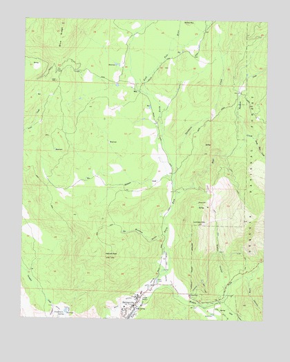
Springville, CA USGS Topographic Map
Click on map above to begin viewing in our Map Viewer.

This topographic map contains these locations and features:
Feature Name Type Latitude Longitude GNIS ID View Map
Bear CreekStreamN36.1774°W118.7968°239093View Map
Buckeye GulchValleyN36.1605°W118.8026°239765View Map
Church of Christ at SpringfieldChurchN36.1291°W118.8231°1835746View Map
Coffee Camp Picnic AreaLocaleN36.1499°W118.7506°1667569View Map
Deep CanyonValleyN36.1322°W118.7737°241341View Map
Dickey RanchLocaleN36.2347°W118.7870°276294View Map
Family Healthcare Network Health CenterHospitalN36.1341°W118.8150°2656329View Map
Hatchet PeakSummitN36.1505°W118.8304°243272View Map
Hickman CreekStreamN36.1849°W118.8018°243405View Map
Long CanyonValleyN36.1424°W118.7593°245072View Map
Lumreau MountainSummitN36.1652°W118.7831°245297View Map
Middle Fork Tule RiverStreamN36.1380°W118.8065°245865View Map
MiloPopulated PlaceN36.2202°W118.8173°1661031View Map
Mount Whitney DitchCanalN36.1336°W118.8181°246285View Map
North Fork Tule RiverStreamN36.1380°W118.8065°246625View Map
Patton House Community CenterBuildingN36.1308°W118.8179°1835766View Map
Rancheria CreekStreamN36.2022°W118.7615°247948View Map
Scicon County SchoolSchoolN36.1991°W118.7648°276299View Map
Sequoia Dawn Senior Citizens ComplexBuildingN36.1341°W118.8156°1835776View Map
Sequoia Ranch AirportAirportN36.1534°W118.8020°1654025View Map
Siphon CanyonValleyN36.1391°W118.7706°249520View Map
Soda SpringSpringN36.1297°W118.8163°249638View Map
South Bear CreekStreamN36.2011°W118.7573°249679View Map
SpringvillePopulated PlaceN36.1302°W118.8181°249828View Map
Springville Elementary SchoolSchoolN36.1302°W118.8226°1835778View Map
Springville Post OfficePost OfficeN36.1316°W118.8164°1835788View Map
Springville United Methodist ChurchChurchN36.1277°W118.8184°1835779View Map
Springville Work Center CDFLocaleN36.1366°W118.8090°276298View Map
Sycamore CreekStreamN36.1858°W118.7981°250204View Map
Tulare CountyCivilN36.2202°W118.8005°277318View Map
Tulare County Fire Department Battalion 2 Springville Fire Station 22BuildingN36.1310°W118.8171°2624429View Map
Ward CanyonValleyN36.1311°W118.7837°251167View Map

Note: Coordinates in the location and feature list above are referenced to NAD83 datum.


Copyright (C) 2008-2024 Ryan Niemi / Sunset Dynamics ... All Rights Reserved