TopoQuest Logo
Do you find TopoQuest useful?
Help keep TopoQuest running and adding new maps/features by donating!
Bitcoin:  19c7KJd3qBynnjoSw5npx9KScwjBe4ifkT
Litecoin:  LXs6TkuXGGXo1vDsWCkWVdjQX94eUKd6ui
Home View Maps Find Maps Find Places Resources & Links


Henkle Butte, Oregon Topographic Map

USGS Map Title: Henkle Butte, OR
USGS Map MRC: 44121C4
DRG (GeoTIFF) Download: o44121c4.tif


Neighboring USGS Topographic Map Quads:


  Little Squaw Back, OR  
44121D5
 

  Squaw Back Ridge, OR  
44121D4
 

  Steelhead Falls, OR  
44121D3
 

  Sisters, OR  
44121C5
 

  Henkle Butte, OR  
44121C4
 

  Cline Falls, OR  
44121C3
 

  Three Creek Butte, OR  
44121B5
 

  Tumalo Dam, OR  
44121B4
 

  Tumalo, OR  
44121B3


Map MRC Location:

N45°
W122°
N45°
W121°
H8 H7 H6 H5 H4 H3 H2 H1
G8 G7 G6 G5 G4 G3 G2 G1
F8 F7 F6 F5 F4 F3 F2 F1
E8 E7 E6 E5 E4 E3 E2 E1
D8 D7 D6 D5 D4 D3 D2 D1
C8 C7 C6 C5 C4 C3 C2 C1
B8 B7 B6 B5 B4 B3 B2 B1
A8 A7 A6 A5 A4 A3 A2 A1
N44°
W122°
N44°
W121°

Henkle Butte, OR USGS 1:24K Topographic Map Preview:
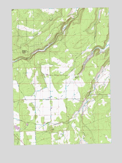
Henkle Butte, OR USGS Topographic Map
Click on map above to begin viewing in our Map Viewer.

This topographic map contains these locations and features:
Feature Name Type Latitude Longitude GNIS ID View Map
CloverdalePopulated PlaceN44.2912°W121.4528°1139855View Map
Cloverdale DitchCanalN44.3001°W121.4653°1139857View Map
Cloverdale Rural Fire Protection District Station 1BuildingN44.2904°W121.4535°2576925View Map
Cyrus DamDamN44.2695°W121.4842°1155548View Map
Cyrus ReservoirReservoirN44.2687°W121.4839°1155549View Map
Desert SpringSpringN44.2593°W121.4381°1140920View Map
Dry CanyonValleyN44.2715°W121.4228°1141266View Map
Fryrear ButteSummitN44.2634°W121.4528°1142523View Map
Henkle ButteSummitN44.3354°W121.4859°1143491View Map
McKenzie Canyon DamDamN44.3122°W121.4209°1155611View Map
McKenzie Canyon ReservoirReservoirN44.3129°W121.4189°1145998View Map
Pineridge Ranch AirportAirportN44.3090°W121.4540°1154033View Map
Sisters - Camp Sherman Fire District Station 703 - Squaw Creek Canyon StationBuildingN44.3401°W121.4713°2576928View Map
Three Sisters CanalCanalN44.3385°W121.3909°1150262View Map
Three Sisters Irrigation District DamDamN44.2632°W121.4928°1155657View Map
Watson ReservoirReservoirN44.2644°W121.4918°1155658View Map
Whippet FieldAirportN44.3227°W121.4315°2646032View Map
Whychus Creek RimCliffN44.3498°W121.4470°1153113View Map

Note: Coordinates in the location and feature list above are referenced to NAD83 datum.


Copyright (C) 2008-2025 Ryan Niemi / Sunset Dynamics ... All Rights Reserved