TopoQuest Logo
Do you find TopoQuest useful?
Help keep TopoQuest running and adding new maps/features by donating!
Bitcoin:  19c7KJd3qBynnjoSw5npx9KScwjBe4ifkT
Litecoin:  LXs6TkuXGGXo1vDsWCkWVdjQX94eUKd6ui
Home View Maps Find Maps Find Places Resources & Links


Capers Inlet, South Carolina Topographic Map

USGS Map Title: Capers Inlet, SC
USGS Map MRC: 32079G6
DRG (GeoTIFF) Download: o32079g6.tif


Neighboring USGS Topographic Map Quads:


  Cainhoy, SC  
32079H7
 

  Sewee Bay, SC  
32079H6
 

  Bull Island, SC  
32079H5
 

  Fort Moultrie, SC  
32079G7
 

  Capers Inlet, SC  
32079G6


Map MRC Location:

N33°
W80°
N33°
W79°
H8 H7 H6 H5 H4 H3 H2 H1
G8 G7 G6 G5 G4 G3 G2 G1
F8 F7 F6 F5 F4 F3 F2 F1
E8 E7 E6 E5 E4 E3 E2 E1
D8 D7 D6 D5 D4 D3 D2 D1
C8 C7 C6 C5 C4 C3 C2 C1
B8 B7 B6 B5 B4 B3 B2 B1
A8 A7 A6 A5 A4 A3 A2 A1
N32°
W80°
N32°
W79°

Capers Inlet, SC USGS 1:24K Topographic Map Preview:
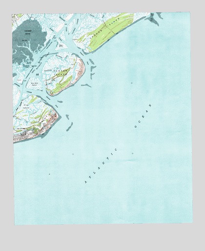
Capers Inlet, SC USGS Topographic Map
Click on map above to begin viewing in our Map Viewer.

This topographic map contains these locations and features:
Feature Name Type Latitude Longitude GNIS ID View Map
Big Hill MarshSwampN32.8335°W79.7345°1220702View Map
Bullyard SoundBayN32.8482°W79.7281°1221122View Map
Capers CreekStreamN32.8627°W79.7081°1229522View Map
Capers InletBayN32.8493°W79.6998°1221341View Map
Capers IslandIslandN32.8682°W79.6790°1229523View Map
Cedar CreekStreamN32.8221°W79.7248°1221431View Map
Copahee SoundBayN32.8580°W79.7409°1221751View Map
Crab BankIslandN32.8393°W79.7306°1221810View Map
Dewees CreekStreamN32.8238°W79.7231°1222009View Map
Dewees InletBayN32.8221°W79.7206°1222010View Map
Dewees IslandIslandN32.8402°W79.7165°1222011View Map
Dewees Island Fire DepartmentBuildingN32.8381°W79.7186°2578707View Map
Horsebend CreekStreamN32.8371°W79.7301°1223329View Map
Mary IslandIslandN32.8566°W79.7156°1224353View Map
Old House CreekStreamN32.8321°W79.7267°1225192View Map
Pine IslandIslandN32.8185°W79.7406°1225458View Map
Price CreekStreamN32.8732°W79.6509°1230199View Map
Price InletBayN32.8741°W79.6512°1225667View Map
Seven ReachesGutN32.8216°W79.7459°1226505View Map
Toomer CreekStreamN32.8571°W79.7112°1227177View Map
Watermelon CreekStreamN32.8513°W79.7187°1227432View Map
Whitehall TerracePopulated PlaceN32.8735°W79.7484°1253332View Map
Whiteside CreekStreamN32.8613°W79.7109°1230492View Map

Note: Coordinates in the location and feature list above are referenced to NAD83 datum.


Copyright (C) 2008-2025 Ryan Niemi / Sunset Dynamics ... All Rights Reserved